08.31.10
World Wide Weather #15: Cape Hatteras, North Carolina
This week’s post in the global weather and climate series features Cape Hatteras, North Carolina.
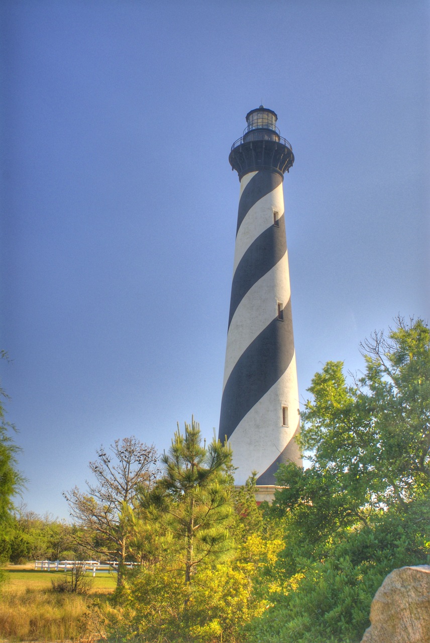
Cape Hatteras is the point that just about sticks out the farthest along the North Carolina coast. On Hatteras Island in the Outer Banks of North Carolina, Cape Hatteras is most famous for its 208-ft-tall lighthouse, built in 1870. Cape Hatteras is also sometimes known as the “Graveyard of the Atlantic”, as so many ships have been lost there. The nearest town to the lighthouse is Buxton, an unincorporated community of nearly 1,500 people.
The Outer Banks is a 200-mile-long barrier island chain off the North Carolina coast. The islands are very narrow but separate Currituck Sound, Albemarle Sound, and Pamlico Sound from the Atlantic Ocean. The Wright brothers’ first flight took place from the Outer Banks, at Kill Devil Hills near Kitty Hawk, on the northern side of the island chain. Ocracoke Island, just southeast of Hatteras Island, was the home of the famed pirate Blackbeard (as well as the location of his death). The islands are highly prone to hurricanes; in September 2003, Hurricane Isabel’s storm surge washed out part of Hatteras Island.
A few more facts about Cape Hatteras (average weather data from Climate Zone, records from NWS):
- Time zone: Eastern Standard Time (UTC-5) or Eastern Daylight Time (UTC-4)
- Elevation: at sea level
- Climate zone: Temperate
- Average high temperature: 69 °F (21 °C)
- Average low temperature: 55 °F (13 °C)
- Record high temperature: 96 °F (36 °C)
- Record low temperature: 6 °F (-14 °C)
- Average annual precipitation: 56.1 inches (1,425 mm)
- Average annual snowfall: 1.9 inches (48 mm)
Current weather: In case you hadn’t guessed, I picked Cape Hatteras this week because Hurricane Earl is about to deal a glancing blow to the Outer Banks Thursday night/Friday morning. The last time I picked a North American City, Hurricane Alex was about to make landfall just south of Brownsville.
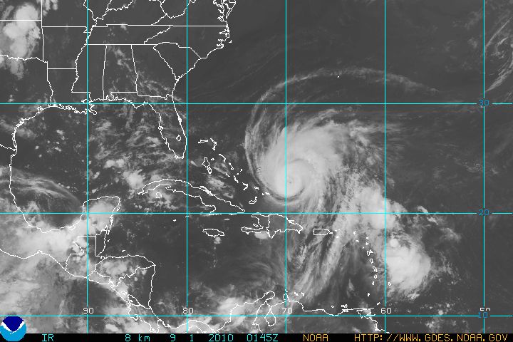
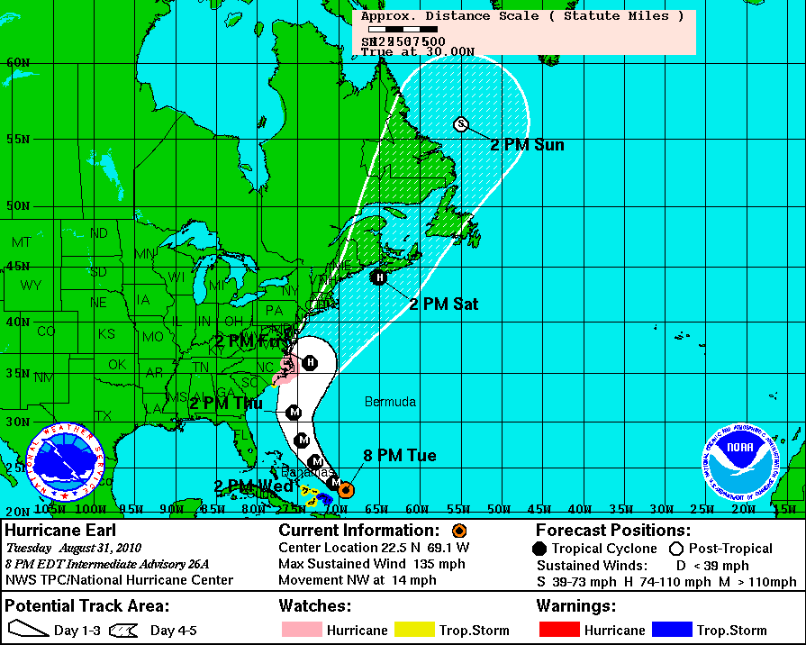
Earl is currently a Category 4 hurricane, moving northwest at 14 mph, with estimated maximum sustained wind speeds of 135 mph and a minimum central pressure of 940 mb. Here’s the latest National Hurricane Center forecast track for Earl (click to enlarge):
A hurricane watch was issued today for the Outer Banks, meaning hurricane conditions are possible and tropical storm conditions are expected to begin within 48 hours. Specific hazards mentioned in the watch include storm surges of 3 to 4 feet at Ocracoke Island and 1 to 2 feet elsewhere, hurricane-force winds (greater than 74 mph), and a high chance for rip currents as breaking waves may reach 15 feet. North Carolina officials announced tonight that an estimated 5,000 tourists have been ordered to evacuate Ocracoke Island (the only way to leave is by ferry), though year-round residents may choose to stay (estimated 800 residents).
Effects from the hurricane are anticipated to begin sometime Thursday afternoon.

Hurricane Earl approaches the U.S. GOES infrared satellite image courtesy of NOAA. Click to enlarge.
For weather maps and information on current and forecast Cape Hatteras weather, see the Newport / Morehead City National Weather Service site. For the latest hurricane intensity and track information, as well as hurricane satellite images, see the National Hurricane Center.
For more information on Cape Hatteras, here’s a link to Wikipedia. For information on the Outer Banks, here’s another link to Wikipedia.
Next Tuesday I plan to take a look at the climate and weather in another part of the globe. As always, if you have any comments or suggestions for future cities, please leave a comment on this post!

