02.27.11
First Chase Of The Year
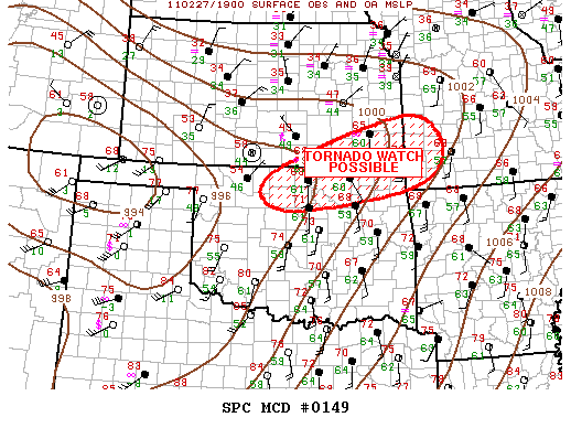
2:12 pm CDT mesoscale discussion graphic from the Storm Prediction Center.
I changed my mind about chasing today, and Jeff and I are on our way up I-35. We’re about 40 miles from Blackwell, Oklahoma, which is around my target area.
There is a nice cumulus field through western Oklahoma, MLCAPE is increasing to above 1500 J/kg in northwest Oklahoma (SBCAPE is above 2500 in western Oklahoma), lapse rates are fairly steep, dewpoints are in the low 60s, and 0 to 6 km bulk shear over much of western and northern Oklahoma is around 60 knots.
A dryline is sharpening in far western Oklahoma, and a warm front is stretching up from southern into eastern Kansas. A surface low is intensifying along the western Kansas/Oklahoma border, in response to a deep shortwave trough heading into the Texas Panhandle.
My expectations are fairly low, but there is a decent chance that there could be a supercell or two up around the Kansas/Oklahoma border late this afternoon. Some elevated storms have already formed along the warm front, but we’re hoping for more surface-based storms closer to the triple point.
