05.24.11
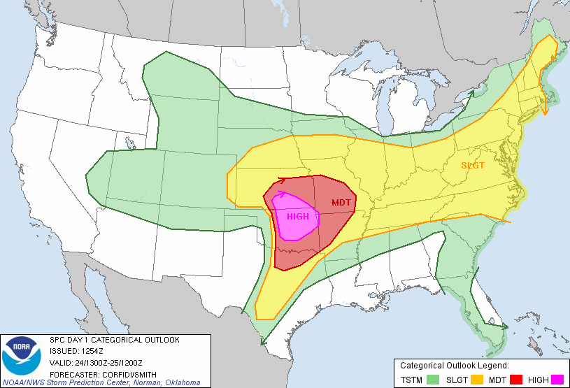
Chase #9: High Risk
Another high risk for severe weather in Oklahoma today, with a 30% hatched for tornadoes in the high risk area (hatched means a chance for EF2 to EF5 tornadoes within 25 miles of a point).
Everything looks ripe for explosive supercell development later today along a dryline just west of I-35. A shortwave trough will be moving through Oklahoma this evening, a nice surface low will be setting up around southwest Kansas / northwest Oklahoma, dewpoints near 70, high shear, high instability, etc. It actually looks like a pretty scary tornado outbreak is possible, and I hope that everyone in the high and moderate risk areas will be weather aware today.
We’ll be heading out soon for Enid, initially, where we’ll wait around and adjust our target area if necessary. We’ll need to get on storms early, as they could quickly become messy.
