01.28.10
And now for round 2…
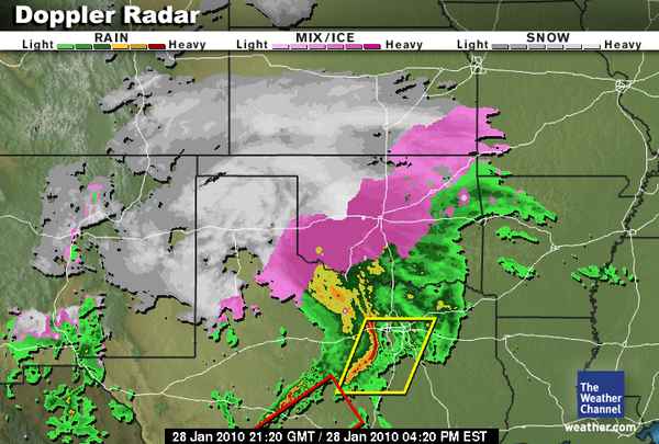
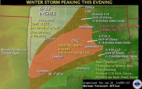
It’s been pouring down sleet here for a little while now. I’m trying to keep the heat in my apartment up in case the power goes out and I can’t heat the place. There’s a thick glaze over the trees outside my apartment now, and the screens on my windows are so coated with ice I can’t see through them. Here are a couple of updated graphics, the first one is radar, showing two watch boxes as well–a severe thunderstorm watch in north Texas and a tornado watch in south Texas! Not too far south of here the temperatures are in the upper 60s and lower 70s. The other image shows an updated image of the NWS forecast, now expecting up to 1 inch of ice and more sleet and snow on top of that.
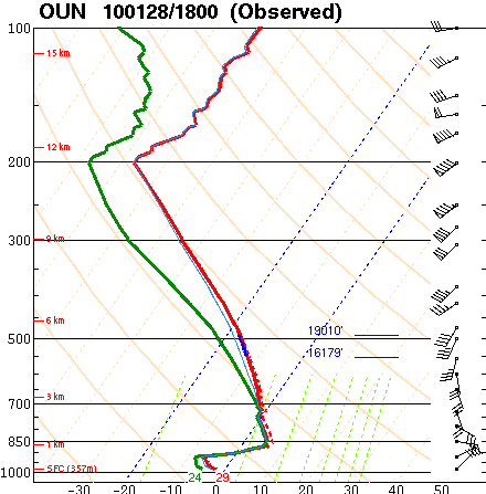
I’ll also post the latest special sounding from Norman, at noon today (18Z), still showing a great freezing rain sounding. On the sounding you can tell the surface cold layer was getting deeper (from 15Z) and the elevated warm layer was getting shallower, indicating that the atmosphere was getting closer to producing sleet.


