01.28.10
Ice Storm
Central Oklahoma is right in the middle of a large ice storm. Several-inch-long icicles have already formed on my apartment building and my car is iced over. OU canceled classes for noon onward today and all day tomorrow. I had a class at 10-11 this morning, but skipped it as I didn’t want to risk driving in the ice. Most flights (95%) have been canceled at the Oklahoma City airport today as freezing rain has been steadily falling for the past several hours. Winds have calmed down a bit since last night; only 10 mph winds in Norman at the moment, but if the winds go back up to 20mph or so, we could be in big trouble as far as trees and power lines coming down by tomorrow morning.
The freezing rain is expected to continue throughout the day, turning into sleet by late today and snow over night into tomorrow. The NWS is forecasting up to 3/4-inch of ice and 1-2 inches of sleet and snow…KFOR TV (Oklahoma City news) is predicting up to 1.5 inches of ice. They are comparing this ice storm to the epic December 2007 ice storm. It really is a little scary as to how similar this setup appears to be.
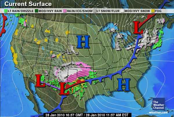
Here are a few weather maps from this morning, starting with a country-wide look at the current setup of fronts and pressure systems as well as radar:
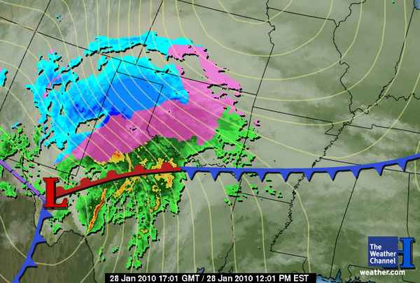
This is the “perfect” setup for an ice storm, blizzard, and severe weather (hail and tornadoes forecast in south Texas!). Now for a zoomed-in look at Oklahoma:
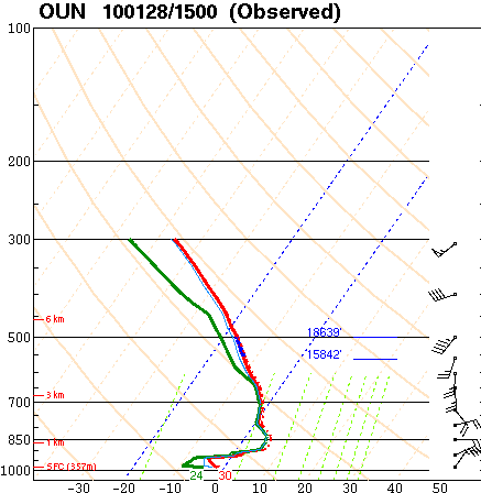
A special 15Z (9am local time) sounding at Norman showed an ideal profile for freezing rain. Ice and snow falling from the clouds melts in the deep warm layer, then the liquid water becomes “supercooled” as it falls into a shallow sub-freezing layer just above the surface.
I think I’m somewhat prepared for the power to go out, though I think it’s difficult to be fully prepared. Power outages are already being reported in southwest Oklahoma. Photos of trees bent over with ice are showing up on TV, and those photos are from just southwest of here, with the worst of the storm headed this way.


