03.15.10
March Madness in Melbourne
Last Saturday, March 6th, several strong thunderstorms swept through Victoria, Australia (the southeast part of the country). The largest storm was a supercell, a rotating thunderstorm that pummeled Melbourne and surrounding areas with heavy rain and 1- to 4-inch hail.
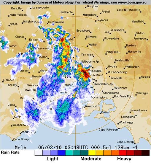
Here’s a radar image, courtesy of the Australian Bureau of Meteorology, showing the line of thunderstorms at 0348Z, or 2:48pm local time (the southernmost cell is directly over Melbourne at this time):
In the Melbourne metropolitan area, 1.8 inches (46 mm) of rain fell within 15 to 30 minutes, causing massive flooding. Here’s a video someone took of the hailstorm and the downpour.
2- to 4-cm hailstones were common across south Victoria. The largest hailstone was 10 cm (nearly 4 inches) in diameter.
Here’s another video (from an Australian news source) where the storm is described and shown.
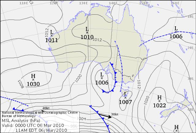
The storms formed along a low pressure trough in southern Australia (see map below):
The Bureau of Meteorology has a great write-up on this here.
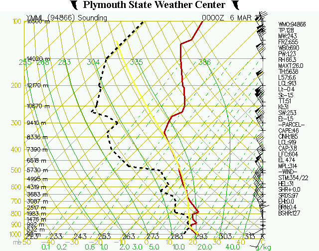
Finally, here’s a sounding taken from Melbourne at 00Z (11am local time), courtesy of the Plymouth State Weather Center, a few hours before the storms hit. It’s not a bad thunderstorm profile, but the instability could be greater…note than when the bold yellow line is to the right of the red line (temperature profile), that means that a rising parcel of air is warmer than the environment…so a lifted parcel would rise (unstable atmosphere)…


