05.16.10
Posted in Uncategorized at 10:21 pm by Rebekah
See the website for a full chase log and photos.
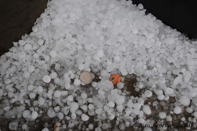
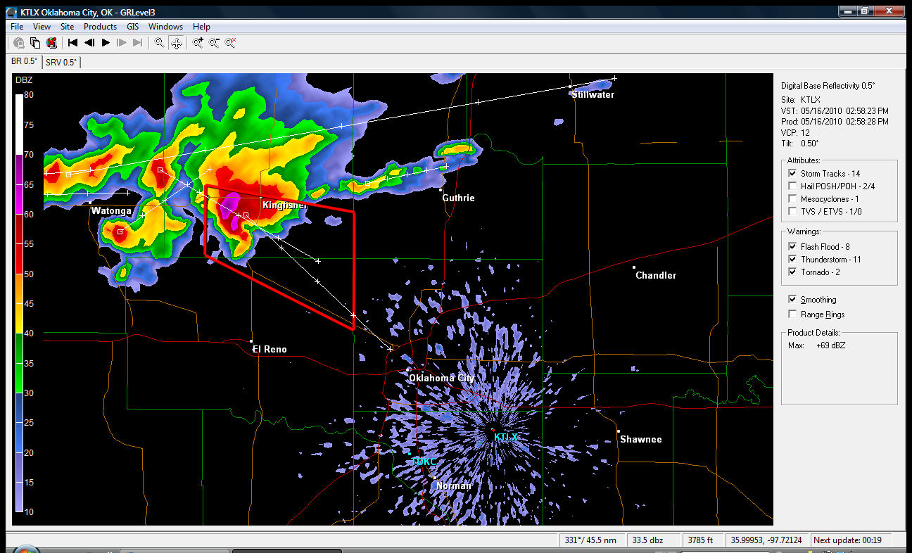
Long story short, intercepted HP supercell near the Oklahoma City State Capitol and successfully streamed hail footage to KSBI (dime- to quarter-size hail falling). I even got on air (speaking about the hail) for the first time.

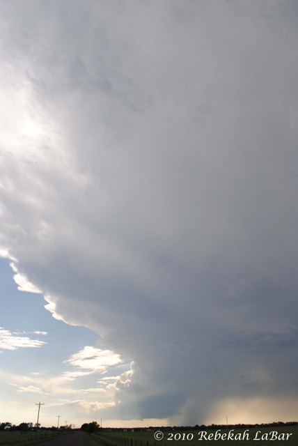
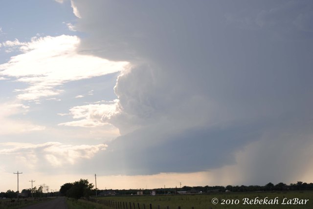
We later got on an LP supercell southeast of El Reno (we were sitting just a few miles east of Newcastle and west of north Norman / south Moore). This beauty had a high base and a stacked plate appearance as it slowly rotated. Eventually the cloud base eroded and we headed back to Norman.


Not bad for a 3-hour, 80-mile chase: HP supercell with hail and lightning, and LP supercell with amazing structure!
Permalink
Posted in Uncategorized at 3:06 pm by Rebekah
There’s an interesting-looking supercell headed southeast towards the OKC metro, and I’m going to head out and take a gander at it. It’s just been tornado-warned, and it’s headed in this direction.
I should be streaming shortly after I get on the road, within the next 30 minutes, if the storm holds together!

Permalink
05.15.10
Posted in General News at 9:19 pm by Rebekah
Chase #6 is up on my website–go to the chasing page to see my full chase log and photos from May 12.
The next chase may be sooner than expected…a day or two in this coming week may prove chase-worthy. In the meantime, it looks like we’ll at least be getting plenty of showers and thunderstorms over the next several days!

Permalink
05.14.10
Posted in Severe Weather Post-analysis, Weather News at 1:36 pm by Rebekah
Updated as of 3pm…two upgrades to EF4!
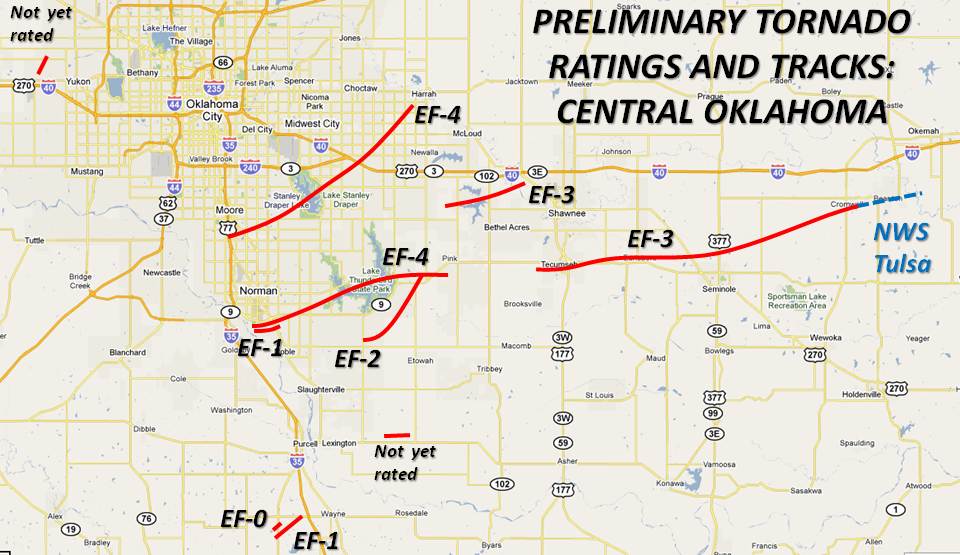
On Monday, while I was up gallivanting around northern Oklahoma, there were two EF4 tornadoes that occurred within a 5-mile radius of my apartment! Looking even farther out, there were twoEF3 and two EF4 tornadoes that occurred within about a 30-mile radius of my apartment, and roughly ten tornadoes that occurred within that same radius.
The National Weather Service is still working on damage surveys following Monday’s tornado outbreak, but as of this morning, here’s a map of the tornadoes (click to enlarge) that occurred around central Oklahoma. Note the EF4 that passed over south Norman and Lake Thunderbird formed right around the National Weather Center. Yikes!

Tomorrow I hope to spend some time compiling some information on the outbreak and doing a post-storm analysis of the day. Once I get that together, I’ll make a webpage for it and post the link. For now, the National Weather Service in Norman has some good information, mostly on the tornado tracks (but it’s being updated pretty frequently), on their website, so you can check that out if interested in where some of the other tornadoes occurred and what they were rated.
The top rated tornadoes were EF4 (meaning the strongest tornadoes of the day passed through south Norman and Moore).
Later this afternoon and evening I plan on posting some photos and possibly video from Monday’s chase in northern Oklahoma, as well as a chase log and a few photos from Wednesday’s chase (long story short–saw an impressive tornadic supercell near Clinton, but didn’t see the tornado).
Permalink
05.12.10
Posted in Severe Weather Forecast at 11:36 am by Rebekah
I’m in a hurry to get ready, so this will have to be short.
Thermodynamics are fairly similar to the last couple of days, with CAPE values in Oklahoma over 3000 J/kg, ahead of the dryline along the Texas Panhandle/Oklahoma border. Dewpoints are already in the upper 60s in Oklahoma.
Surface low in the Texas Panhandle today with a warm front extending northeastward through central into northeastern Kansas. A cold front extends south of the low back into southern New Mexico, but that will eventually start to catch up with the dryline tonight.
Shortwave trough over the Four Corners region will assist in providing some lift for storms today, although CINH may prove too high in some areas (e.g., GFS shows high CINH over much of Oklahoma, with the exception of a narrow band in west central Oklahoma ahead of the dryline…while the RUC shows not much CINH everywhere but southeast Oklahoma).
Wind shear may be a bit of a problem, with the highest values of helicity in northeastern Oklahoma into southeastern Kansas, but surface winds are not as backed to the southeast as I would like. If the low-level jet kicks in this evening, we may have more rotating storms.
Suffice it to say that this setup leaves much to be desired in the way of supercells, and it looks as if a broken line may form (I hope to catch the southern end of it, at any rate), but there looks to be a ridge setting in next week and who knows when the next best chase day (especially in the Oklahoma area) will be, so I’m going for it.
Initial target (leaving in the next hour): Enid, Oklahoma.
Permalink
« Previous Page — « Previous entries « Previous Page · Next Page » Next entries » — Next Page »
