06.29.10
World Wide Weather #8: Brownsville, Texas
This week’s post in the global weather and climate series features Brownsville, Texas.
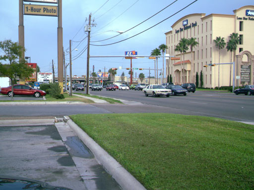
The southernmost city in Texas, Brownsville is located on the US/Mexico border (marked here by the Rio Grande), just a few miles from the Gulf of Mexico. Brownsville’s history stretches back to 1845, when construction on a fort was begun at the Mexican border. During the Civil War, Brownsville was used as a smuggling point for Confederate goods to Mexico and cotton to Europe. On Christmas Day 2004, Brownsville had its first measurable snow in 109 years, with 1.5 inches (3.8 cm) on the city’s first White Christmas. Today, Brownsville remains an important shipping point. Brownsville is home to 139,722 people (337,227 in the metro).
A few more facts about Brownsville (from Wikipedia):
- Time zone: Central Standard Time (UTC-6) or Central Daylight Time (UTC-5)
- Elevation: 33 ft above mean sea level
- Climate zone: Subtropical
- Average high temperature: 82 °F (28 °C)
- Average low temperature: 65 °F (18 °C)
- Record high temperature: 106 °F (41 °C)
- Record low temperature: 12 °F (-11 °C)
- Average annual precipitation: 28 inches (700 mm)
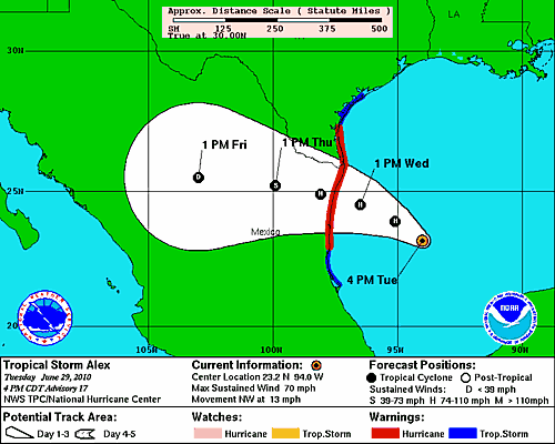
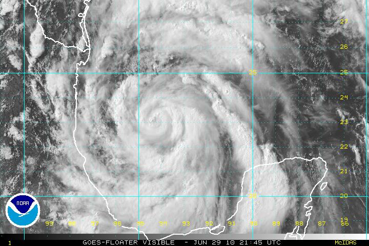
Current weather: As you may or may not be aware, Tropical Storm Alex, the first named storm of the Atlantic hurricane season, is soon expected to become a hurricane and make landfall Wednesday night as a Category 1 hurricane, somewhere from Brownsville to the northeast Mexican coast.
The National Weather Service issued a hurricane local statement this morning for the Brownsville area: “THE PRIMARY IMPACT FOR ALL OF DEEP SOUTH TEXAS WILL BE INLAND FLOODING FROM 12 TO 18 HOURS OF TORRENTIAL RAINS…WITH SIGNIFICANT WIND DAMAGE IMPACTS MORE LIKELY TOWARD THE COAST”.
They emphasize that people should not focus on the forecast track, as the storm can make landfall anywhere within the National Hurricane Center’s forecast cone, and even if the storm makes landfall elsewhere, it can still be wide enough to affect many surrounding people.
For more information on Brownsville, here’s a link to Wikipedia.
For weather maps and information on current and forecast Brownsville weather, see the Brownsville National Weather Service site.
Next Tuesday I plan to take a look at the climate and weather in another part of the globe. As always, if you have any comments or suggestions for future cities, please leave a comment on this post!


Tweets that mention Green Sky Chaser » World Wide Weather #8: Brownsville, Texas -- Topsy.com said,
June 29, 2010 at 9:21 pm
[…] This post was mentioned on Twitter by Anna. Anna said: RT @brownsvillelive: A storm chaser's blog post… Brownsville Living. Be part of it. http://fb.me/v2lPsyuw […]
Green Sky Chaser » World Wide Weather #15: Cape Hatteras, North Carolina said,
August 31, 2010 at 9:47 pm
[…] Current weather: In case you hadn’t guessed, I picked Cape Hatteras this week because Hurricane Earl is about to deal a glancing blow to the Outer Banks Thursday night/Friday morning. The last time I picked a North American City, Hurricane Alex was about to make landfall just south of Brownsville. […]