06.13.10
Posted in Severe Weather Forecast at 10:24 am by Rebekah
I’m off to the Texas Panhandle this afternoon, as severe weather opportunities have returned to the Southern Plains for a few days.
A deep (though rather weak) trough has dug in to the Four Corners’ region, though the strongest upper-level winds are on the east side of the trough, meaning it is about to start lifting out north as it reaches the Plains. A surface low has formed along the southern New Mexico / Texas border, with an associated stationary front (later becoming warm front) lifting up through central Kansas into Iowa.
A dryline will begin to tighten this afternoon in the central Texas Panhandle, with dewpoints in the upper 60s to lower 70s and surface winds from the south/southeast in the warm sector.
CAPE of between 1500 and 2000 J/kg will be possible over the central to east Texas Panhandle (over 3000 in southeast Kansas and northeast Oklahoma). 0 to 1 km storm-relative helicity values should reach 100 to 200 or greater in the north central Texas Panhandle (0 to 3 km values forecast to reach 300). Surface to 500mb bulk shear vector forecast to be between 40 and 50 knots over the north Texas Panhandle, but barely reaching 30 knots over the south and east Texas Panhandle.
Although the bulk of storms is likely to form over the Kansas/Oklahoma border along the front, the greater chance for strong to severe storms is along the dryline, near the triple point. A line of storms is likely to form from the central Texas Panhandle up into Kansas by the evening, but I expect some of the storms along the southern end of the line will be supercells that will have the potential for large hail and possibly a tornado or two.
Initial Target: Shamrock/Pampa/Clarendon, Texas
Permalink
06.12.10
Posted in General News at 12:48 pm by Rebekah
One of the features of the remodeled website will be to view photos in more of a photo gallery format as is common on many other websites.
I have been looking at many different options for this, and I found a nice little application that allows me to display photos in this manner. The html output allows me to edit the photo gallery to suit my needs, so I may not be done with this yet. I would have liked to find an option that is more dynamic, and gives that sort-of animated scrolling appearance to the thumbnails, but until I find a php script to do that for me (or learn enough php to do it on my own), this is what I’ve got.
Please visit this sample site (3 photos from 23 Feb 2007), and let me know what you think! The only link back to my site is one on the index page that goes to the chase log.
Comments and suggestions are welcome!
————————-
PS – Another change (which I’ve already implemented) is no more “this day in history” on the front page…it’s too time-consuming to maintain in its present state, and if I find a good way to automate it, it may return – but for now, I’m sad to say it’s gone…
Permalink
06.08.10
Posted in Non-US Weather, Weather News at 3:48 pm by Rebekah
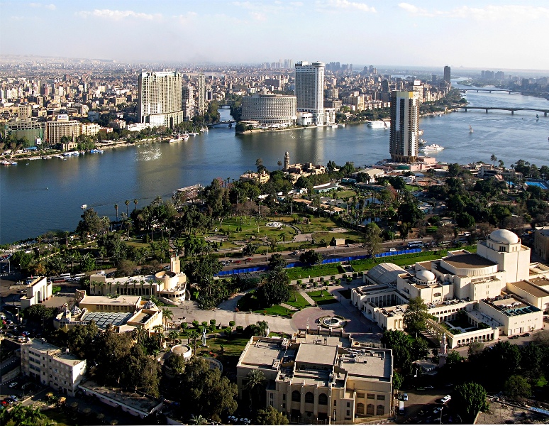
This week’s post in the global weather and climate series features Cairo, Egypt.

View of Cairo, Egypt from Cairo Tower. Courtesy of Wikipedia. Click to enlarge.
Centered along the banks of the Nile River, Cairo is located in northeast Egypt, about 100 miles south of the Mediterranean Sea and about 75 miles west of the Suez Canal. Cairo has a long and rich history, probably most often associated with the Great Sphinx and the Pyramids of Giza, located near the suburbs of Cairo. The capital of Egypt and the largest city in Africa, Cairo is home to 6.8 million people (about 18 million in the metro).
A few more facts about Cairo (from Wikipedia):
- Time zone: Eastern European Time (UTC+2) or Eastern European Summer Time (UTC+3)
- Elevation: about 75 to 250 ft above mean sea level
- Climate zone: Desert
- Average high temperature: 81 °F (27 °C)
- Average low temperature: 59 °F (15 °C)
- Record high temperature: 117 °F (47 °C)
- Record low temperature: 34 °F (1 °C)
- Average annual precipitation: 1 inch (29 mm)
Current weather: I could not dig up much information on recent or current Egyptian weather, partly because the website for Egypt’s national meteorological agency, the Egyptian Meteorological Authority, is down right now (see link, below).
However, Weather Underground is forecasting clear skies this week with high temperatures in the low to mid-90s and lows in the upper 60s to lower 70s, as is typical this time of year.
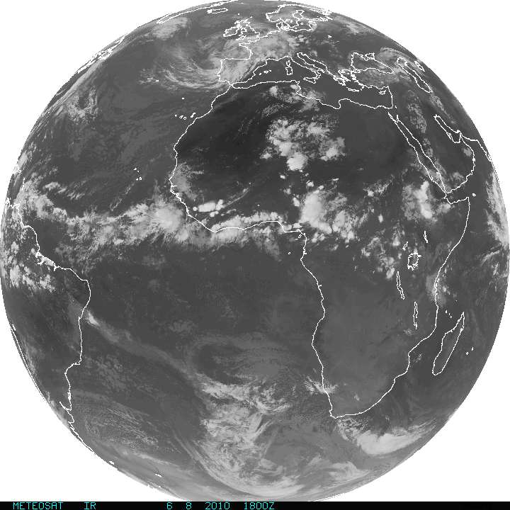
Here is an infrared satellite image, showing the clear skies over Egypt as of 18Z (9pm Cairo time, 2pm New York time). Note there are clouds over Libya (west of Egypt), as well as clouds over the tropics.

METEOSAT infrared satellite image (from http://www.goes.noaa.gov). Click to enlarge.
For more information on Cairo, here’s a link to Wikipedia.
For weather maps and information on current and forecast Cairo weather, see the Egyptian Meteorological Authority (I have yet to look at this site as it is currently down) or Weather Online UK (great collection of weather maps and models for all over the world).
Next Tuesday I plan to take a look at the climate and weather in another part of the globe. As always, if you have any comments or suggestions for future cities, please leave a comment on this post!
Permalink
06.06.10
Posted in General News at 8:46 pm by Rebekah
I apologize for the lack up updates on both my website and blog for the last couple of weeks…some friends of mine from Australia and England came over to do some chasing recently, and I spent a week running around the Plains with them, having an amazing time.
I didn’t have much computer access while I was gone, so I’m only just now starting to edit photos, edit videos, and compile chase logs. This will probably take me some time, as I’m also working on a few other projects and am starting my PhD research.
Here’s a summary of what’s coming, hopefully complete within the next 2 to 3 weeks:
*May 19 chase log/photos – supercells in central Oklahoma (chase log is up, but I didn’t get around to photos yet)
*May 29 chase log/photos – multicells in southwest Nebraska
*May 30 chase log/photos – supercells/squall line in south central Kansas into north central Oklahoma
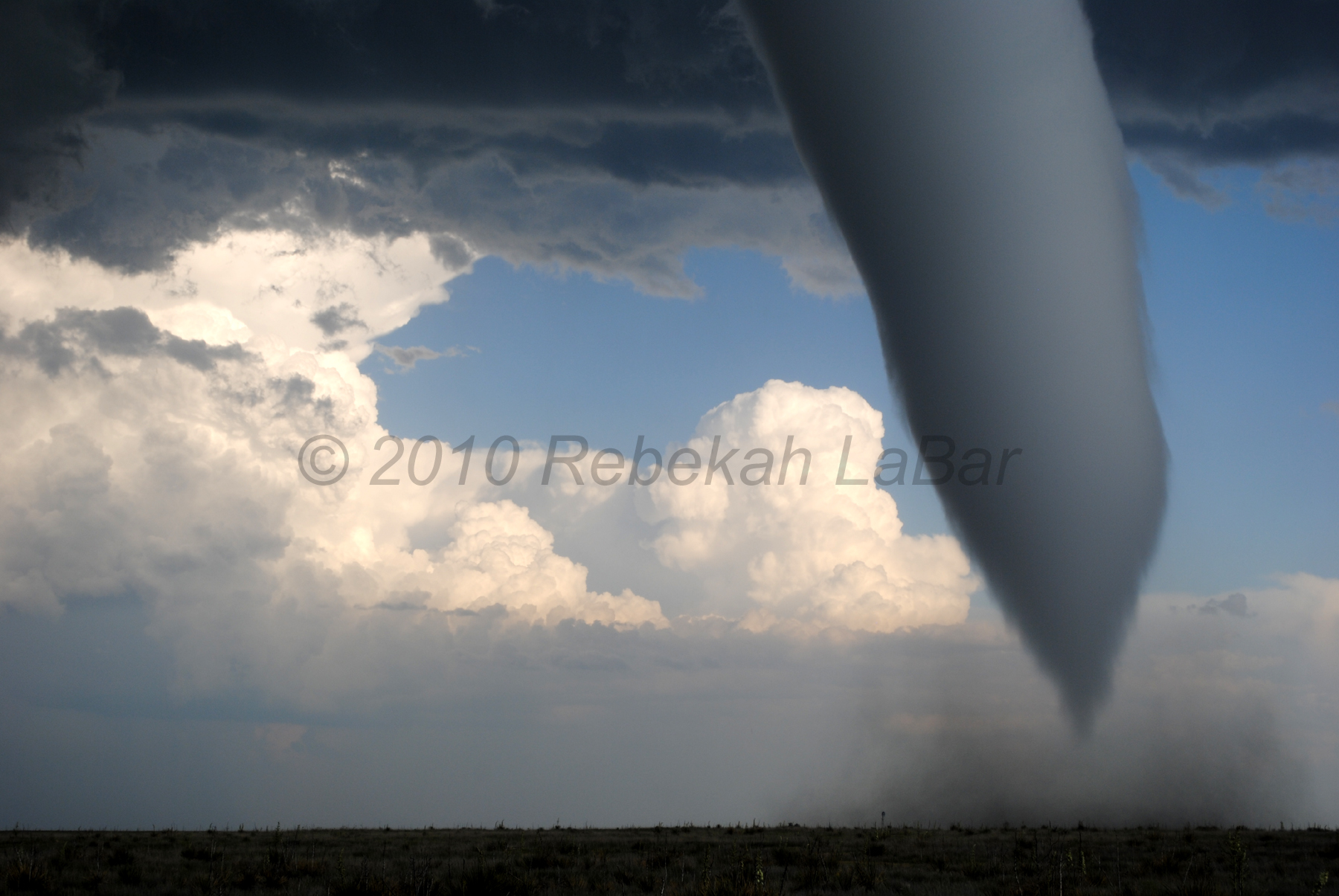
*May 31 chase log/photos/video – tornado in southeast Colorado
*June 1 chase log/photos – supercell/squall line in south central/southeast Nebraska
I am also still plodding along on Dreamweaver; one of the improved features of my new website will be the ability to hopefully scroll through large versions of chase photos, rather than having to click on thumbnails to go to individual photos, then go back to look at another one.
I posted a new photo of the week on my website this evening, but I’ll post again here, as it’s one of my favorites–this is of the EF2 tornado near Campo, Colorado. This will be included in the chase photos of May 31, once I get those up…

Permalink
06.01.10
Posted in Uncategorized at 4:09 am by Rebekah
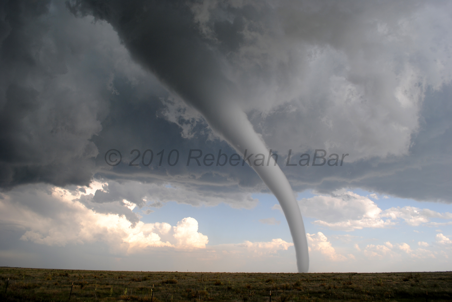
Wondering why no updates lately? I’ve been chasing the Plains with some friends this weekend, and today I saw the tornado of my life (chase brief here). The following photo is only one of many photos; some of the others may be even better (I can’t pick my favorite!) and I will be posting them later in this week or next…will be chasing northeast Kansas / southeast Nebraska tomorrow, then home on Wednesday.
See below.
Enough said.

Permalink
« Previous Page « Previous Page Next entries »
