07.23.10
Tropical Depression Bonnie
Tropical Storm Bonnie formed just southeast of Florida last night, and made landfall over southern Florida this morning.
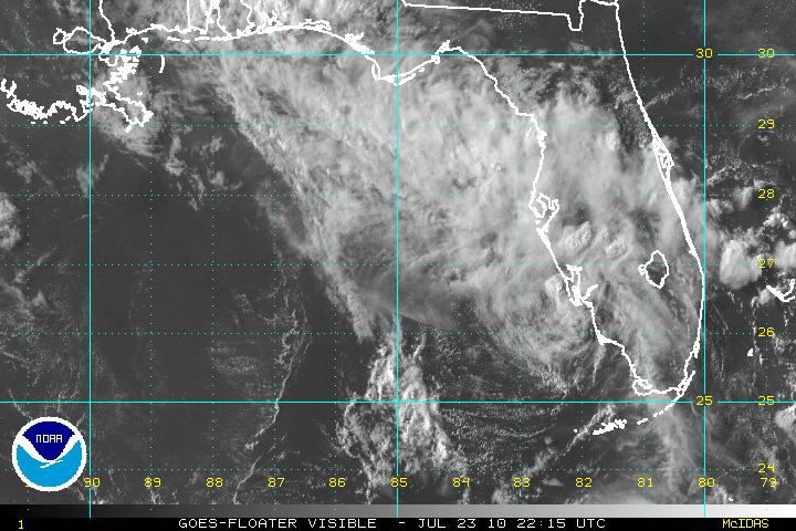
The above visible satellite image, from the National Hurricane Center (NHC), shows the remains of Bonnie entering the Gulf of Mexico this evening.
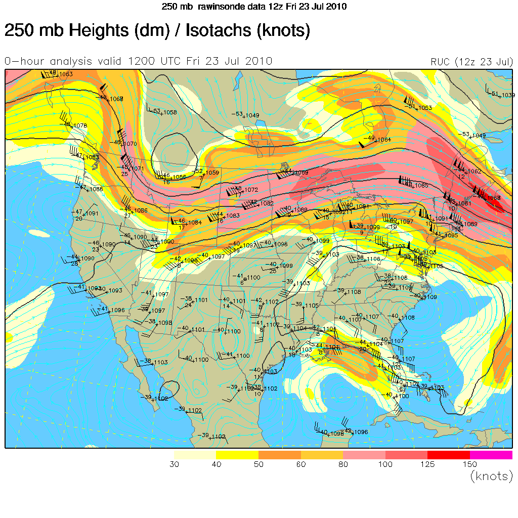
Although the NHC initially forecast Bonnie to strengthen to a tropical storm again before making landfall in Louisiana, an upper-level high over the southeastern U.S. and an upper-level low over the Gulf of Mexico are working to steer the tropical depression towards an area of wind shear, which will prevent Bonnie from strengthening.
The 250mb map below (click to enlarge), from the UCAR RAP, indicates the upper-level high by the blue, clockwise streamlines and the upper-level low by the blue, counter-clockwise streamlines. The orange and yellow highlighted area over the northeastern Gulf of Mexico represents an upper-level jet streak (enhancing the wind shear across Bonnie’s track), with winds going from southeast to northwest.


Green Sky Chaser » Lightning Photos said,
July 24, 2010 at 5:21 pm
[…] As expected, Bonnie has not survived her trip across the Gulf, thus she is not even a tropical depression anymore. […]