08.11.10
U.S. Heat
For much of the central and eastern U.S., it has been a pretty hot summer.
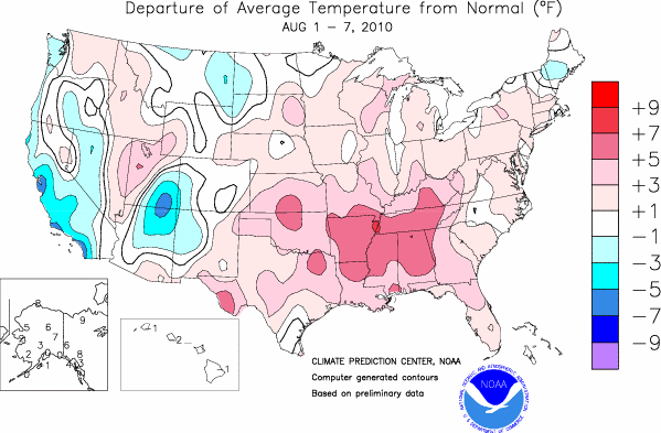
Take a look at the map below, from the Climate Prediction Center, showing average temperature anomalies across the country over the past week.
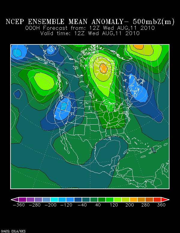
Now look at an ensemble model map showing the average 500 mb height anomaly from this morning, from the Earth Systems Research Laboratory.
(Put very simply, green to orange shading means pressure is higher than normal, while blue shading means pressure is lower than normal. 500 mb heights are the gray lines on the map.)
Notice any similarities to the first map?
A ridge of high pressure has brought above normal temperatures to the central and eastern U.S., while a trough of low pressure over the West Coast has brought below normal temperatures to the coast, especially to California.
Good news for those of us in the central U.S., though–models are showing a cold front coming through Kansas and Oklahoma by early next week, as the ridge finally breaks down and allows a large trough to progress through the northern U.S.
Temperatures should finally drop a few degrees and we may actually get the chance for some storms along the front!

