08.20.10
Soon-To-Be Danielle?
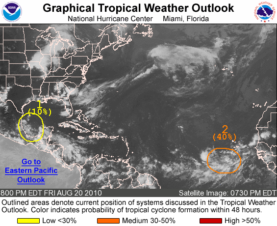
An area of low pressure just southwest of the Cape Verde Islands shows some promise for tropical development within the next several days (#2 on the NHC graphic above).
In an area with sea-surface temperatures in the mid- to upper 80s and deep layer wind shear of 10 to 15 knots (and moving into even warmer waters and calmer winds aloft), this low has the potential to become a tropical storm by early next week.
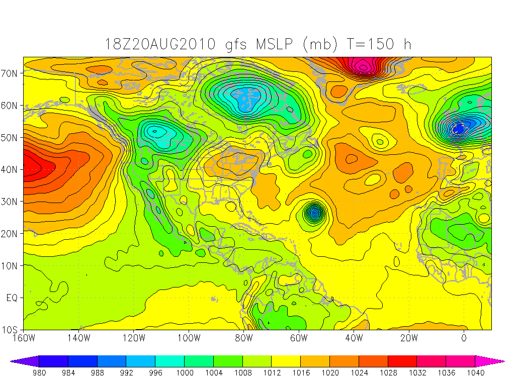
Several models are showing this system rapidly developing into a hurricane, possibly a strong hurricane, by the middle of the week. Models also show that the possible hurricane would likely recurve back eastward before it ever came close to land.
It has been a quiet start to the hurricane season in the Atlantic, but we are nearing the peak of the season, so we’ll probably start to see things picking up soon.
Sea-level pressure, GFS model, valid for 00Z on the 27th (Thursday night). Note the area of low pressure in the Atlantic. Click to enlarge.

