08.26.10
Tropical Cyclones: How They Form, Move, and Strengthen (aka, What Danielle, Earl, and Frank Are Up To) – Part 2
Yesterday we took a brief look at some of the factors behind tropical cyclone development. Those same factors come into play for tropical cyclone strengthening, particularly the warm water and lack of wind shear.
But once it’s formed, how does a tropical storm or hurricane move?
When tropical cyclones are small and still near the equator, they are at first steered by low-level easterly winds. Once tropical cyclones become stronger and move farther north (or south, if in the southern hemisphere), they are steered by upper-level troughs and ridges.
For example, all else being equal, if there is a trough over the eastern United States, an approaching hurricane will get steered back out to sea by southwesterly upper-level winds on the eastern side of the trough (the hurricane would also “want” to get closer to the falling pressure on the downwind side of the trough).
If there is a ridge over the eastern U.S., all else being equal, the hurricane may want to go south of the ridge and continue towards the coast. Also, if there is a high pressure system downwind of the ridge, the easterly winds on the southern side of the high would also push the storm westward.
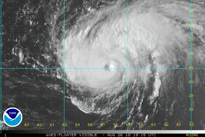
Currently, a ridge is moving into the central and eastern U.S….but Danielle and Earl are forecast to stay out at sea. As a trough exits the U.S., Danielle will be pushed up towards the northeast. Also, in this case, the storms formed so far east they began to get pulled clockwise around the semi-permanent high pressure system over the eastern Atlantic (known as the Azores or Bermuda High).
At present, Danielle is a strong Category 2 hurricane with sustained winds of 110 mph and Earl is a strengthening tropical storm. Both cyclones are in areas of warm water and low vertical wind shear, so should continue to strengthen. Danielle should finally become a Category 3 hurricane by tomorrow night, while Earl is also forecast to become a Category 3 hurricane by Tuesday afternoon, at which point the storm may have some effect on the Leeward Islands before recurving back north and east.
In the eastern Pacific, Frank is a Category 1 hurricane with winds of 90 mph, but is forecast to weaken to a tropical depression by Monday, as the cyclone encounters colder waters off the coast of Mexico.
Models are showing that the next Atlantic tropical cyclone may form within a few days. The next name on the list is Fiona, replacing Frances, which was retired following the 2004 hurricane season.
