09.01.10
Typhoon Kompasu Makes Landfall In Korea
While the U.S. is concerned with what will happen to the East Coast when Category 4 Hurricane Earl passes by (starting tomorrow), as well as what will eventually happen with newly formed Tropical Storm Gaston, another hurricane is just now making landfall at Seoul, South Korea.
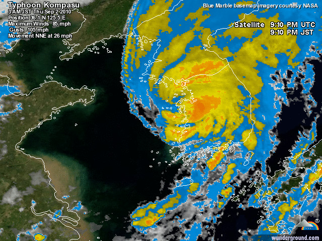
Typhoon Kompasu’s eye is coming ashore, with maximum sustained wind speeds estimated at 85 mph (Category 1 on the Saffir-Simpson scale) and a minimum central pressure of 975 mb.
Infrared satellite image of Typhoon Kompasu making landfall, courtesy of Weather Underground.
As of the time I write this post, the pressure is still dropping at Seoul and the wind speeds are still climbing. At the top of the last hour, Seoul recorded rain, winds of 43 mph, gusts to 63 mph, and a pressure of 992 mb. For the latest observations, see the Weather Underground weather history page for Seoul.
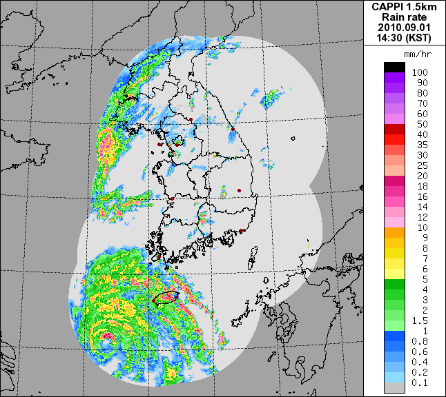
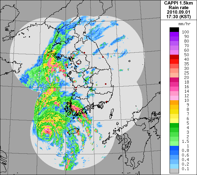
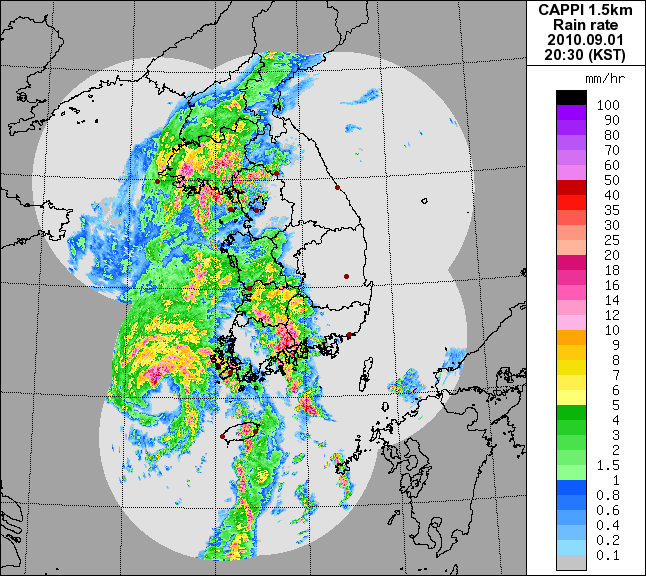
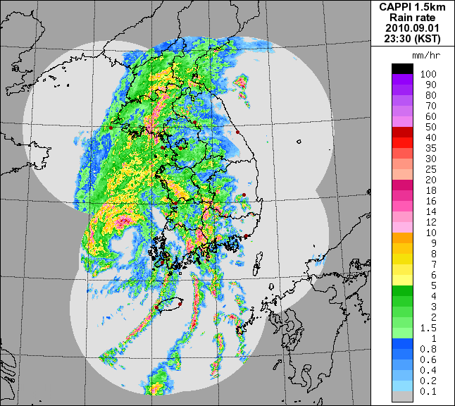
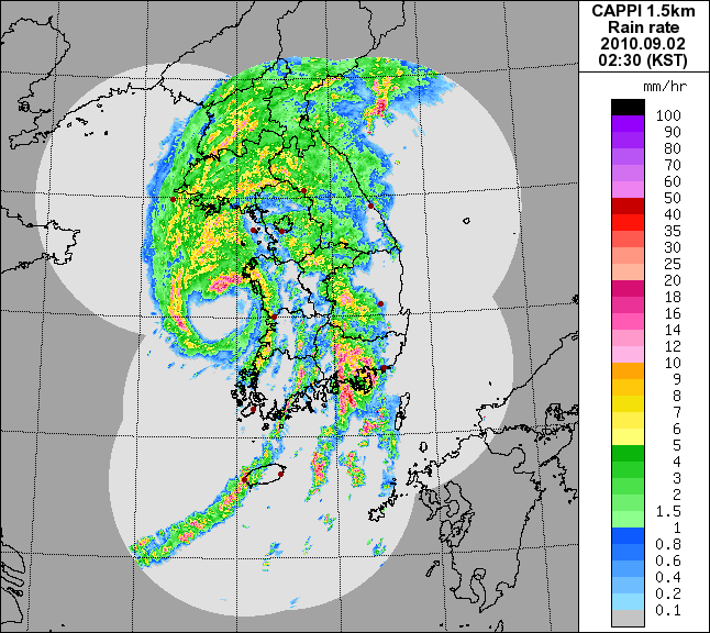
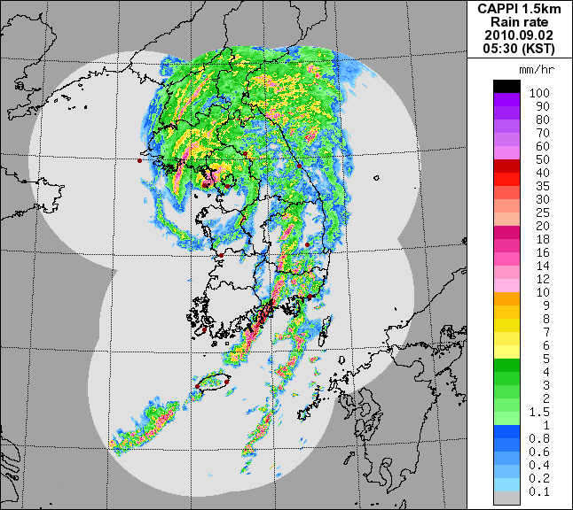
Here is a series of radar images from the Korean Meteorological Administration (weather service for South Korea) over the last several hours, showing Kompasu approaching Korea and making landfall.
Kompasu will weaken further over land and will be steered out towards Japan.
For the latest Korean weather information, see the Korean Meteorological Administration and Weather Underground.
World Wide News Flash said,
September 1, 2010 at 6:51 pm
Green Sky Chaser » Typhoon Kompasu Makes Landfall In Korea…
I found your entry interesting do I’ve added a Trackback to it on my weblog :)…