09.24.10
Fall Flooding and Cooler Weather
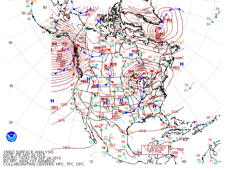
Check out this 18Z (1pm Central Daylight Time) surface analysis from the Hydrometeorological Prediction Center (click to enlarge).
There’s an extratropical cyclone just north of Lake Superior, and a cold front extending southwestward through southern Oklahoma. The low pressure system brought lots of rain to the upper Midwest, and is causing flooding problems in Minnesota and Wisconsin.
NWS rainfall and flooding reports here.
Dramatic news footage of a bridge wiped out in Minnesota.
Cooler air is still to come, behind another cold front that is forecast to make it through Oklahoma Saturday night. This front will bring much more fall-like temperatures to the central and possibly eastern US. The NWS forecast low for Norman on Sunday night is just 51 °F!
Note also that Tropical Storm Matthew is on the map; it’s just now making landfall in Nicaragua. Models do show that another tropical system could form in the Caribbean or Gulf of Mexico within a week. This tropical cyclone could have a chance at making landfall somewhere along the Gulf Coast by the end of next week, although it’s too far out to say if this will actually happen.
