10.14.10
Upcoming Nor’easter
Models over the last week have consistently been showing a nor’easter developing at the end of this week.
A nor’easter is a strong extratropical cyclone that forms off the New England coast, bringing strong northeast winds into New England. These storm systems are most often associated with wintry conditions.
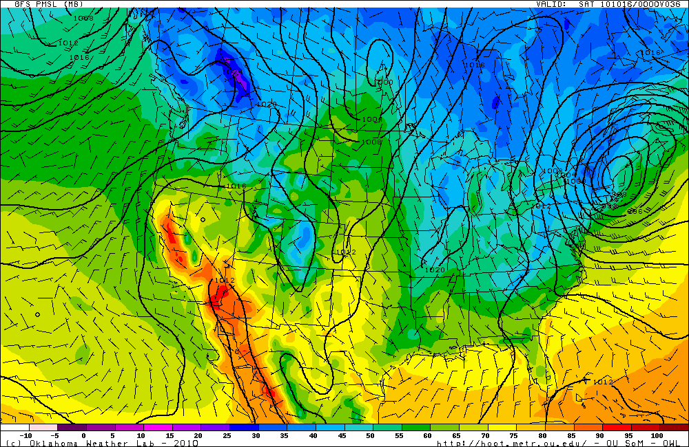
Here’s what the GFS model shows in terms of the location and depth of the nor’easter (this map is valid for 00Z Saturday, or 8pm EDT Friday; click to enlarge):
This surface map, courtesy of the Oklahoma Weather Lab, shows a 988 mb low (fairly low pressure for this time of year) centered over southern Maine. The lines represent surface pressure, and the colors represent surface temperature. Temperatures at this time are forecast to be in the 30s in northeastern New York, Vermont, western New Hampshire, and northwestern Massachusetts.
The most likely scenario is for there to be some snow in the mountains of Vermont and New Hampshire tomorrow night, with cold rain and the possibility for flooding over much of the rest of New England.
It’s probably a good thing that the American League Championship Series starts in Texas tomorrow night. I can’t cheer for the Rangers and Cliff Lee, especially after the Rangers got Lee from the Mariners this year. So GO YANKEES!!
