10.15.10
There’s Snow In Them Thar Hills!
The nor’easter intensified ahead of schedule, deepening by 16 mb in just 12 hours. A bomb cyclone is an extratropical cyclone which intensifies by 24 mb in 24 hours, so this nor’easter could have come close to that, had the deepening continued.
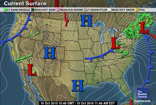
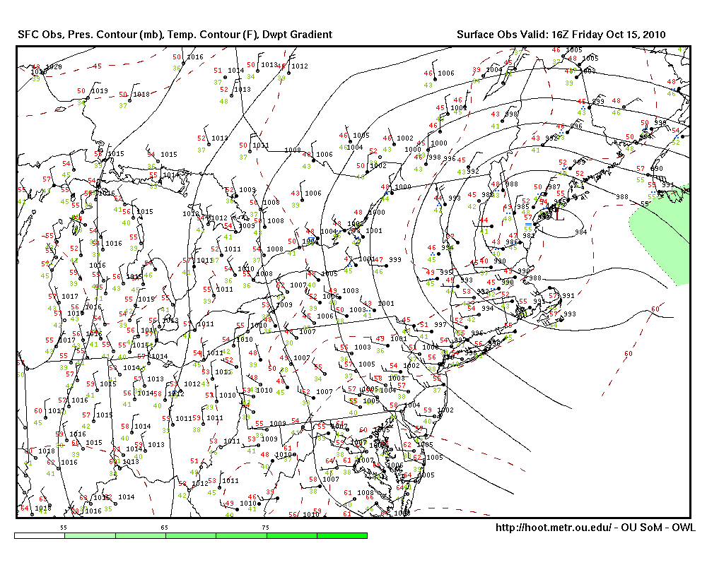
The pressure is now 984 mb, and the first snow (several inches of it) has been reported in the mountains of Vermont and New Hampshire! Winds in the New England area are also pretty strong, as there is a pretty tight pressure gradient with this low.
The Weather Channel map of the cyclone as of 11:49 am EDT:
Oklahoma Weather Lab surface map of the cyclone, as of 12:00 pm EDT (click to enlarge):
In future news, models are picking up on the possibility of a strong hurricane developing in the Caribbean in another week. The GFS model has it crossing over Cuba, but perpendicular to Paula’s track…this one would go south to north across Cuba. Could be something to keep an eye on for those in the Caribbean. The next named storm in the Atlantic would be Richard.

