01.11.11
Weather Update: Bomb Cyclone
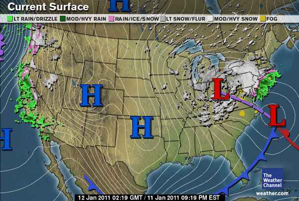
Tonight’s surface analysis from The Weather Channel shows most of the U.S. in the grips of a strong, large area of high pressure. This high pressure has ushered in cold, dry air for much of the U.S.
Perhaps the biggest story tonight, though, is that the low pressure center over Ohio, associated with a deep, upper-level trough, should merge late tonight with the low moving up the Atlantic Coast. This secondary low is what tracked along the Gulf Coast early in the week, aiding in the snow and ice storms of the Southeast.
As the smaller low moves up the coast tonight, an area of upper-level divergence on the east side of the trough (what’s causing the low in Ohio) will cause the surface low to intensify. The two areas of surface low pressure will appear to merge below the trough, and the pressure of the resulting surface low is expected to rapidly drop.
Models are showing that the pressure of this low could drop by 28 millibars in 24 hours, which is well within the definition of a “bomb cyclone” (low pressure center drop of 24 millibars in 24 hours). Currently, the pressure of both lows is about 1012 mb.
This extratropical cyclone / nor’easter is expected to result in several inches of snowfall across the Northeast, starting tonight.
In other news, there is also an extratropical cyclone off the Pacific Coast, and this is responsible for strong winds and rain and wintry precipitation along the West Coast. Western Washington and northwestern Oregon are already receiving snow and freezing rain.
