01.30.11
Thoughts On This Week’s Oklahoma Winter Storm
For quite some time now the models have been hinting at the possibility for a decent amount of snow and possibly ice for Oklahoma this week. The models have come to some sort of agreement lately and it’s looking like parts of central to northern Oklahoma could see several inches of snow from Monday night into Tuesday.
There may be some sleet or even freezing rain Monday night as well, but the GFS and the NAM aren’t showing much of a warm layer, if any.
A strong, arctic high (could be as high as 1048 mb or so) will edge down into the Northern Plains, bringing frigid air along with it. The National Weather Service in Norman (Oklahoma) is calling for a low of 7 °F in Norman Tuesday night.
We could certainly use some precipitation…it’s been so dry in the Southern Plains, and numerous fires have broken out in the last couple of days.
These last two days have been nice in terms of temperature, though; yesterday Norman reached 79 °F and today 76 °F! 🙂 I still haven’t turned my heat on…I haven’t had the heat on since March, if not February of 2010. My apartment stays insulated pretty well and so far this winter it hasn’t stayed cold for longer than a couple of days.
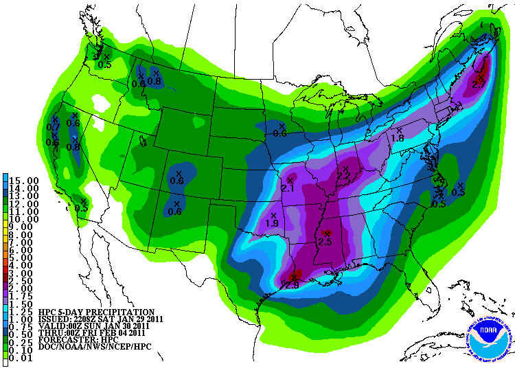
Here’s the 5-day precipitation (liquid-water equivalent) forecast from the Hydrometeorological Prediction Center…looks like it could be wet for much of the U.S. this week!
