02.26.11
West Coast Cold And Snow
The last few days have brought cold temperatures and snow to the Pacific Northwest. Even western Washington and northwestern Oregon received a rare few inches of snow, prompting a visit to Seattle from The Weather Channel’s meteorologist Chris Warren.
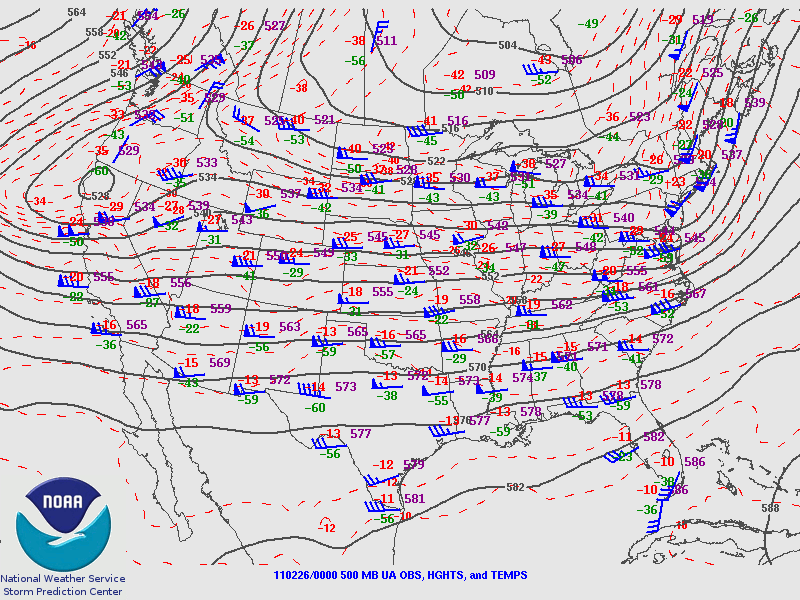
The trough associated with this storm system is dipping a bit further south into central California this morning, where cold air will advance behind a front and surface low moving over the Great Basin.
Friday night’s 500 mb analysis from the Storm Prediction Center, showing the trough over the West Coast.
This cold air is bringing snow early this morning down to at least 1000 feet in the San Francisco Bay Area, and it is even possible that a few flakes may fall at sea level in the Bay Area. As of 11 pm Pacific Time last night, light snow was already confirmed in the San Francisco metro.
It has not snowed in downtown San Francisco since February 1976.
Record cold and a few inches of snow is also forecast for southern California, as a stream of moisture is coming up from the tropics (the Pineapple Express); snow levels in the Los Angeles area could drop to 500 feet.
Record lows were set Friday morning in Seattle, Washington (21 °F) and Billings, Montana (-14 °F), and more records could be broken tomorrow morning. A few examples of California record lows that may be threatened (info from The Weather Channel) include Los Angeles (38 °F), Long Beach (37 °F), and Sacramento (28 °F).
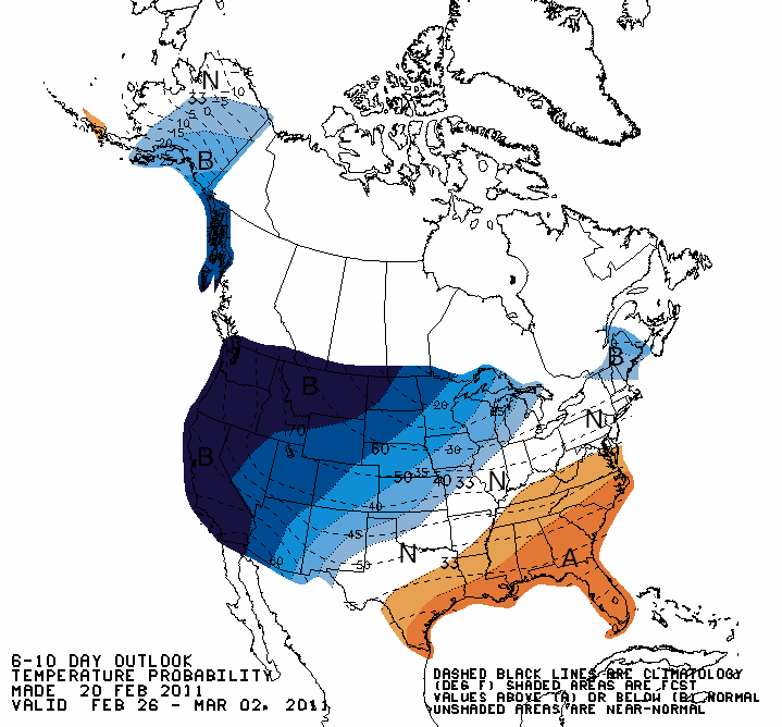
Climate Prediction Center outlook for temperatures from today through Wednesday, showing well below average temperatures expected across the West Coast.
Note also that this unusual cold follows record California warmth earlier in February (e.g., San Francisco experienced some 70 and 80-degree weather).

