02.25.11
Posted in Uncategorized at 8:00 am by Rebekah
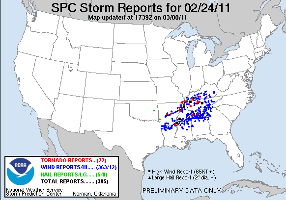
Here’s a map of the storm reports from yesterday/last night…the tornado risk was largely a bust in the forecast area, but there were a few tornadoes near the Mississippi River and into central Tennessee.

It looks like Sunday is shaping up to have a similar severe weather threat in about the same area. I don’t have time for a more detailed post on it just now, but you can check out the Storm Prediction Center’s website for more.
Once again, I don’t plan on chasing this next setup…with gas prices going up the way they are, I may have to be even pickier this year on which days I chase. The Southern Plains season should be gearing up fairly soon, though. The long-range model solution changes with just about every run, so it’s too early to say just when I may be chasing again.
Thanks for staying tuned!
Permalink
02.24.11
Posted in Severe Weather Forecast at 8:00 am by Rebekah
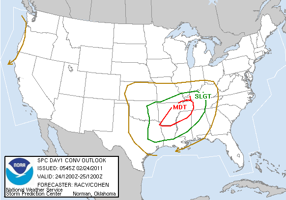
The Storm Prediction Center issued the first moderate risk of the year yesterday, valid today and tonight. Today’s moderate risk includes a 15% chance for tornadoes, 30% for 1″ or greater hail, and 45% for severe wind, centered in eastern Arkansas into northwest Mississippi and western Tennessee.

I won’t be chasing this one; I’m planning on waiting for better setups farther west. That being said, this is a fairly potent setup and there may be a similar one in about the same location on Sunday.
I’ll probably post a bit more on this setup and the storms that form later in the day.
Stay safe!
Permalink
02.23.11
Posted in Weather News at 8:00 am by Rebekah
The Oklahoma Mesonet is a network of 120 environmental observing stations distributed across Oklahoma. Sometimes (if not most of the time), the Oklahoma Mesonet, run by the Oklahoma Climatological Survey, can be more accurate than the National Weather Service observing stations.
Yesterday, the Norman National Weather Service station was having issues…including a temperature range of -20 °F to 86 °F (it was actually in the 50s) and a dewpoint range of -42 °F to 45 °F (actually all in the 20s)!!
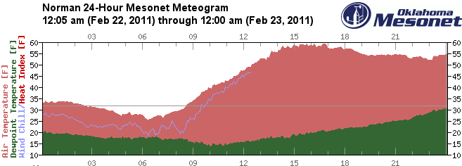
The following meteograms show temperature and dewpoint for Norman from about midnight last night through midnight this morning. Check out that temperature drop and spike on the NWS version! Note the dewpoint drops off a couple times on the NWS meteogram…no data was recorded these two times, but then it came back with a reading of -42 °F!
NWS Norman station; click to enlarge (based on a meteogram from the University of Wyoming; temperature [pink] and dewpoint [green] given on the side scales, local time and hourly temperature given below):

Oklahoma Mesonet Norman station:

Permalink
02.22.11
Posted in Non-US Weather, Weather News at 8:00 am by Rebekah
This week’s post in the global weather and climate series features Manaus, Amazonas, Brazil.

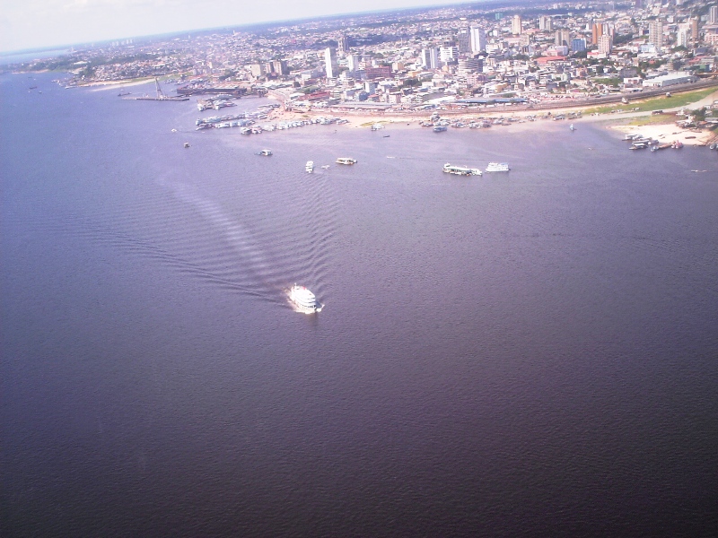
Aerial view of Manaus, looking over the Rio Negro. From Wikipedia
Manaus is a city of over 1.7 million people (over 2 million in the metro), lying at the confluence of the Negro and Amazon rivers. The capital of the Brazilian state of Amazonas, Manaus is located in the heart of the Amazon Rainforest and is a popular ecotourist destination. Manaus makes up 50% of the population of the Amazon.
Manaus was founded as a fort in 1669, to help establish the Portuguese claim on the area. In the late 19th century, Manaus was at the center of the rubber boom of the Amazon. Current exports include timber and Brazil nuts, while petroleum refining, soap manufacturing, shipbuilding, chemical industries, and tourism are also a part of the economy.

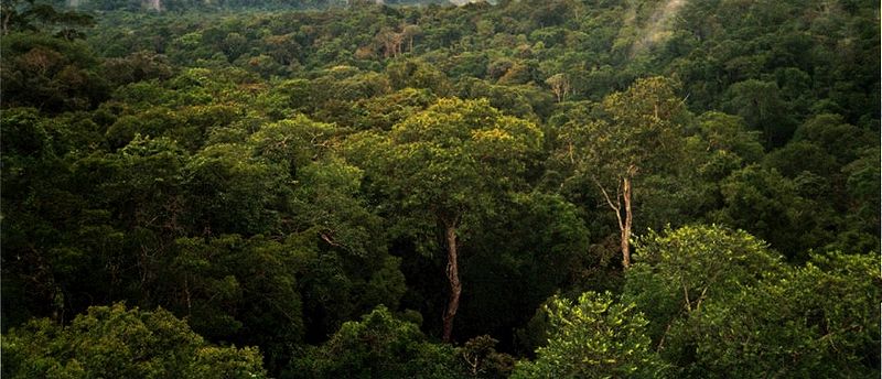
Amazon Rainforest, on the north side of Manaus. From Wikipedia
A few more facts about Manaus (from Wikipedia):
- Time zone: Atlantic Standard Time (UTC-4)
- Average elevation: 302 ft (92 m)
- Climate zone: Tropical rainforest
- Average high temperature: 86 °F (30 °C)
- Average low temperature: 73 °F (23 °C)
- Average annual high/low temperature range: 86 to 90 °F (30 to 32 °C) / 73 to 75 °F (23 to 24 °C)
- Record high temperature: 99 °F (37 °C)
- Record low temperature: 55 °F (13 °C)
- Average annual precipitation: 66 inches (1,670 mm)
Weather: As Manaus is situated at just 3 °S and in the middle of a rainforest, the climate is pretty steady year-round. As you can see by the climate stats above, the temperature really doesn’t range outside of the low to mid-70s at night to the upper 80s during the day. Makes for an easy forecast! There is a distinct rainy season, though; the wettest months are December through May.
This week the forecast is calling for…you guessed it, lows around 73 °F and highs around 84 °F, with a chance of rain every day.

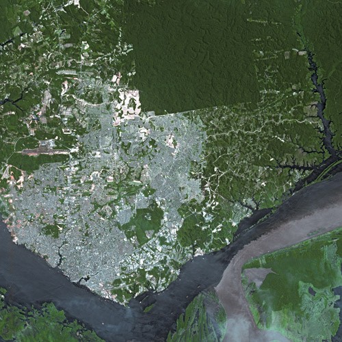
Satellite view of Manaus, showing the Rio Negro (left) flowing into the Amazon River (going off to the right). From Wikipedia
For weather maps and information on current and forecast Manaus weather, see Weather Underground and Weather Online UK (maps and models).
For more information on Manaus, here’s a link to Wikipedia.
Next Tuesday I plan to take a look at the climate and weather in another part of the globe. As always, if you have any suggestions for future cities, please leave a comment!
Permalink
02.21.11
Posted in Weather Education at 8:00 am by Rebekah
Last week we finished up talking about the elements of weather (temperature, pressure, wind, moisture, clouds, precipitation, and visibility); this week we’re going to move on to time zones.
When analyzing weather and weather models around the world, it becomes much easier to think of everything in terms of one time zone. For example, weather balloons are launched twice daily around the world, always at the same time (i.e., a balloon is launched in Los Angeles at the same time that one is launched in London). If you look at a weather map, you may see time given in “UTC”. Coordinated Universal Time (or Universal Time, Coordinated) is the standard time zone that meteorologists use.
UTC / GMT / Z
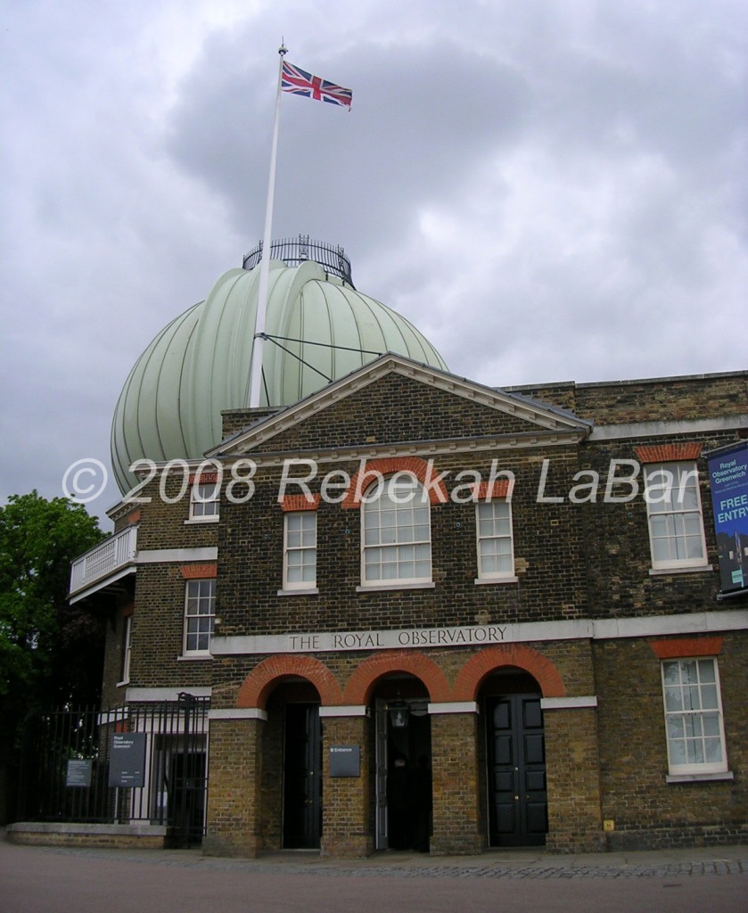
Universal Time, Coordinated (UTC) is the same time zone as Greenwich Mean Time (GMT). You probably already know that Greenwich Mean Time is the time at the Royal Observatory in Greenwich, London, England, where the prime meridian divides the eastern hemisphere from the western hemisphere.

Another time zone you may see on weather maps is Zulu Time (Z). Zulu (in South Africa) is also a place divided by the prime meridian, and as such Zulu Time is also the same time zone as UTC and GMT. While UTC may be the more formal way to write time in meteorology, many (including myself) prefer to use Z in informal settings as it is faster to write and say.
In summary,
- UTC = Z = GMT
- 24-hour time clock, like in the military
- Midnight GMT = 0000 UTC = 00Z
- Noon GMT = 1200 UTC = 12Z
- 7:30 PM GMT = 1930 UTC = 1930Z
US Time Zones
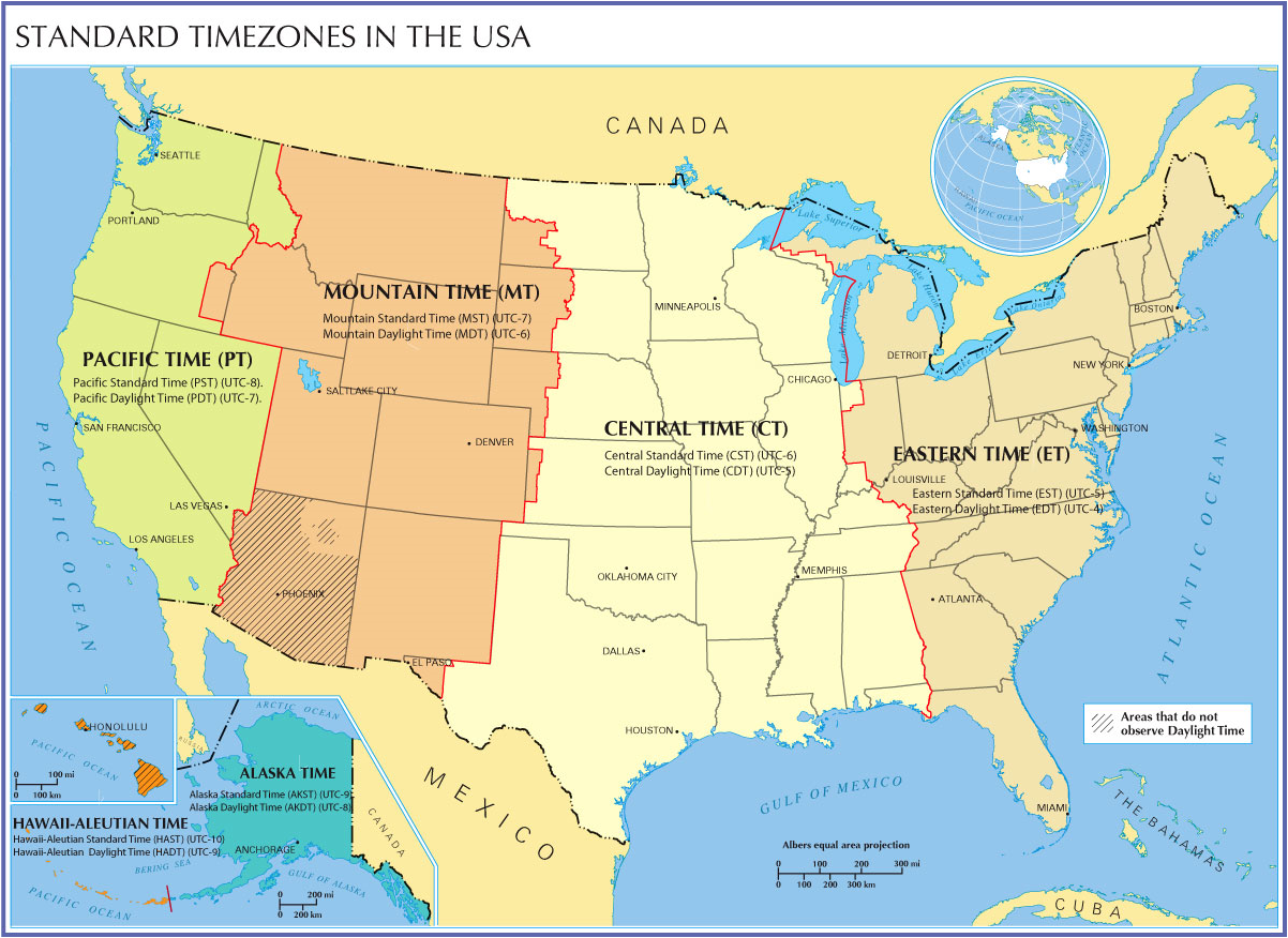
There are four time zones for the contiguous United States: Pacific, Mountain, Central, and Eastern. The following map (click to enlarge) shows the conversion factors between these time zones and UTC.

For example, I live in Oklahoma, so I’m currently in Central Standard Time. The conversion is UTC-6, which means if it is 1200 UTC / 12Z (noon in London), it is 6 am in Oklahoma. If I want to go to UTC, I have to go forward in time, and add six hours.
————————————————–
Next Monday we will start talking about weather measurements, beginning with surface observations!
Permalink
« Previous Page — « Previous entries « Previous Page · Next Page » Next entries » — Next Page »
