02.01.11
Posted in Weather News, Winter Weather at 3:58 pm by Rebekah

The blizzard has struck Oklahoma…my first blizzard was a pretty big one, and by now the worst is up around Missouri and Illinois.
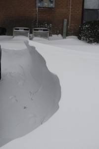
I measured about 8 or so inches of snow here in Norman, but it’s difficult to measure just how much snow we would have gotten without the strong winds. I found quite a few 2-foot snow drifts, and some drifts that were around or just over 3 feet deep!
The wind has really been howling, at about 30 mph or greater, with gusts to 40 mph. The temperature this afternoon when I went out was around 10 °F, with a wind chill of -15 °F!

Last night we got some heavy thundersleet (with quite a bit of lightning!), starting about 9:15 or so. We probably got around an inch of sleet before the snow even started, after midnight. The snow was done falling by noon, but it’s still blowing around out there.
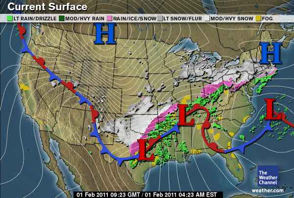
Here’s a surface map from The Weather Channel, at about 3:30 am Central Time:

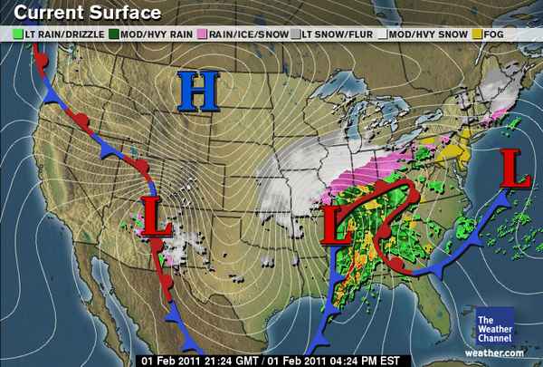
And here’s a map from 12 hours later, showing where the snow and ice has moved on to (there’s also a tornado threat for the Southeast):

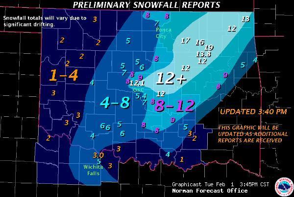
Preliminary snow totals for Oklahoma, via the NWS Norman:

Permalink
Posted in Non-US Weather, Tropical Weather at 1:27 pm by Rebekah
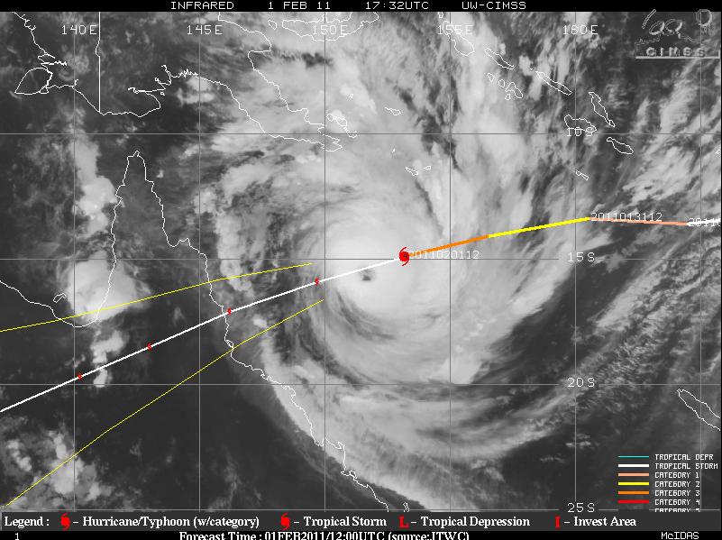
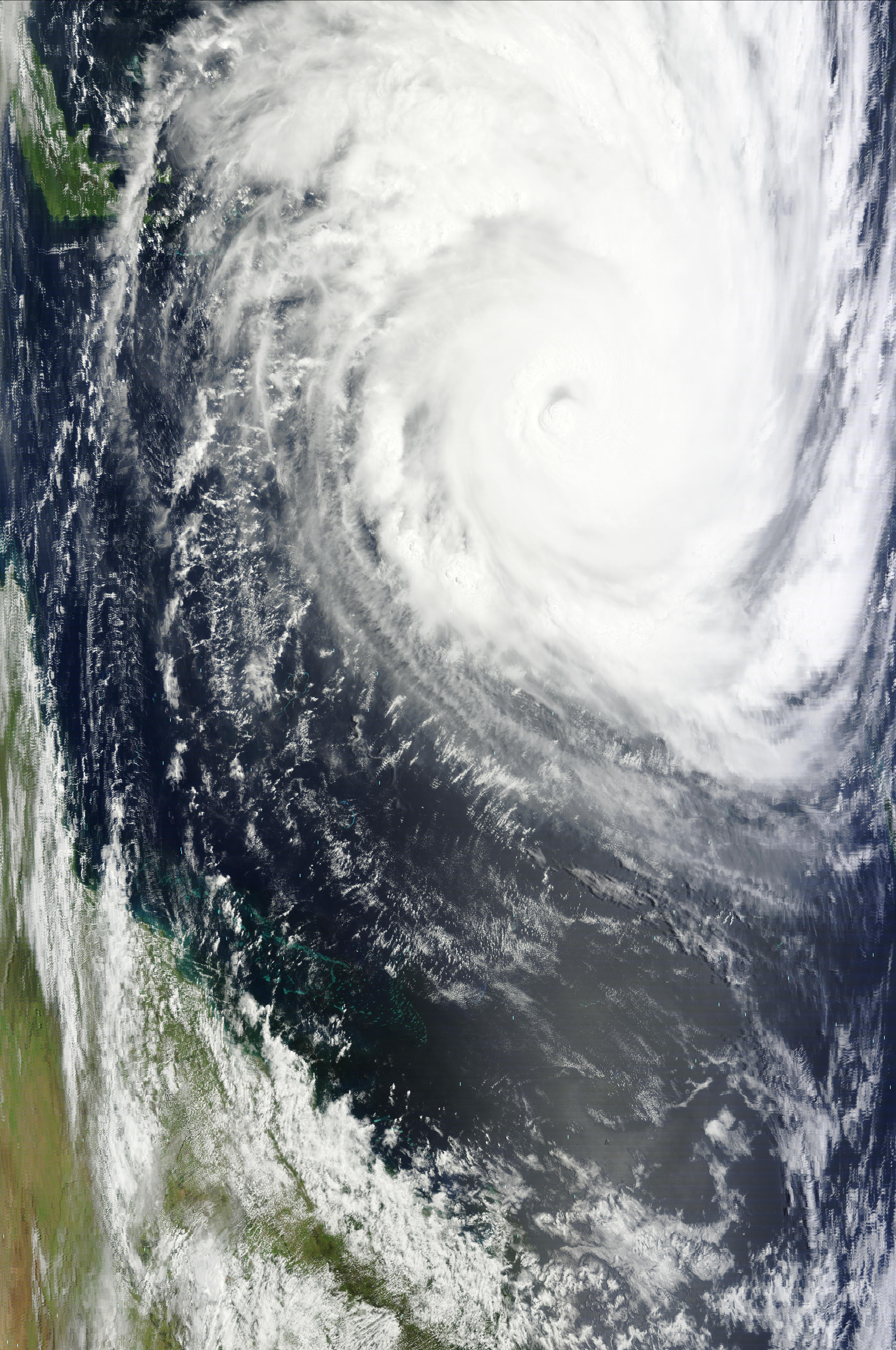
Severe Tropical Cyclone Yasi is a Category 5 tropical cyclone this morning (Australian scale …Category 4 on the Saffir-Simpson scale).
The maximum sustained winds are 138 mph (221 kph), and the minimum central pressure is 924 mb. Yasi is moving towards the west-southwest at about 17 mph (28 kph).

Yasi, at 1732 Z (3:32 am Australian EST), from UW-CIMSS (click to enlarge)
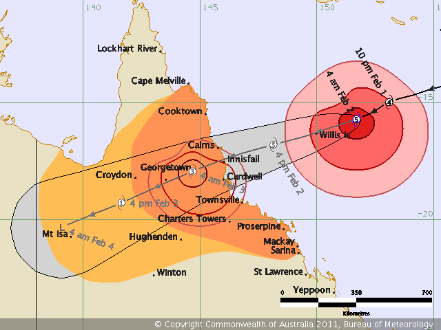
Yasi’s wind field is enormous, so don’t just focus on where the eye is headed…here’s some excerpts from the latest (5:01 am Australian EST) tropical cyclone advice from the Bureau of Meteorology:
“SEVERE TC YASI IS A LARGE AND VERY POWERFUL TROPICAL CYCLONE AND POSES AN EXTREMELY SERIOUS THREAT TO LIFE AND PROPERTY WITHIN THE WARNING AREA, ESPECIALLY BETWEEN PORT DOUGLAS AND TOWNSVILLE.”
“THIS IMPACT IS LIKELY TO BE MORE LIFE THREATENING THAN ANY EXPERIENCED DURING RECENT GENERATIONS.”
This is obviously some pretty strong wording, so if you are in the path of this cyclone, please take all warnings seriously, and find higher ground if you live near the sea. The storm surge is expected to be very high and some areas could get as much as 3 feet of rain, so there will be some flooding up and down the coast (and further inland, wherever the heaviest rains set up).

Yasi’s latest forecast track and intensity, from the Bureau of Meteorology (click to enlarge)
Permalink
Posted in Non-US Weather, Tropical Weather, Weather News at 8:00 am by Rebekah
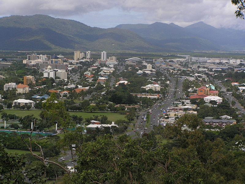
This week’s post in the global weather and climate series features Cairns, Queensland, Australia.

Cairns, from Mt. Whitfield, looking east. From Wikipedia
Cairns is situated on the northeastern coast of Queensland, on the eastern side of the Cape York Peninsula. The Great Dividing Range is to the west, and the Great Barrier Reef is just off the coast. Cairns is home to over 164,000 people.
Cairns was founded in 1876, and was later used by the Allied Forces during World War II as a base for Pacific operations. Today, the city is an important international tourism destination. Following Sydney, Melbourne, and Brisbane, Cairns is the fourth-most popular destination in Australia for foreign tourists.
A few more facts about Cairns (from Wikipedia):
- Time zone: Australian Eastern Standard Time (UTC+10)
- Average elevation: sea level
- Climate zone: Tropical monsoon
- Average high temperature: 84 °F (29 °C)
- Average low temperature: 69 °F (21 °C)
- Average annual high/low temperature range: 78 to 89 °F (26 to 31 °C) / 63 to 75 °F (17 to 24 °C)
- Average annual precipitation: 79 inches (2,011 mm)
Weather: February is climatologically the wettest month of the year for Cairns. The city’s monsoon climate means that there is a very pronounced wet season in the summer, with a dry season in the winter.
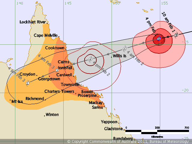
While not as affected by the Australian flooding as some points further south, Cairns has received copious precipitation recently. The rain is not going to stop any time soon, unfortunately; there is a chance of showers and thunderstorms every day and night for the next week or so, and Tropical Cyclone Yasi could bring as much as a foot or more of rain for some places around and just east of Cairns.
Models show Yasi could stall a bit in the mountains for about 12 hours or so after making landfall, bringing greater chances for large rain totals. Cairns will also get some strong winds (maximum winds could reach 100 mph, with higher gusts) from Yasi, as the cyclone is expected to make landfall as a Category 4.

See also yesterday’s post, Strengthening Tropical Cyclone Yasi.

Tropical Cyclone Yasi, at 00Z (10am on the 1st, Australian Eastern Standard Time), from MODIS (click to enlarge)
For the latest on Tropical Cyclone Yasi, see the Australian Bureau of Meteorology.
For weather maps and information on current and forecast Cairns weather, see the Australian Bureau of Meteorology, Weatherzone, Weather Underground, and Weather Online UK.
For more information on Cairns, here’s a link to Wikipedia.
Next Tuesday I plan to take a look at the climate and weather in another part of the globe. As always, if you have any suggestions for future cities, please leave a comment!
Permalink
« Previous Page « Previous Page Next entries »

