04.23.11
Keeping An Eye On KSC Weather
I’ve got so much on my plate right now, I’m going to keep this short.
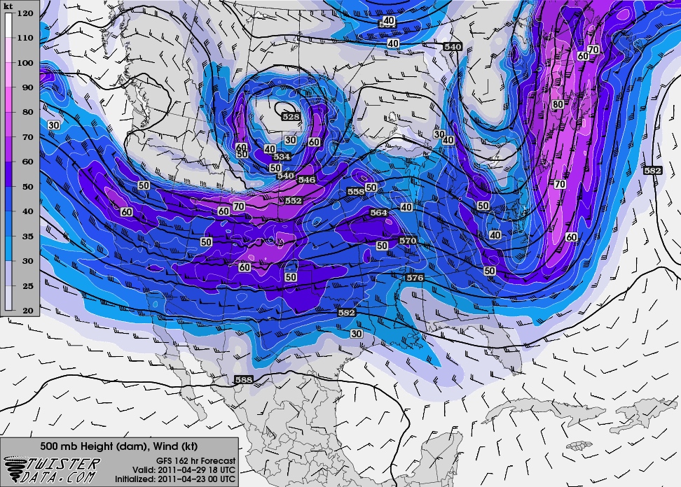
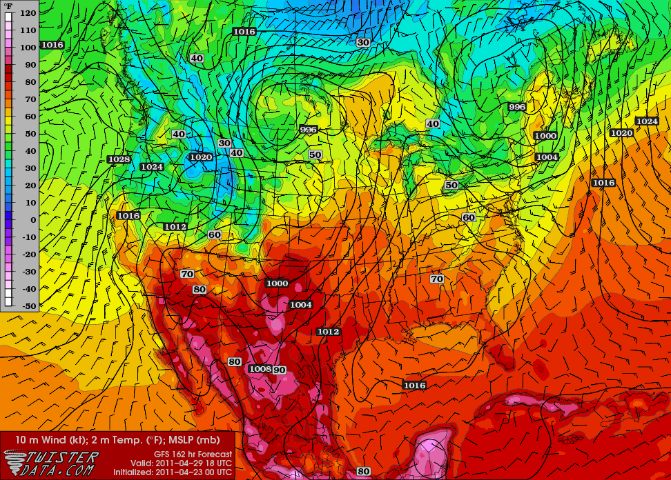
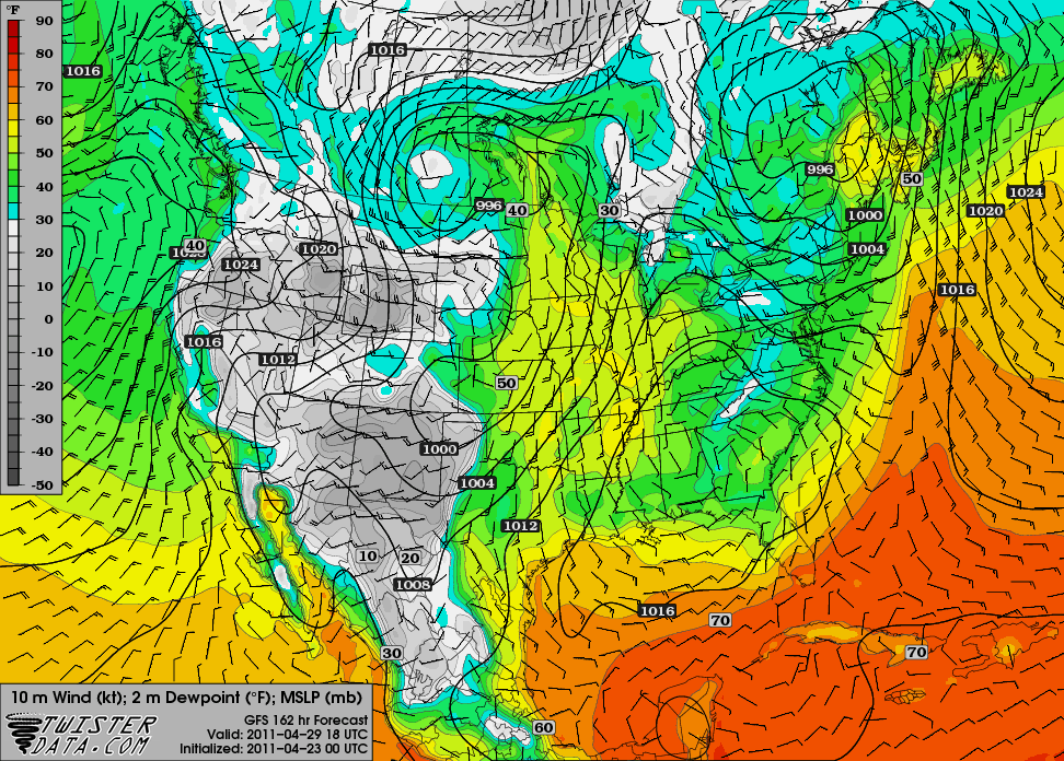
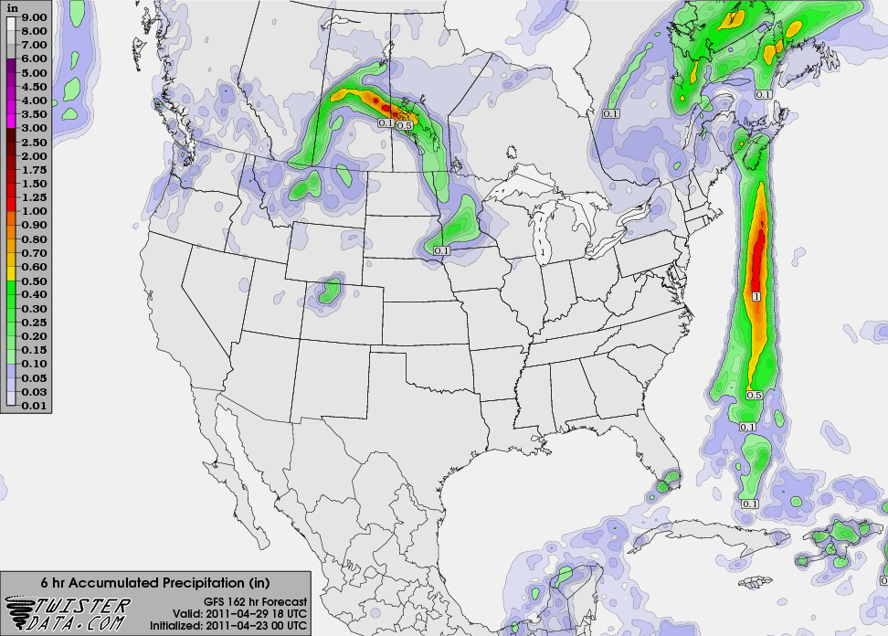
Here are a few weather maps (click to enlarge) from TwisterData, based on last night’s 00Z run of the GFS, valid for 18Z on the 29th (i.e., 2 pm EDT on shuttle launch day).
The 500mb map shows a trough over the east coast, north of Florida, with a ridge building in the Midwest. I’d say this is a pretty good setup for a general lack of rain.
The surface temperature map indicates a weak front pushing through, with winds over Cape Canaveral out of the north-northeast and a temperature near 70 °F (I’m certain it’s going to be higher than that, though!).
The model forecast for dewpoints in the mid-50s to near 60 °F at the Cape is also lower than I expect it will be.
Finally, what we’re all most interested in…will it rain on launch day? Currently models have the front passing through central Florida the day before the launch, suggesting we could have a slight chance for showers and thunderstorms on the first day of the Tweetup, but hopefully will be good to go on launch day (the below 6-hour precipitation total shows showers in south Florida, but not east central Florida).
Note: Coming up this week, I plan on blogging more about my road trip, NASA, and the launch experience than about weather (except for perhaps weather along the way!). This means I plan on suspending the normal Monday and Tuesday series until I get back.


