04.08.11
Posted in Uncategorized at 3:13 pm by Rebekah
Well, I decided to chase today after all. I had my eye on tomorrow more, but in the end couldn’t resist the opportunity to go for an in-state chase.
Currently we’re just northeast of Enid, and headed for Enid and possibly points south of there. There is already a decent cumulus field forming in southwest Oklahoma, but I’m still tempted by the northern Oklahoma target.
A stationary front near the Kansas / Oklahoma border could provide a greater chance for lift and low-level shear for supercells, but of course the instability is higher and cap is more likely to break in southwest Oklahoma.
Permalink
Posted in Severe Weather Forecast at 8:00 am by Rebekah
Eastern Kansas up into Iowa may get a shot at some supercells tomorrow, if lift proves sufficient for storm initiation.
I still wish temperatures were cooler and the trough was a tad further east by 00Z.
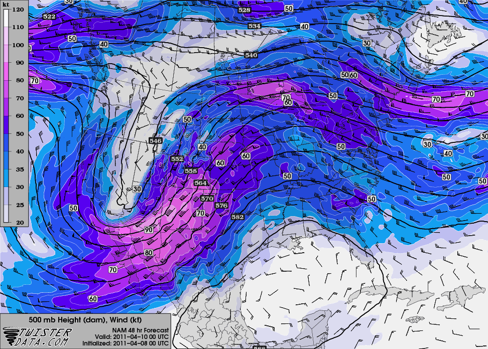
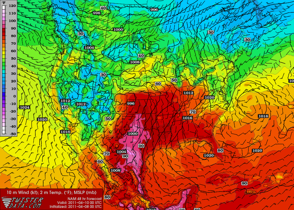
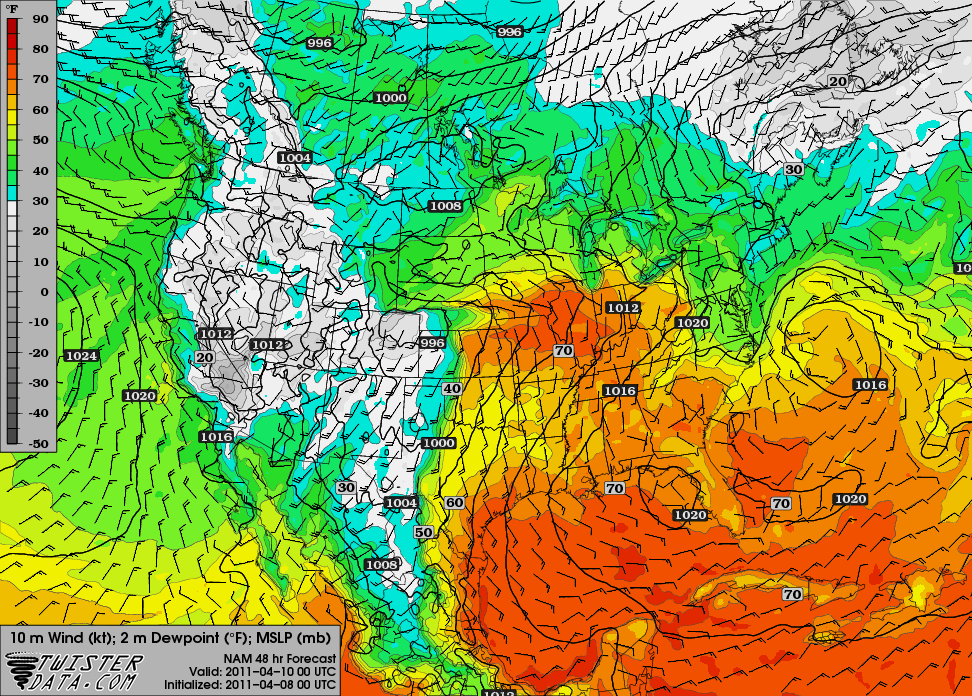
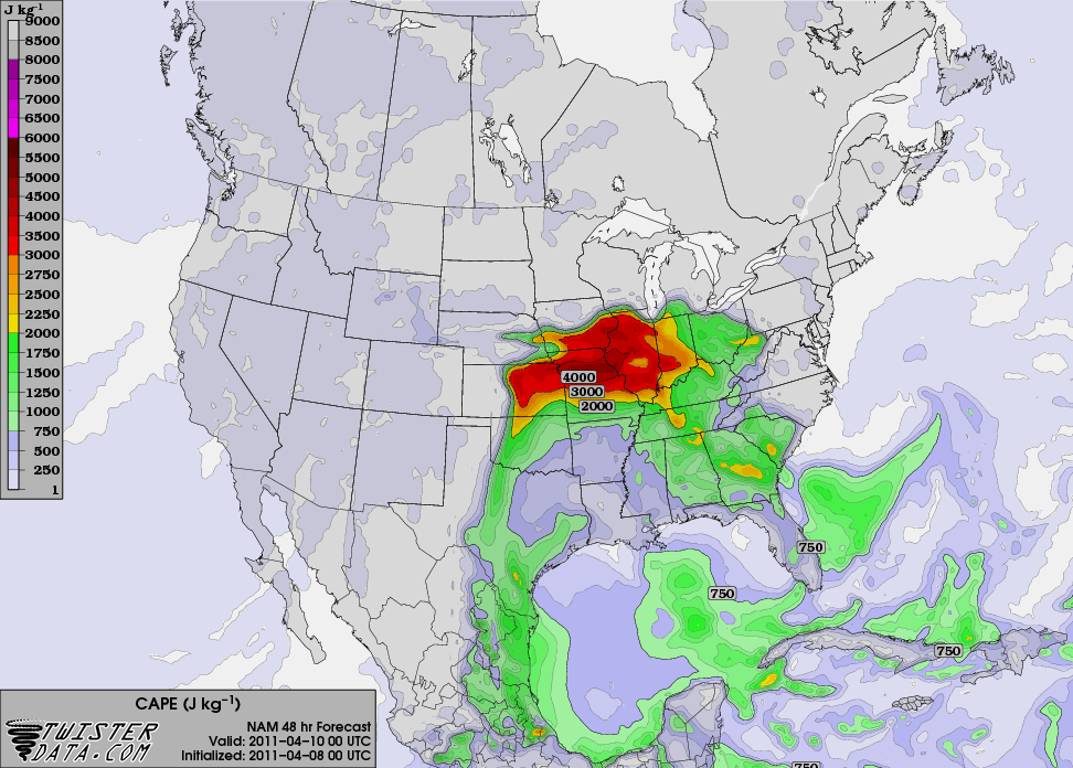
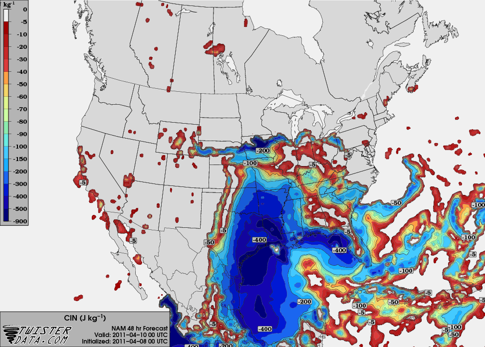
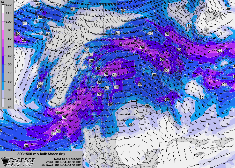
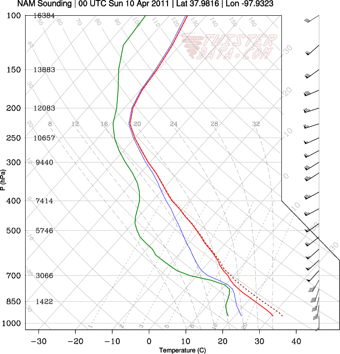
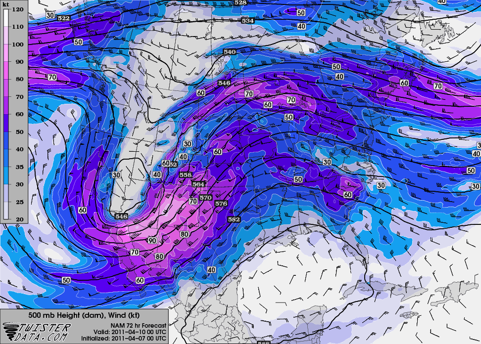
Here are some maps from the 00Z NAM, valid for 00Z Sunday (Saturday evening), from TwisterData.
500 mb:

Surface temperature and pressure (it’s HOT for early April!):

Surface dewpoint and pressure:

Max SBCAPE:

Max SBCINH:

0 – 6 km bulk shear:

A sounding for / Hutchinson, Kansas:

The NAM isn’t showing any precipitation at 00Z for Kansas or Oklahoma, but that doesn’t have me too concerned yet. On the other hand I’m not excited about this setup, but I do think it may have some potential.
Permalink
04.07.11
Posted in Severe Weather Forecast at 8:00 am by Rebekah
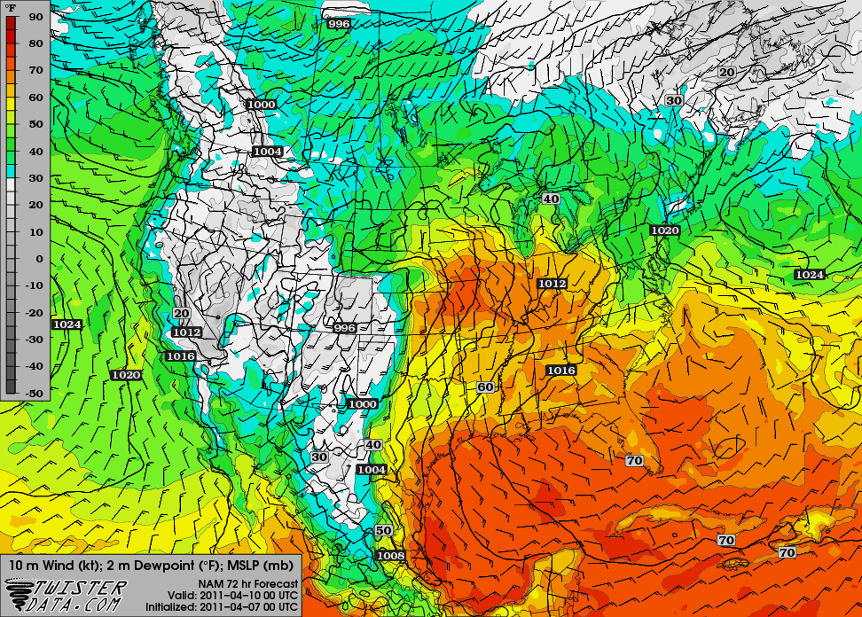
Here’s the next big trough that the NAM model shows for us, valid at 00Z Sunday (Saturday evening):

The model output for the dewpoint shows a dryline in far western Oklahoma (the GFS shows a bit higher dewpoints, a slightly tighter dryline, and a more well-defined surface low):

Temperatures are going to be a little high, though, and there may not be enough forcing in time to get storms firing along the dryline.
There may be a supercell or two that forms up closer to the dryline / warm front intersection, but so far this setup isn’t anything for me to get excited about.
The bigger severe weather day may be Sunday, but I haven’t looked at that one as much as it will be beyond my chase territory (into the Mississippi River Valley area).
Permalink
04.06.11
Posted in Severe Weather Post-analysis at 8:00 am by Rebekah

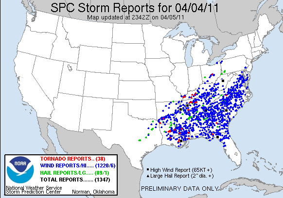
On Monday (into early Tuesday), the National Weather Service received 1,347 severe thunderstorm reports!
There were 38 tornado reports, a whopping 1,220 severe wind reports, and 89 severe hail reports.
This is the highest number of severe storm reports in 24 hours since 2000, according to The Weather Channel.
A few more facts from The Weather Channel:
-
Between 2000 and 2009, April has averaged 1,090 severe wind reports. Monday’s severe weather outbreak had more than this in one 24-hour period.
-
The 10-year average of all severe thunderstorm reports for the month of April is 3,402. Monday’s outbreak saw nearly 40% of this value.
-
The reports stretched across 19 states.
What an incredible event!
Permalink
04.05.11
Posted in Astronomy, General News, Space Shuttle at 8:00 am by Rebekah
I’m afraid today’s regularly scheduled world wide weather post is going to be canceled, as I didn’t have time to complete it last night and am not sure I’ll get to it later today.
I found out in the morning that the space shuttle launch would be delayed for at least 10 days, so have been scrambling to change travel plans. As of now, Endeavour is scheduled to launch at 3:47 pm EDT on April 29th. Hopefully this time it will go according to schedule!
Yesterday afternoon/night I went down to Dallas for a Rangers v. Mariners baseball game. It was the much anticipated return of pitcher Erik Bedard, which was a lot of fun to watch!
Still waiting to go chasing again…
Permalink
« Previous Page — « Previous entries « Previous Page · Next Page » Next entries » — Next Page »
