12.04.12
World Wide Weather: Hoquiam, Washington
As I get back to weather blogging as promised when I began the overhaul of my website this summer, I’m bringing back the once popular World Wide Weather series, in which I highlight a place and take a look at the local weather and climate.
This week’s post features Hoquiam, Washington, on the west central coast of the state and currently experiencing a heavy rain event mentioned earlier this week (“Staying Connected“).
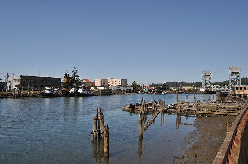
Hoquiam waterfront (US Route 101 bridge on right), photographer Joe Mabel, from Wikimedia Commons.
Hoquiam is situated on the southwest coast of Washington State, just inside Grays Harbor and at the mouth of the Hoquiam River.
The city’s history is primarily centered around logging and the export of lumber. Hoquiam was incorporated in 1890 and the town name comes from a Native American word for “hungry for wood”.
Every September, Hoquiam is host to loggers from around the world who come to the “Loggers’ Playday”, featuring a street fair, parade, logging competition, and fireworks. Other festivals include the River Festival and a world-famous Shorebird Festival, at which time hundreds of thousands of migrating shorebirds stop over at the Grays Harbor estuary.
A few more facts about Hoquiam (from Wikipedia):
- Time zone: Pacific Standard ( UTC – 8 ) or Pacific Daylight ( UTC – 7 )
- Elevation: 20 ft (6 m)
- Climate zone: Mediterranean / Oceanic
- Average high temperature: 58 °F (14 °C)
- Average low temperature: 44 °F (7 °C)
- Average annual high/low temperature range: 47 to 68 °F (8 to 20 °C) / 37 to 53 °F (3 to 12 °C)
- Record high temperature: 99 °F (37 °C)
- Record low temperature: 9 °F (-13 °C)
- Average annual precipitation: 69 inches (1,761 mm)
- Average annual snowfall: 5 inches (13 cm)
Weather: Hoquiam’s climate is considered Mediterranean, due to the mild and dry summers (driest month is July with an average of 1.2 inches of precipitation) and cool and wet winters (wettest month is November with an average of 10.7 inches of precipitation). The climate can also be considered oceanic, as the Pacific Ocean keeps temperatures mild without much variation throughout the year. Also thanks to the moderating effect of the ocean, snow is rare and does not fall most years.
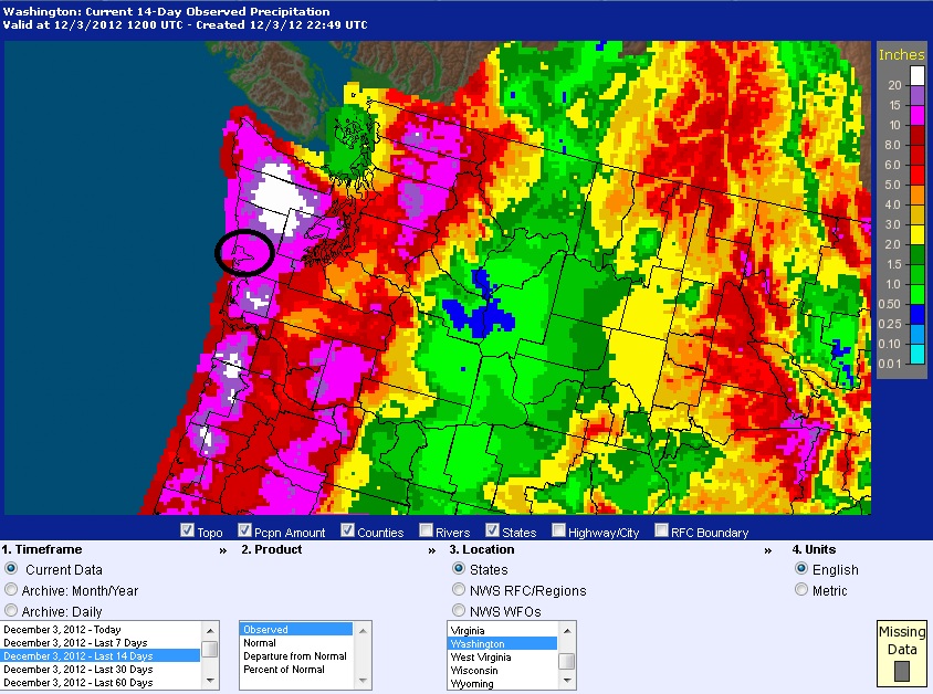
We’re currently in Hoquiam’s second rainiest month of the year on average, which this year is starting off particularly wet. As I mentioned in the post a couple days ago about a river of atmospheric moisture moving towards the Pacific Northwest, heavy rains are starting to fall along the coast on soil that is already heavily saturated. Wind Advisories are also being posted by the National Weather Service for winds of 20-35 mph and gusts to 50 mph, which in combination with the wet soil will probably knock out some trees and power lines over parts of the western side of the state. A few rivers in the area are also expected to crest at minor flood stage.
Observed precipitation for Washington over the last 14 days. Grays Harbor is circled. Courtesy of the NWS.
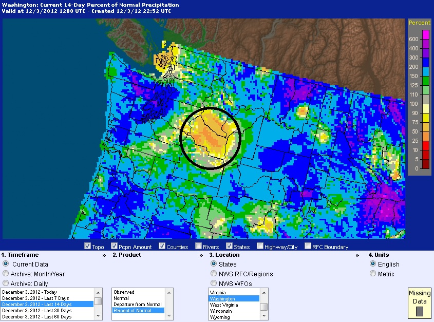
Percent of normal precipitation for Washington over the last 14 days. Note Grays Harbor and most of the coast is 150 – 300% above average. Kittitas County (circled), on the other hand, where my parents live just east of the Cascades, has been pretty dry for a while now and is still the driest place in the state! Courtesy of the NWS.
For weather maps and information on current and forecast Hoquiam weather, check out the local NWS page (looks rainy all week!). For more information on Hoquiam, see Wikipedia and the City of Hoquiam page.


