10.25.10
Northern U.S. Wind Storm
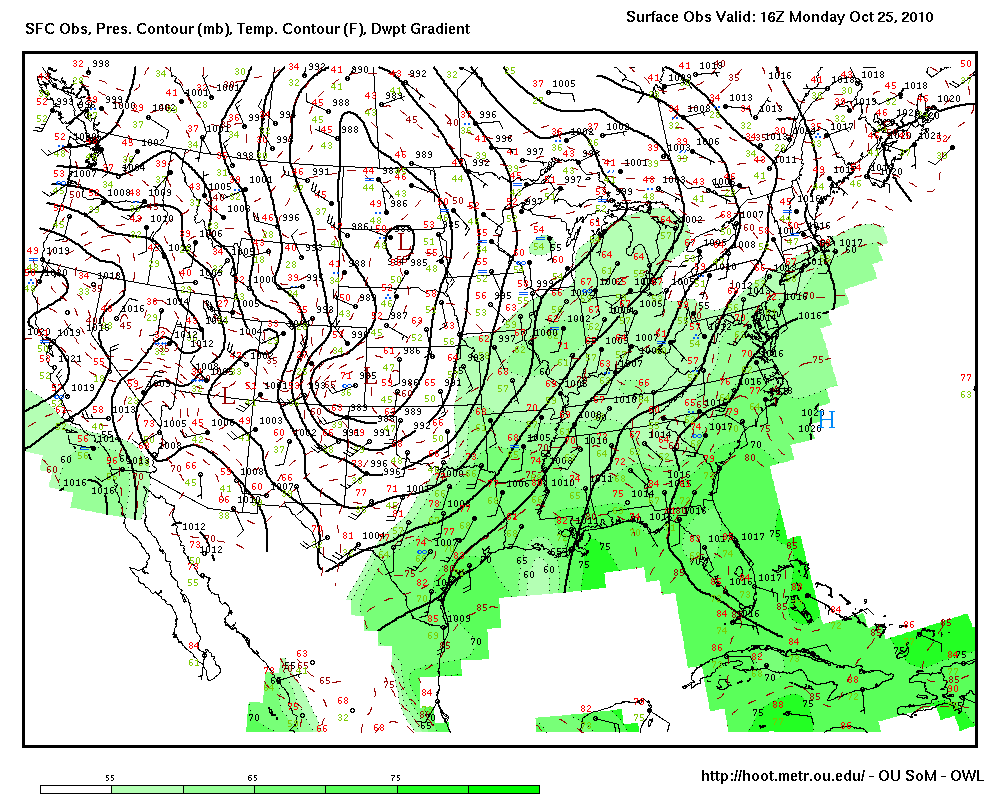
A surface map of the U.S. right now shows an elongated area of low pressure over the Great Plains. The lowest pressure on this map is 984 mb.
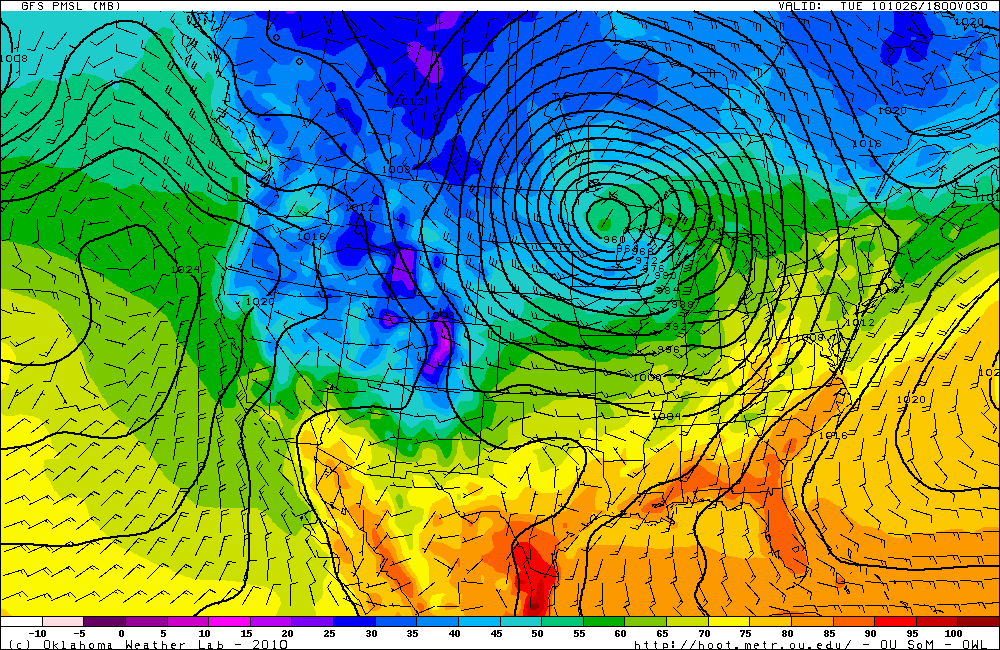
This low pressure system is expected to rapidly strengthen today and tonight, and could even bomb out. A bomb cyclone is a mid-latitude cyclone with a pressure that drops by 24 mb in 24 hours…the GFS model (below) shows that the pressure of this cyclone could get down to 960 mb in about 24 hours.
GFS model valid at 18Z (1 pm Central Time) Tuesday, showing surface pressure and temperature. Click to enlarge.
When the pressure gradient becomes this strong, the wind speeds increase. High wind watches have already been issued for much of the Midwest. The National Weather Service says that sustained winds of 4o to 50 mph are expected behind this low pressure system, and gusts could get to 55 mph late tomorrow.
A cyclone that strengthens to 960 mb over land does not happen very often. If this same cyclone occurred in another month or two, there would likely be a big blizzard. However, the air behind the cold front associated with this system is not quite cold enough for snow just yet.
For more on the how this cyclone is expected to develop, please see Jeff Makowski’s blog: Mid-week Storm

