02.16.11
Forecast: Sunday, Feb. 20
A quick look at last night’s 00Z GFS run for 00Z Monday, or 6 pm Central Time on Sunday (bound to change, but it can be interesting to look at trends as it gets closer):
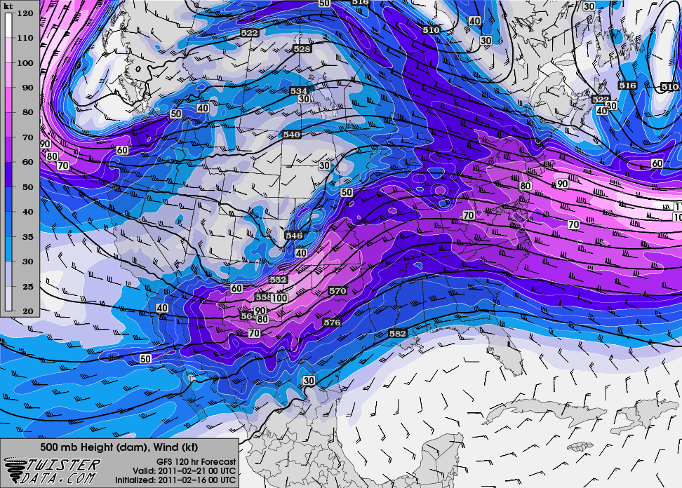
500 mb shows a nice little shortwave trough centered over New Mexico:
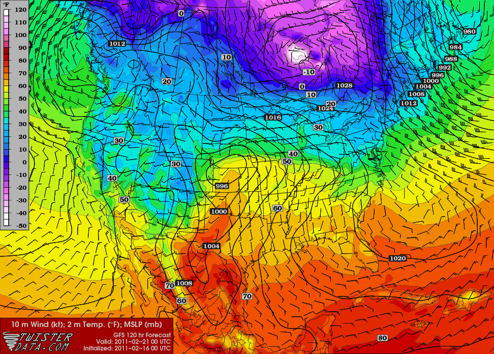
Surface temperatures in the lower 60s in western Kansas and western Oklahoma, with a surface low over western Kansas…surface winds in central Kansas are from the south-southeast:
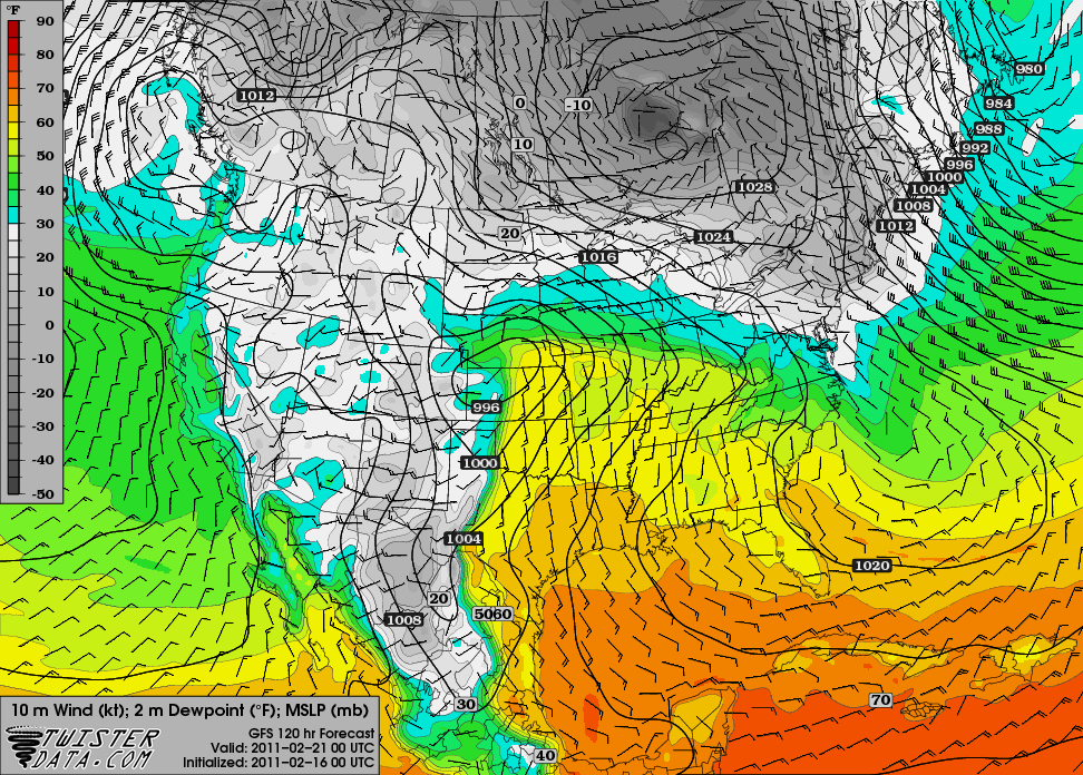
Surface dewpoints in the lower 50s up through central and eastern Kansas:
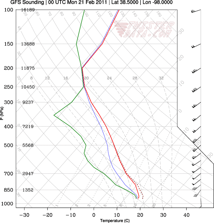
Sounding from Hutchinson, Kansas…would be nice if the high clouds would be gone and the surface could warm up a bit more…but hey, it’s February:
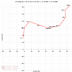
Hodograph for Hutchinson also shows decent wind shear:
Does this mean severe storms are returning to the Plains? No. But even thunderstorms of the non-severe variety would be welcome at this point, and the models are certainly showing some hope of that.
If moisture return is any greater, surface temperatures any higher, and the winds are a little more backed (more out of the southeast), I would be happier and might even consider a jaunt to Kansas, but this is still not a bad setup for February storms. We’ll have to wait and see. There may be another few setups coming soon as well…but a lot of this is still in wishcasting land!
Maps from TwisterData.
