04.08.11
Plains Severe Weather Tomorrow?
Eastern Kansas up into Iowa may get a shot at some supercells tomorrow, if lift proves sufficient for storm initiation.
I still wish temperatures were cooler and the trough was a tad further east by 00Z.
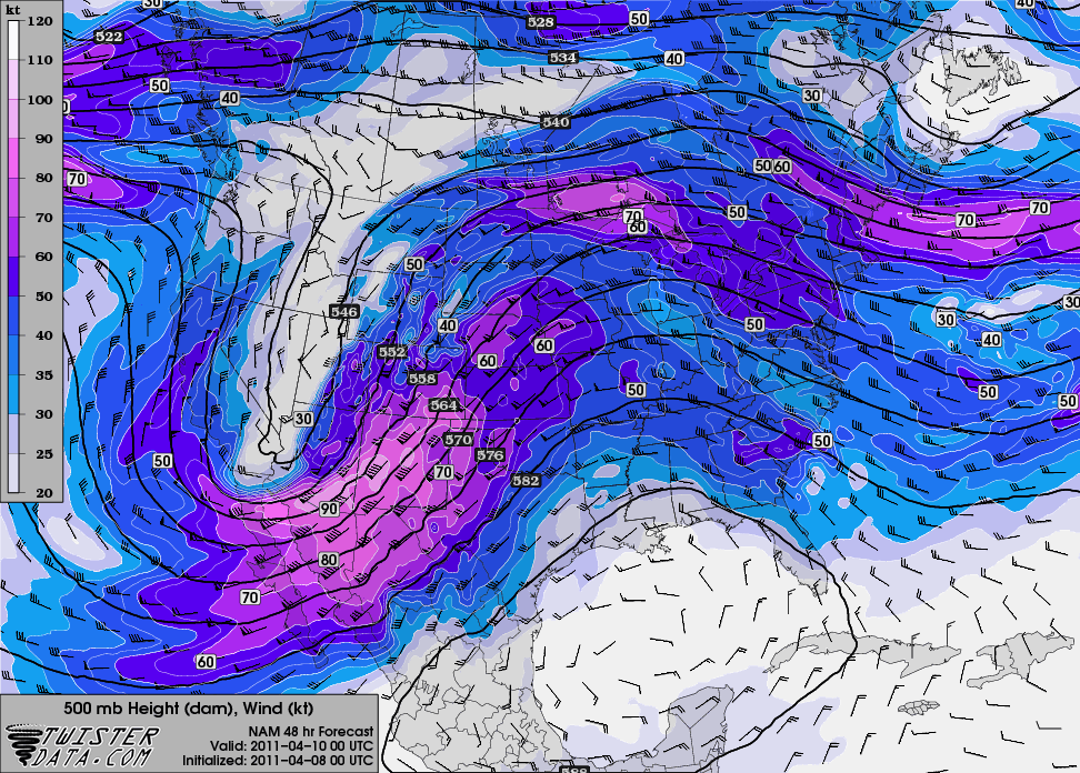
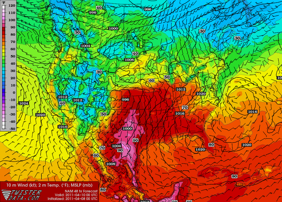
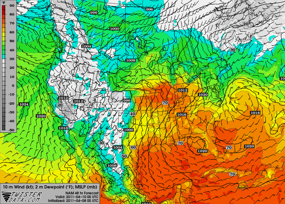
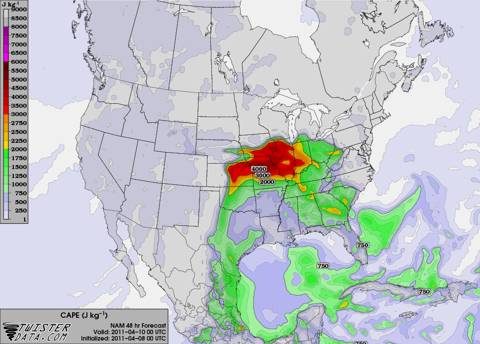
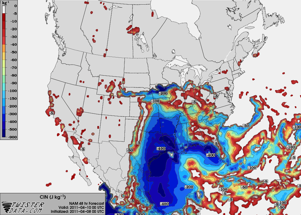
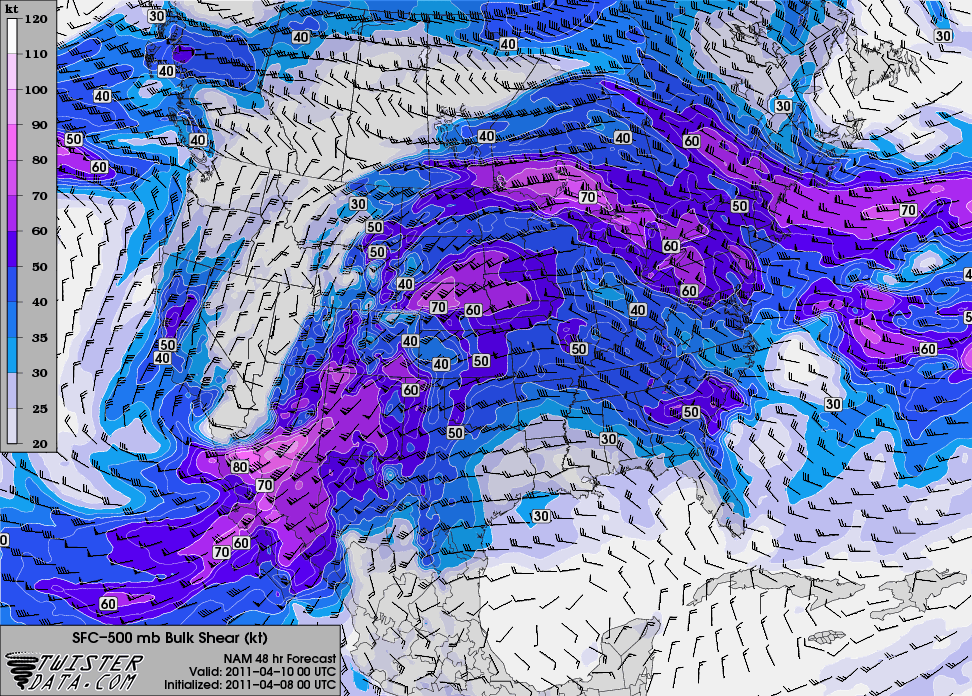
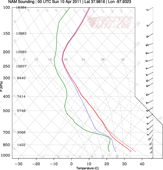
Here are some maps from the 00Z NAM, valid for 00Z Sunday (Saturday evening), from TwisterData.
500 mb:
Surface temperature and pressure (it’s HOT for early April!):
Surface dewpoint and pressure:
Max SBCAPE:
Max SBCINH:
0 – 6 km bulk shear:
A sounding for / Hutchinson, Kansas:
The NAM isn’t showing any precipitation at 00Z for Kansas or Oklahoma, but that doesn’t have me too concerned yet. On the other hand I’m not excited about this setup, but I do think it may have some potential.
