03.14.10
Blocking and Flooding
In case you hadn’t heard, major flooding is going on in the Northeast. Heavy rains and strong winds are wreaking havoc and knocking out power to thousands of people. Why?
Remember my post on Thursday, regarding rex blocks? The extratropical cyclone that brought tornadoes to the central US several days ago has been prevented from leaving the country, because of a large ridge over the eastern US. Even a “normal” cyclone would cause problems if it were to sit over the same spot for a while.
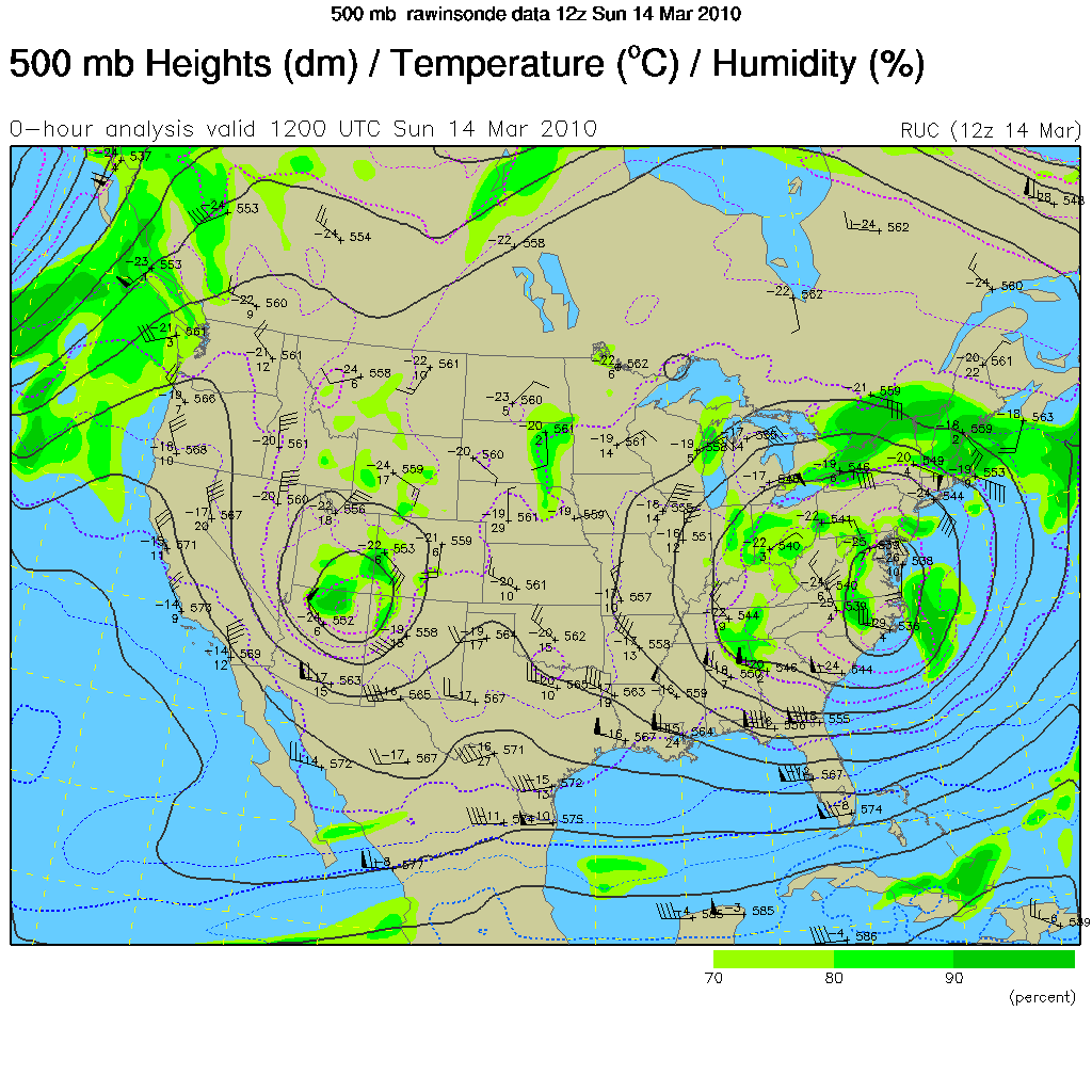
As a followup to Thursday’s post, I now have to post what the actual 500-mb map looked like this morning, so we can see how well the model did on predicting this setup (the models don’t usually handle blocking patterns very well). The following map is from 12Z this morning, courtesy of UCAR.
Large low centered over western North Carolina and Virginia? Check. Smaller low just east of the four corners? Check. Ridge of high pressure centered just north of Ontario, over Hudson Bay? Check. Closed high over Ontario? Check (much smaller, and offset a bit, but still there). Even the pressure height values match up perfectly, or close to perfectly. Wow, I’d say the GFS model did very well, considering it’s a blocking pattern, and I first noticed it a full 72 hours out! This may not be a full, perfect rex block in the sense of a large closed high north of a large closed low, but it’s definitely a high over low block, and a beautiful one at that (unless you live along the East Coast, then maybe not quite so beautiful).
Tomorrow’s post: hail storms in Melbourne last week.
