03.24.10
Cold Colorado; Tepid Texas
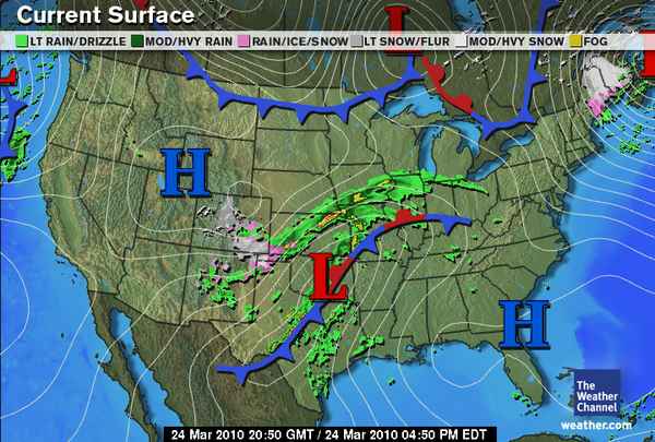
While Denver digs out from nearly two feet of snow in places and attempts to restore power to thousands of homes and businesses, central Texas is experiencing some strong thunderstorms. There is currently a severe thunderstorm watch box out for north central and central Texas, but instability and vertical, directional wind shear is not great enough for very severe thunderstorms. The thunderstorms are currently forming along a cold front (see map, above).
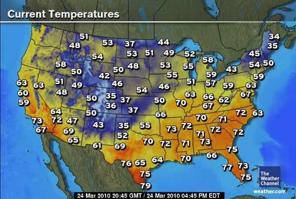
Most of the cooler air in the US (see below) is currently confined to the Colorado Rockies (as well as Maine; they are under a snowstorm as well right now).
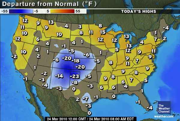
To see how today’s forecast highs (by The Weather Channel) stack up against the normal (or average) highs for today, see the map below. You can see that Colorado, Kansas, New Mexico, and the Texas Panhandle are well below average, while much of the rest of the US is (finally) near or above average. Yay.
The big question remains, when will there be some good, chase-able severe thunderstorms within my region again? There are a few interesting-looking troughs that may move through in the first week of April, but it appears that a lack of moisture and instability may still be a big problem. Obviously the models can and will change before then, but the first decent chance of a big severe weather day may not be until mid-April or so. In the meantime, that gives me more time to get work done and write blog posts about nothing much in particular. 😉


