04.30.10
High Risk in Arkansas
The Storm Prediction Center started off the morning by issuing a Slight Risk for severe thunderstorms, but has since upgraded to a High Risk, centered in Arkansas.
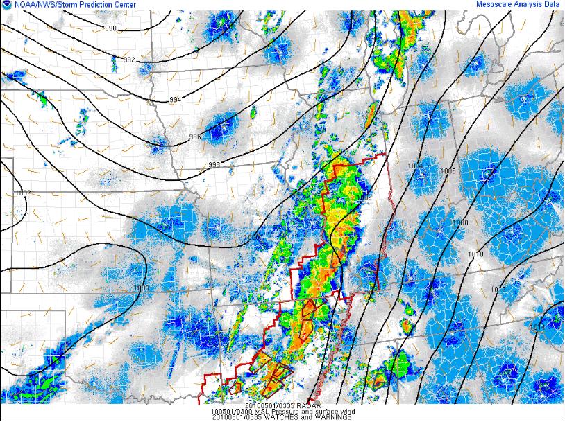
A line of supercells, now merging into more of a squall line, is marching across parts of the Midwest into the Mississippi River Valley area, putting down numerous tornadoes from Wisconsin to Arkansas (see the radar image, above; tornado warnings are small red boxes, while tornado watches are larger red boxes and severe thunderstorm warnings are are in blue).
Ample CAPE and wind shear have been conducive to rotating storms in this general area, along a cold front, for most of the afternoon.
Sadly, there have already been reports of deadly tornadoes in Arkansas. Tomorrow, the storms will progress towards the Southeast, giving the already tornado-weary Mississippi and Alabama another chance for severe storms.
The low that is responsible in part for this severe weather may be the last one we see for a while, on the Plains anyway. Models for at least the next week show primarily zonal flow across the US, meaning no big troughs to assist in producing strong thunderstorms.
Right in time for VORTEX2, which starts up tomorrow…
