09.03.10
Weather in the USA
Today let’s take a very brief look at what the weather’s doing around the country.
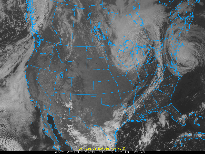
Visible satellite image from today, at 4:45 pm EDT, courtesy of College of DuPage:
You can see Category 1 Hurricane Earl off the New England coast, a low pressure system bringing clouds and rain to the Midwest, and clouds along a front from New York to Texas.
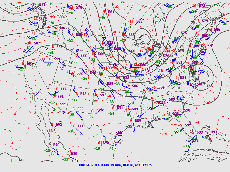
500-mb map from this morning, from the SPC:
Note the ridge over the West, bringing clear skies. The trough over the Midwest is associated with the low, and you can also see Hurricane Earl at this level. This trough is what’s going to push Earl back towards the East, although he may recurve a bit back up into Canada.
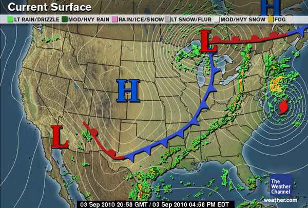
Surface map, from The Weather Channel, from 5pm EDT:
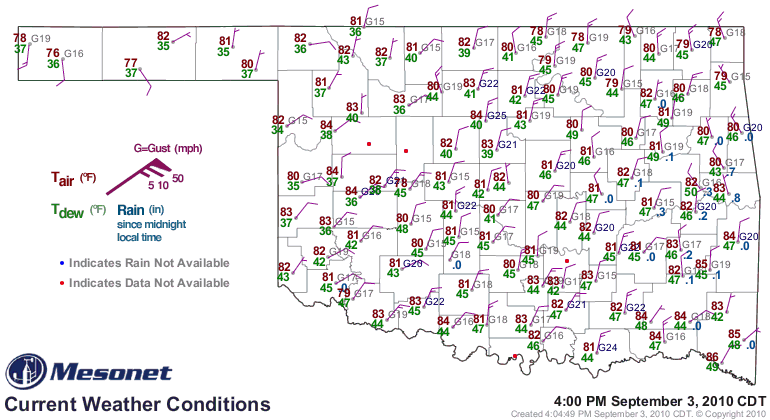
Here you can see the low pressure, high pressure, Earl, and the cold front. This cold front moved through Oklahoma last night, finally bringing us some much needed thunderstorms and cooler weather. Today has been very pleasant. See the surface map below, from 5pm EDT / 4pm CDT, from the Oklahoma Mesonet:


