05.24.11
Posted in Severe Weather Forecast at 12:28 pm by Rebekah
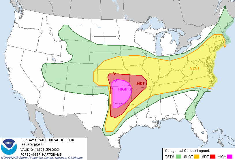
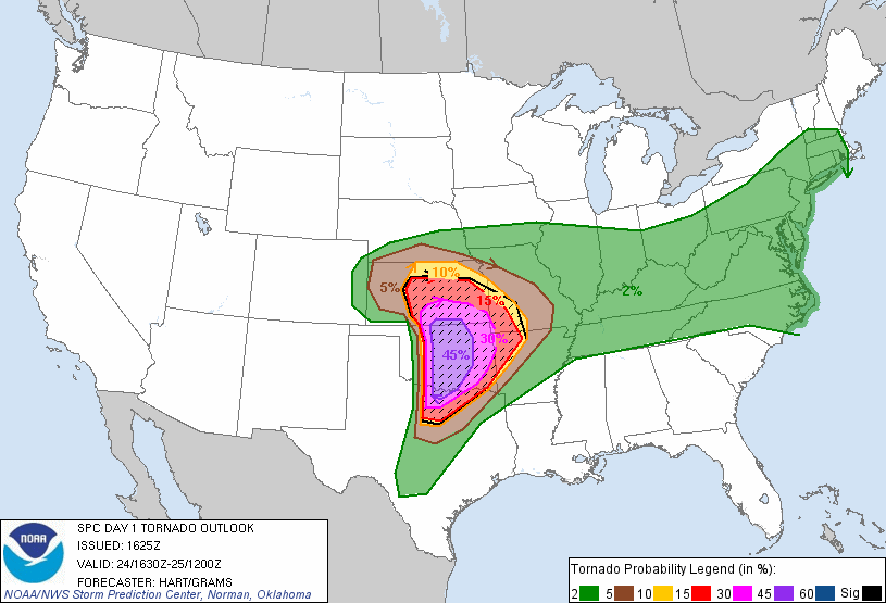
The 1630Z update from the Storm Prediction Center shows they expanded the High Risk area and increased the tornado risk to 45% hatched, which is almost unheard of! There is also a 60% hatched risk for large hail.
Be very careful today if you are in the risk area…keep a close eye on the weather and know where to go for safety if the sirens go off!


The first tornado watch will soon be issued for west Oklahoma into Wichita Falls, Texas. The National Weather Service and Storm Prediction Center are wording these forecasts VERY strongly.
Permalink
05.23.11
Posted in Severe Weather Forecast at 9:48 am by Rebekah
First, my heart goes out to those affected by yesterday’s storms and tornadoes, especially to those in Joplin. This year has been particularly bad for large tornadoes in populated areas, leading to record numbers of fatalities.
Today a surface low is moving into far northwest Oklahoma, with a warm front stretching eastward near the Oklahoma/Kansas border and a dryline that will tighten near the Oklahoma/Texas Panhandle border. Dewpoints are already in the upper 60s, though some of the moisture may mix out a little bit later in the day. There is a trough out west, but not much upper-level support in the Plains. In fact, there may actually be some height rises in the Southern Plains unless we get a little shortwave trough to come through. Instability will be highest along and ahead of the dryline, and shear will be highest along the warm front, of course. The shear is not going to be that great (especially low-level shear), but should be sufficient for supercells should storms form.
I should be available to chase after about noon or 12:30 today, so I’m planning on leaving Norman by 1 or hopefully sooner. My current target area is around Seiling to Enid, but I may head out west on I-40 to Clinton, and evaluate then what I want to do.
Permalink
04.09.11
Posted in Severe Weather Forecast at 12:18 pm by Rebekah
There’s a marginal chance for supercells again today in western Oklahoma, along a dryline. I don’t have much time to write up a forecast now, as we’re off in a bit to Alva, Oklahoma area.
I’ll update from the road as the occasion arises.
I tried to stream some live video yesterday, but am having problems with my streaming camcorder at present. Sometimes the connection to my laptop just gets dropped, and I have to set it up again. It doesn’t take long to do that, but it means I don’t always have a continuous stream. If we see something interesting today, I will do my best to stream it as well as I can…keeping in mind that data coverage isn’t as good in northwest Oklahoma!
Permalink
04.08.11
Posted in Severe Weather Forecast at 8:00 am by Rebekah
Eastern Kansas up into Iowa may get a shot at some supercells tomorrow, if lift proves sufficient for storm initiation.
I still wish temperatures were cooler and the trough was a tad further east by 00Z.
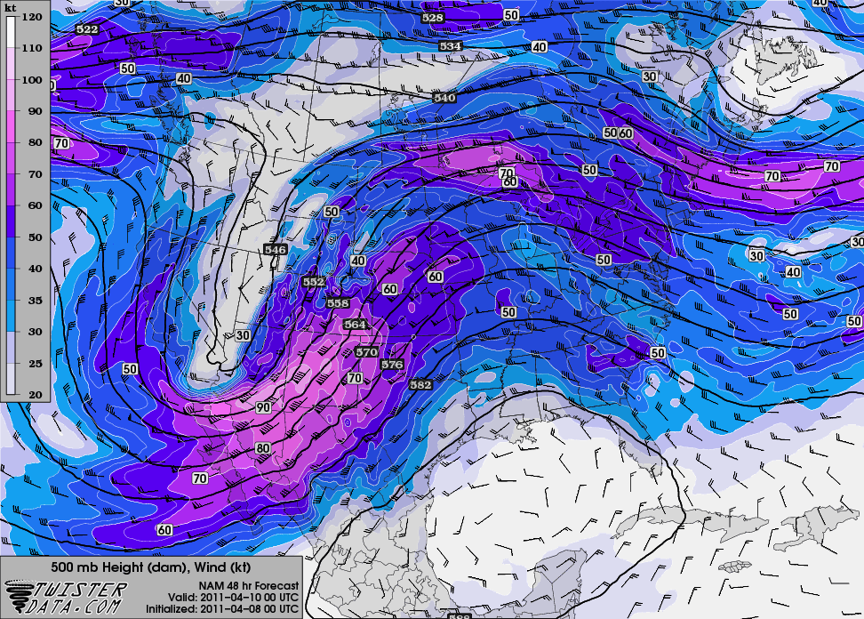
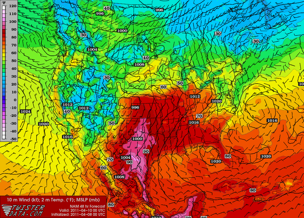
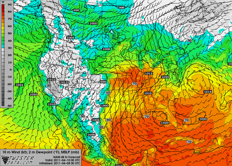
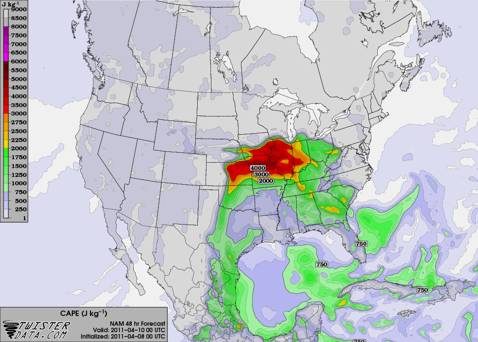
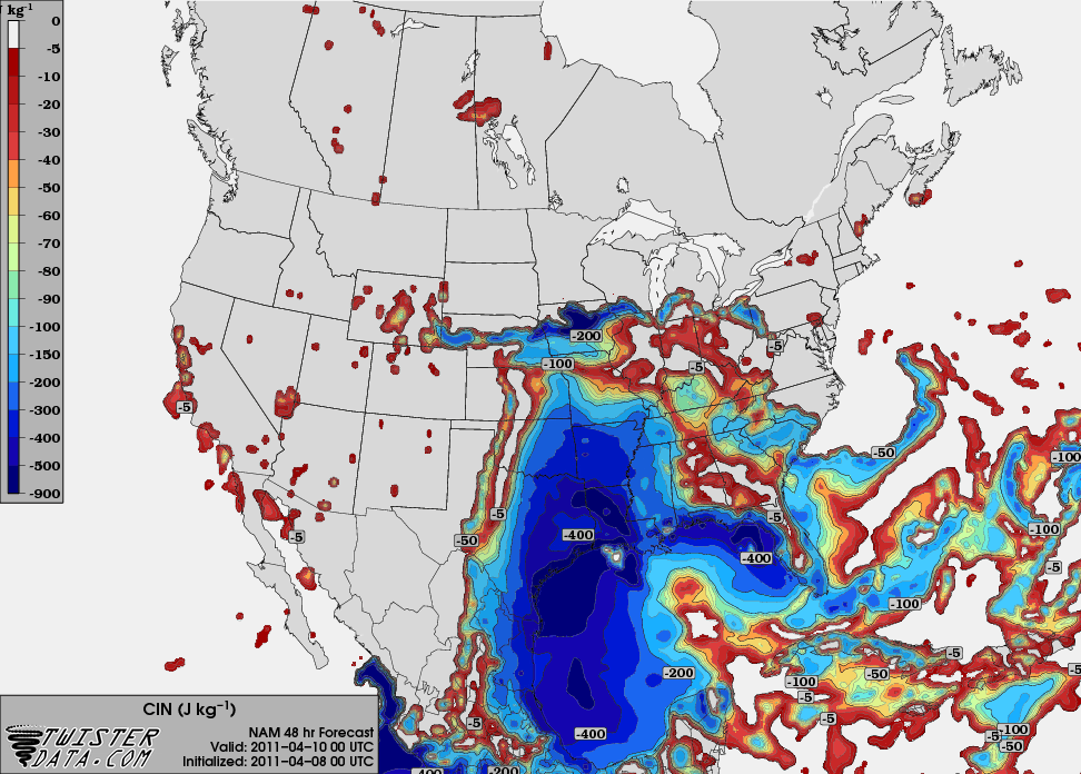
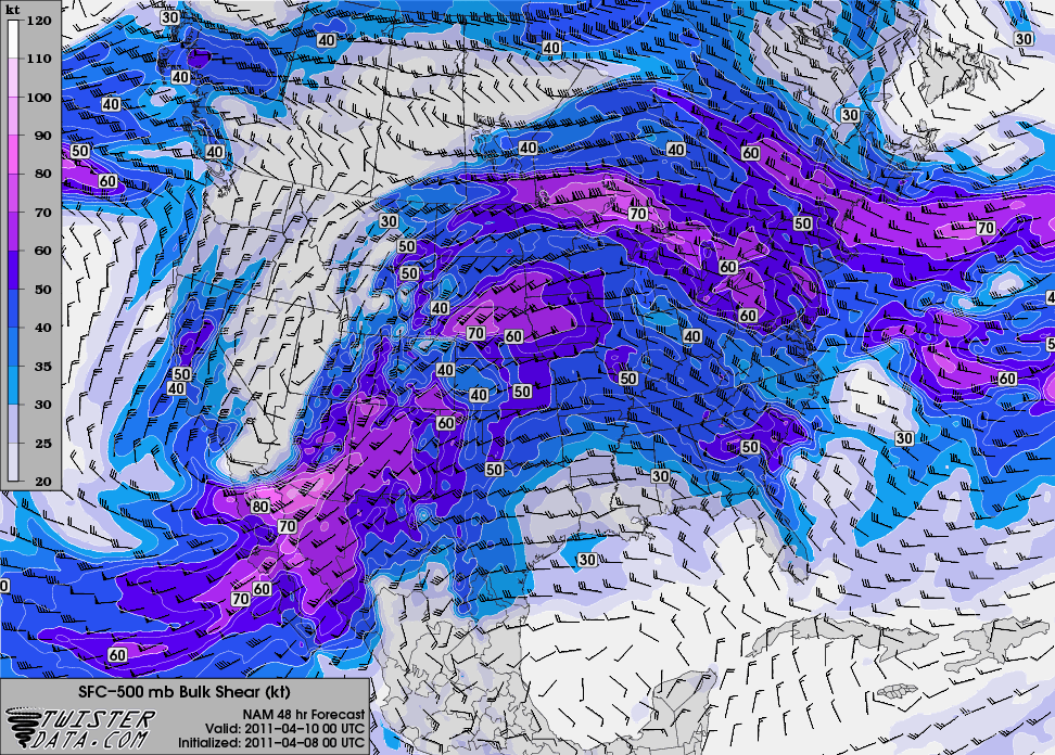
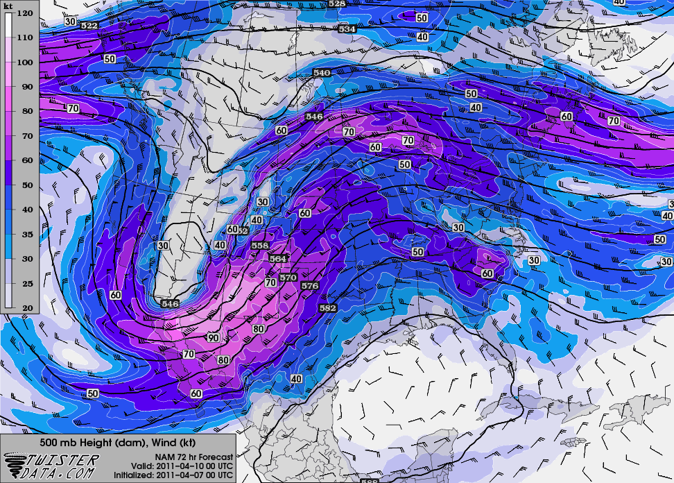
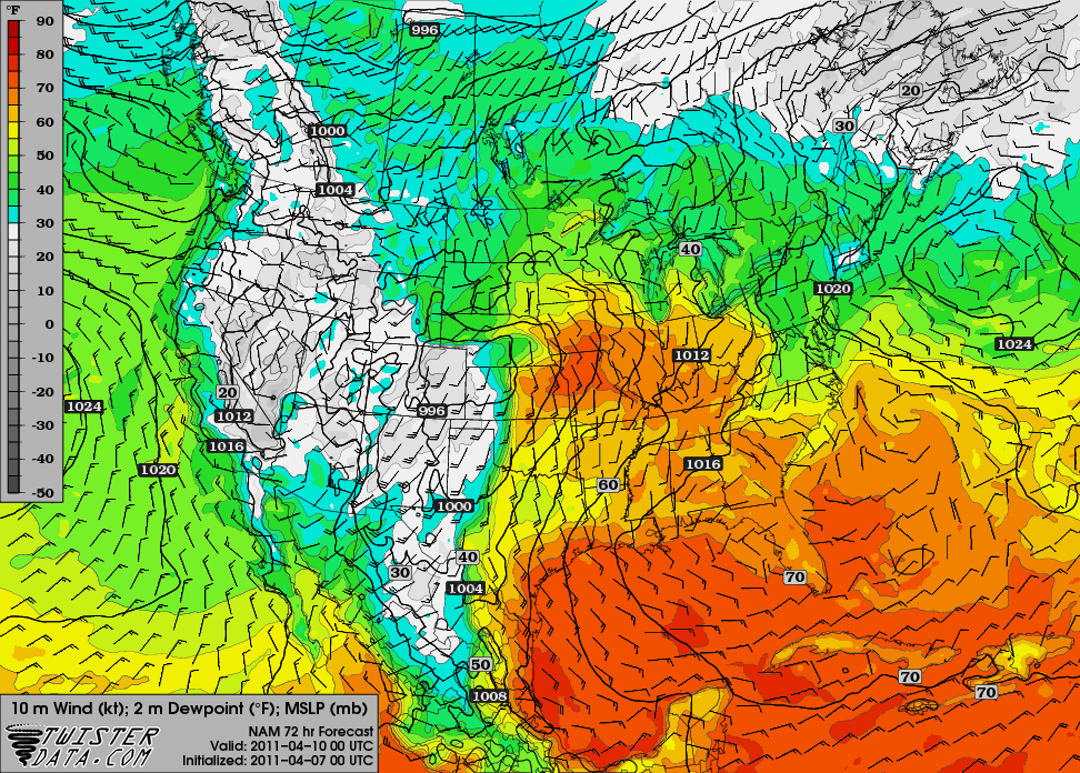
Here are some maps from the 00Z NAM, valid for 00Z Sunday (Saturday evening), from TwisterData.
500 mb:

Surface temperature and pressure (it’s HOT for early April!):

Surface dewpoint and pressure:

Max SBCAPE:

Max SBCINH:

0 – 6 km bulk shear:

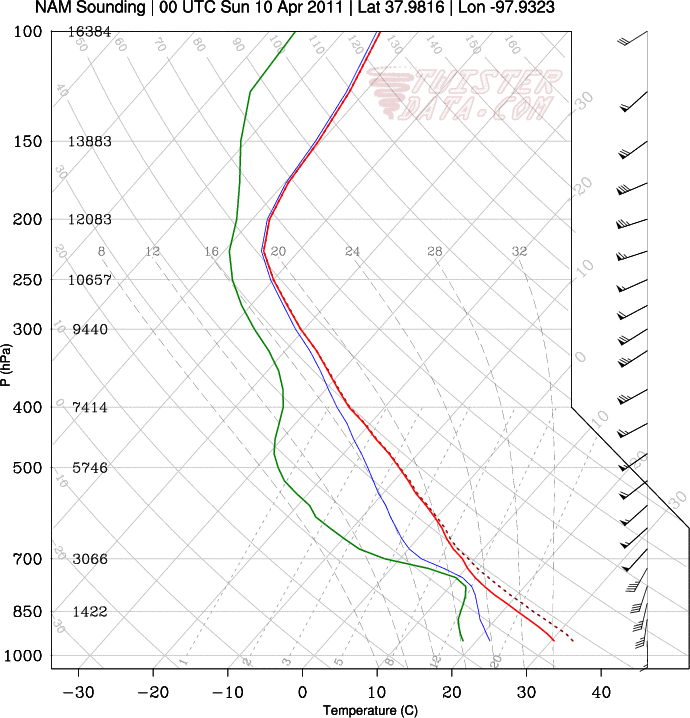
A sounding for / Hutchinson, Kansas:

The NAM isn’t showing any precipitation at 00Z for Kansas or Oklahoma, but that doesn’t have me too concerned yet. On the other hand I’m not excited about this setup, but I do think it may have some potential.
Permalink
04.07.11
Posted in Severe Weather Forecast at 8:00 am by Rebekah
Here’s the next big trough that the NAM model shows for us, valid at 00Z Sunday (Saturday evening):

The model output for the dewpoint shows a dryline in far western Oklahoma (the GFS shows a bit higher dewpoints, a slightly tighter dryline, and a more well-defined surface low):

Temperatures are going to be a little high, though, and there may not be enough forcing in time to get storms firing along the dryline.
There may be a supercell or two that forms up closer to the dryline / warm front intersection, but so far this setup isn’t anything for me to get excited about.
The bigger severe weather day may be Sunday, but I haven’t looked at that one as much as it will be beyond my chase territory (into the Mississippi River Valley area).
Permalink
« Previous entries Next Page » Next Page »
