10.21.10
Posted in Severe Weather Forecast, Weather News at 3:00 pm by Rebekah
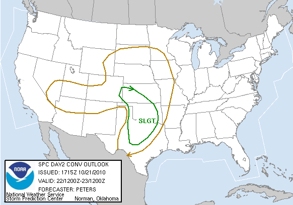
There’s a slight chance for some severe weather this afternoon in west Texas into eastern New Mexico, including a chance for supercells, but today I’m going to focus on the risk for severe weather tomorrow.
I had a quick look at the 12Z GFS and NAM, and this is what I’m seeing.
There’s a stacked, closed low over Arizona right now, expected to move into eastern Colorado by tomorrow evening. Dewpoints are forecast to reach the lower 60s from Texas up into south central Kansas as surface winds will be from the south-southeast and a cold front / dryline will set up in the east Texas Panhandle. Although there will not be a ton of instability along the dryline, with CAPE values likely only in the 500 to 1500 J/kg range, there will also not be much of a cap. There will be positive vorticity advection in western Oklahoma and ample wind shear for rotating storms (the NAM has 0 to 1 km SRH of 100 to 150; the GFS and NAM have 0 to 6 km bulk shear of 35 to 50 knots centered around Wichita Falls, Texas). Hodographs in parts of western Oklahoma look pretty curved.
The primary limiting factor for severe weather is the lack of instability, largely caused by cloud cover. If sufficient heating is there for surface-based storms to form, there will be enough lift and wind shear to get some supercells and possibly even tornadoes.
There could be two plays on this setup: the possibly more obvious one, from around Lawton, Oklahoma to Wichita Falls, Texas…instability could be greater there and upper-level winds are stronger. The other target I’m looking at is in northwest Oklahoma, closer to the low. There could be enhanced lift there (as well as steeper mid-level lapse rates), enough to overcome the lack of instability.
Bottom line: there could be a decent chance for supercells tomorrow from northern Texas (Wichita Falls area) all the way up through western Oklahoma and possibly even southwest Kansas. If conditions improve by 1pm tomorrow, I may go out chasing…provided that I can make it to my target on time. I’m having lunch with a group of students and a prospective grad student until 1, so I can’t leave before then anyway.
Stay tuned!

Permalink
09.10.10
Posted in Severe Weather Forecast at 11:46 am by Rebekah
Off on another September chase today. Eastern Kansas looks favorable for supercells with large hail and a few tornadoes. CAPE is high, shear is decent, lift is decent, and moisture is high. The low-level winds could be better (i.e., stronger and more backed), but it could turn out to be a good day for storms.
Target is around Emporia, Kansas, with adjustments possible to the east and either north (better shear north of the warm front) or south (possibly better lift near a surface low), as necessary.
SPC has a 5% risk of tornadoes and a 30% chance for large hail in eastern Kansas.
We’re on the road now, going up I-35 in northern Oklahoma. You can follow us on Spotter Network, and we’ll be streaming with ChaserTV.
Permalink
06.15.10
Posted in Severe Weather Forecast, Weather News at 1:43 pm by Rebekah
This week’s post in the global weather and climate series features Matador, Texas.
I chose this town because I briefly stopped there last night on the way back to Norman from a storm chase, and there could be some storms around Matador this afternoon/evening as well.

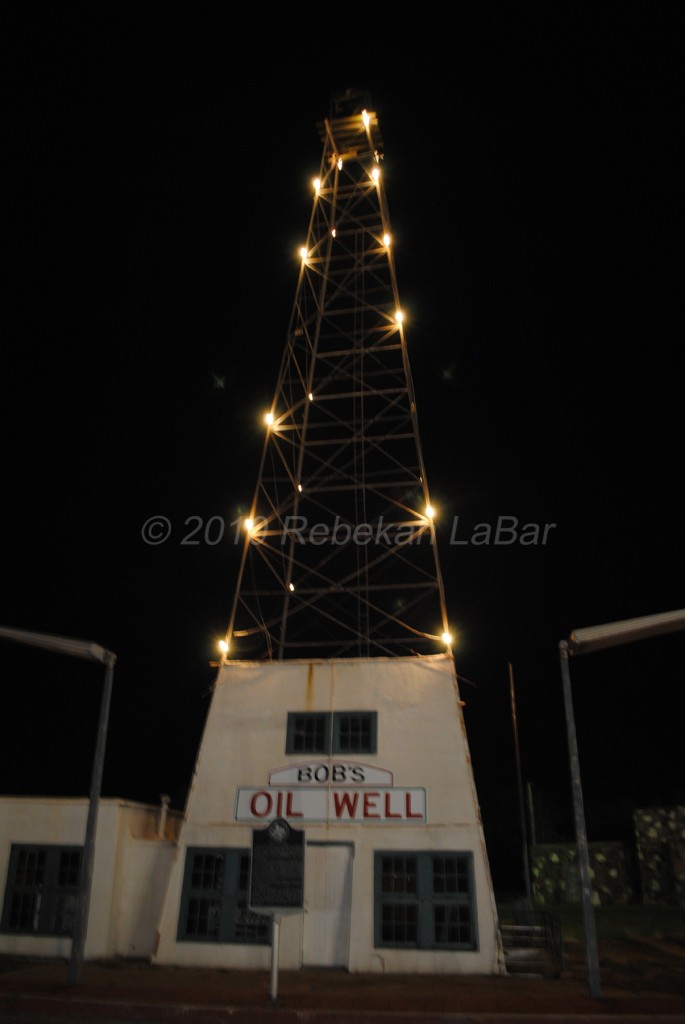
Bob’s Oil Well in Matador, Texas.
Located in west north Texas, just south of the panhandle, Matador is home to 740 people (2000 census) and the seat of Motley County, Texas. Bob’s Oil Well, seen in the photo above, was established by a guy called Bob who moved to Matador after he fought in World War I. Up until his death in 1947, Bob kept live rattlesnakes and exotic animals in a small zoo to attract visitors from across the country to come to his adopted hometown.
A few more facts about Matador (weather data from US Climate Data):
- Time zone: Central Standard Time (UTC-6) or Central Daylight Time (UTC-5)
- Elevation: 2382 ft above mean sea level
- Climate zone: Semi-arid (Plains climate)
- Average high temperature: 75 °F (24 °C)
- Average low temperature: 49 °F (9 °C)
- Average annual precipitation: 23 inches (584 mm)
Current and forecast weather: The National Weather Service is calling for mostly sunny skies and highs in the lower 90s this week in Matador, with lows in the upper 60s to lower 70s. Yesterday, some strong thunderstorms passed through Matador, and today there could be some strong to severe thunderstorms that pass through the same area.
With dewpoints in the upper 60s, southerly surface winds veering to westerly winds aloft, moderate instability, and some weak wind shear, it looks like there will be a decent chance for multicells and probably a few supercells to form in the south Texas Panhandle into west central Texas and eastern New Mexico. Severe hail and an isolated tornado or two cannot be ruled out.
For more information on Matador, here’s a link to Wikipedia.
For information on current and forecast Matador weather, see the National Weather Service Lubbock page for Matador.
Next Tuesday I plan to take a look at the climate and weather in Antarctica. As always, if you have any comments or suggestions for future cities, please leave a comment on this post!
Permalink
Posted in Severe Weather Forecast at 1:12 pm by Rebekah
On the road again…targeting Texas for the third day in a row. 🙂
(As of the time I am now posting this, 1:10pm, we are between Lawton and Altus on Highway 62, heading west.)
Chase forecast hasn’t changed much the last couple of days…there is less upper-level forcing today, as the trough has lifted. We don’t have very high expectations of today, but again, hard to resist a chase day in west Texas, especially when it could be the last one for a long time.
Long story short, we’re heading down I-44 and then will go out towards Childress (Texas) and perhaps see how far west we can get. Today is a bit tricky as far as determining storm initiation location…yesterday’s storms laid down some outflow boundaries that storms today may form along. There should be some supercells today, but my primary concern at this point is that we may not get to them (at least for a while) as the forecast keeps pushing the storm initiation location further west.
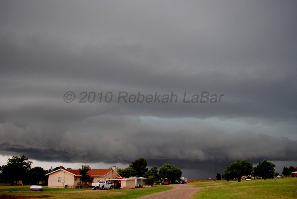
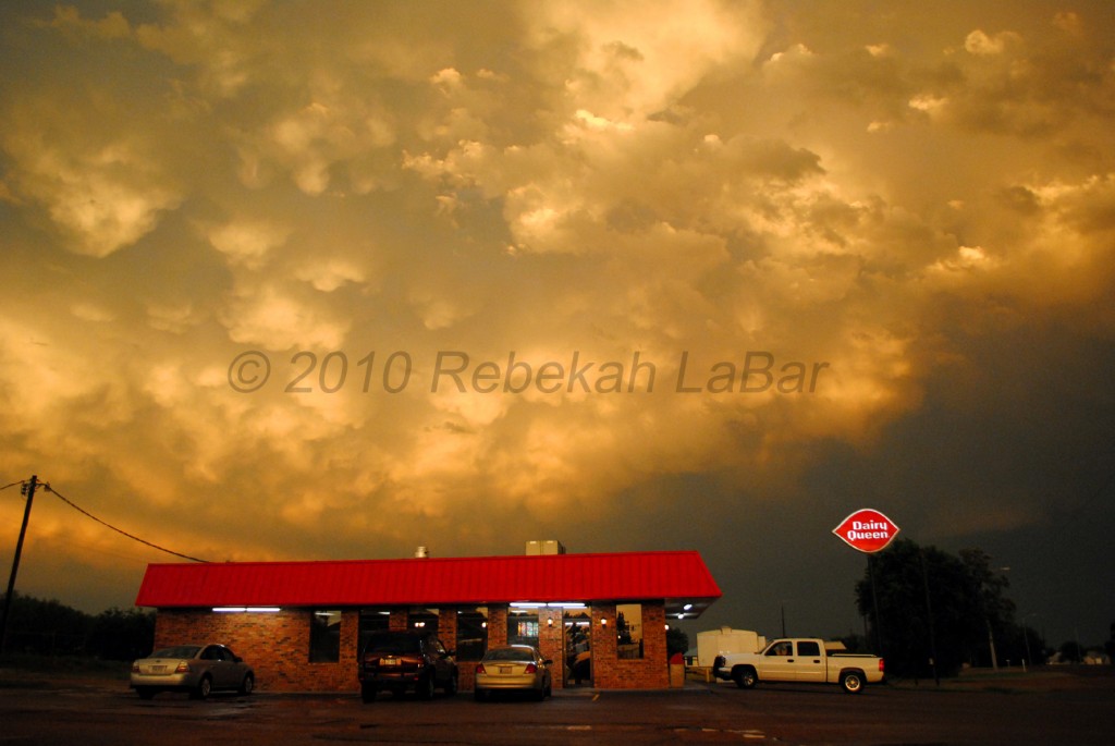
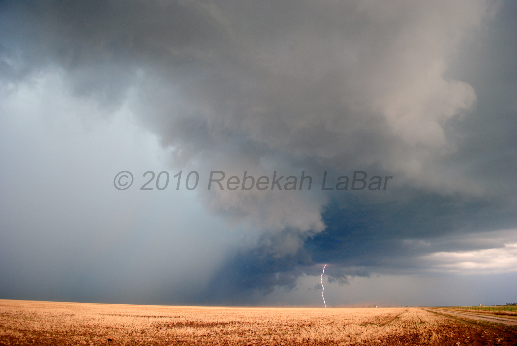
As to yesterday…we drove all over certain parts of west central Texas, chasing a tornado-warned supercell that fell apart as soon as we got on it, chasing another tornado-warned supercell with tennis ball-sized hail that dropped to only quarters when we got on it (did see the most amazing shelf cloud and green sky, though, and got some tiny hail), and later chasing a bow with a great shelf cloud and getting pea-sized hail with extremely strong winds that made my car shudder even as we were parked under shelter. We saw a beautiful sunset with mammatus clouds, and also saw one of the most incredible lightning displays that I have ever seen…the lightning on the way back to Norman (behind the line) was not that frequent, but when we did see it, there were many tendrils that crawled along the underside of the clouds and occasionally touched the ground. We’d see a dozen or more both intra-cloud and cloud-to-ground flashes in one several-second display at a time.
More to come in the chase logs later…I probably won’t be updating the chase logs until I get the new website up, but hopefully that will come as soon as the end of this week!!

Shelf cloud over Guthrie, Texas

Sunset and mammatus clouds over Spur, Texas

Sunset and mammatus clouds over Dairy Queen in Spur, Texas
Permalink
06.14.10
Posted in Severe Weather Forecast at 11:00 am by Rebekah
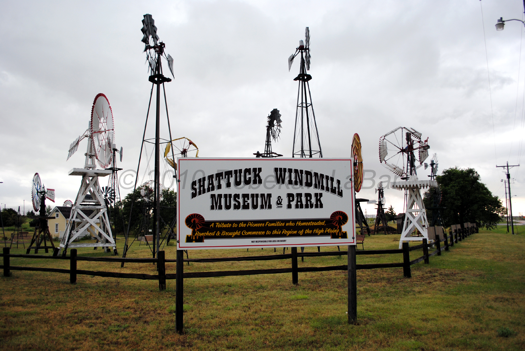
Didn’t see too much yesterday…two supercells and two wall clouds, as well as plenty of CG lightning and a very green sky (and a bit of tiny hail)…but overall it was a bit of a frustrating day as we missed a few tornadoes that were in our area. However, we did get to see a fun little windmill museum in Shattuck, Oklahoma (oh, and we also saw a flock of wild turkeys south of Lipscomb, Texas)!
However, it’s off again today; setup is fairly similar to yesterday so I won’t go into details. A few supercells with hail and tornadoes possible south of the Texas Panhandle.
Just about to head out for the area just east of Lubbock, around Matador to Ralls, Texas. Will be on Spotter Network, but not streaming (using old computer again, which doesn’t like my streaming camcorder).
From yesterday:


Permalink
« Previous Page — « Previous entries « Previous Page · Next Page » Next entries » — Next Page »
