08.20.10
Posted in Tropical Weather, Weather News at 9:37 pm by Rebekah
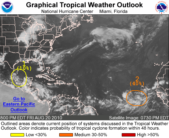
An area of low pressure just southwest of the Cape Verde Islands shows some promise for tropical development within the next several days (#2 on the NHC graphic above).
In an area with sea-surface temperatures in the mid- to upper 80s and deep layer wind shear of 10 to 15 knots (and moving into even warmer waters and calmer winds aloft), this low has the potential to become a tropical storm by early next week.
Several models are showing this system rapidly developing into a hurricane, possibly a strong hurricane, by the middle of the week. Models also show that the possible hurricane would likely recurve back eastward before it ever came close to land.
It has been a quiet start to the hurricane season in the Atlantic, but we are nearing the peak of the season, so we’ll probably start to see things picking up soon.
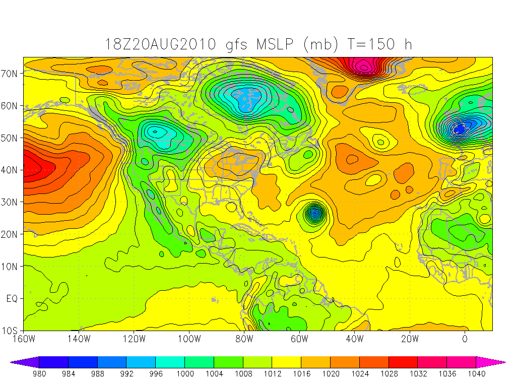
Sea-level pressure, GFS model, valid for 00Z on the 27th (Thursday night). Note the area of low pressure in the Atlantic. Click to enlarge.
Permalink
08.05.10
Posted in Tropical Weather, Weather News at 8:43 pm by Rebekah
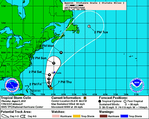
Tropical Storm Colin is back!
Wind shear decreased enough across Colin’s path for the system to re-intensify. Aside from the Bermuda Triangle, ships, and some fish, Colin presents no immediate threat.
Permalink
08.04.10
Posted in Tropical Weather, Weather News at 3:41 pm by Rebekah
It’s hot.
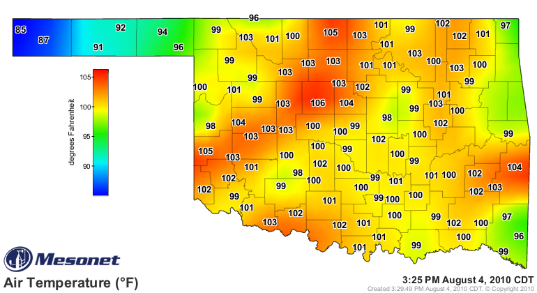
We do have the possibility for a few passing showers and thunderstorms with the passage of a “cold” front tonight into tomorrow…but this is what the NWS Norman has to say about the temperatures behind the front:
“Although the temperatures will be a little cooler behind the front, moisture will increase and keep heat indices elevated. Therefore, we are not expecting significant relief from the heat.”
In other news, Tropical Storm Colin only lasted a few hours yesterday before degenerating into an open trough. As the system will be passing under an upper-level low with plenty of wind shear, regeneration is not likely. However, the National Hurricane Center seems to think it’s not entirely out of the question, given a few days for the shear to decrease.
The next name on the storms name list is Danielle. However, if a new tropical storm forms from the same trough that Colin was a part of, the cyclone will likely retain the same name. This happened in 2004, when Hurricane Ivan hit the Gulf Coast, curved clockwise back to sea as a low, and made it back into the Gulf, where the original low restrengthened and regained tropical characteristics, becoming Ivan once again.
Permalink
08.03.10
Posted in Tropical Weather, Weather News at 11:05 am by Rebekah
Tropical Storm Colin formed out over the Atlantic this morning, but is not expected to become a hurricane and is unlikely to pose any threat to land, aside from possibly a few of the Leeward Islands.
Colin is a new addition to the Atlantic storms name list, as Charley was retired following the 2004 hurricane season.
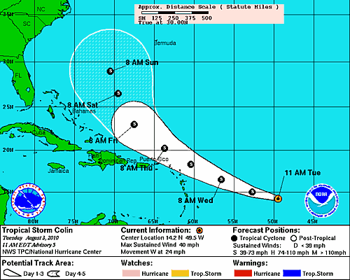
- National Hurricane Center forecast track for Tropical Storm Colin.
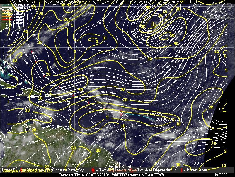
Infrared satellite image (Colin is located at the red tropical storm symbol), with forecast track and wind shear in knots (higher wind shear is not conducive to tropical cyclone development). Courtesy of UW-CIMSS. Click to enlarge.
Permalink
07.23.10
Posted in Tropical Weather, Weather News at 6:59 pm by Rebekah
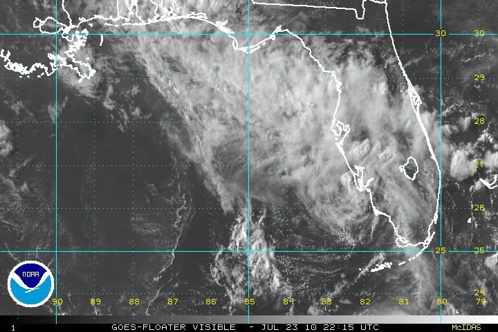
Tropical Storm Bonnie formed just southeast of Florida last night, and made landfall over southern Florida this morning.
The above visible satellite image, from the National Hurricane Center (NHC), shows the remains of Bonnie entering the Gulf of Mexico this evening.
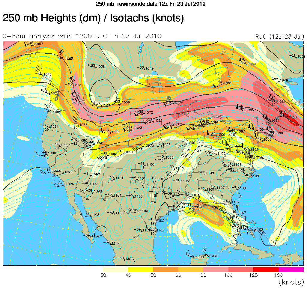
Although the NHC initially forecast Bonnie to strengthen to a tropical storm again before making landfall in Louisiana, an upper-level high over the southeastern U.S. and an upper-level low over the Gulf of Mexico are working to steer the tropical depression towards an area of wind shear, which will prevent Bonnie from strengthening.
The 250mb map below (click to enlarge), from the UCAR RAP, indicates the upper-level high by the blue, clockwise streamlines and the upper-level low by the blue, counter-clockwise streamlines. The orange and yellow highlighted area over the northeastern Gulf of Mexico represents an upper-level jet streak (enhancing the wind shear across Bonnie’s track), with winds going from southeast to northwest.
Permalink
« Previous Page — « Previous entries « Previous Page · Next Page » Next entries » — Next Page »


