07.08.10
Posted in Tropical Weather, Weather News at 1:01 pm by Rebekah
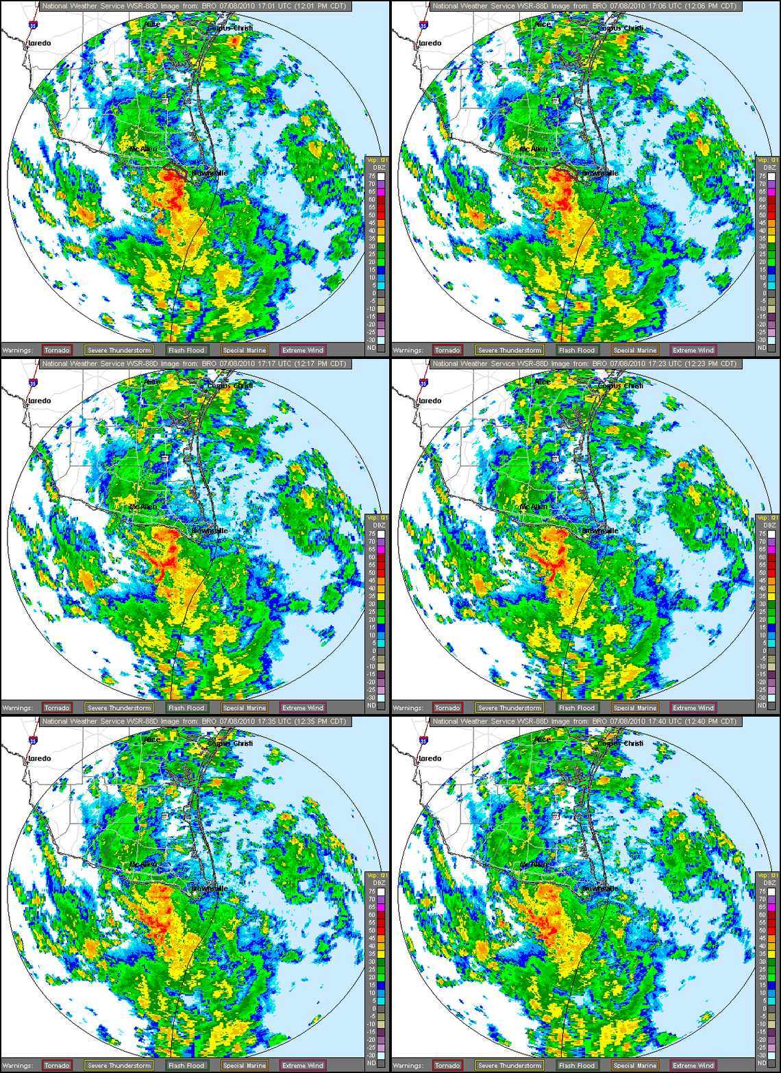
Late last night a new tropical depression formed off of the south Texas / northeastern Mexican coast. Tropical Depression 2 (TD2) was forecast by the National Hurricane Center to briefly become Tropical Storm Bonnie by this morning, but at 10:15 am CDT, TD2 made landfall near Brownsville, Texas.

Brownsville, Texas radar loop, from the NWS Brownsville office.
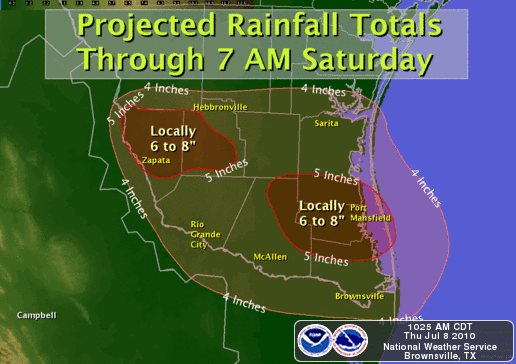
The primary threat with TD2 is heavy rainfall; this rain is coming down on areas already saturated by former Hurricane Alex last week.

Rain forecast by NWS Brownsville office.
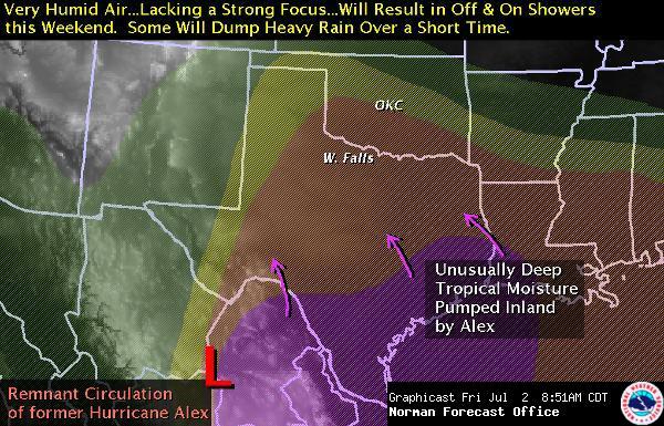
The remnant low will likely follow a similar path to that of Alex, tracking northward up towards Oklahoma, interacting with a front and bringing more showers and thunderstorms to the Southern Plains.
Permalink
07.02.10
Posted in Tropical Weather, Weather News at 7:36 pm by Rebekah
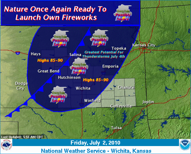
Rain is expected over much of the central US, especially south central. See also this weather graphic from the Wichita, Kansas office:

Their discussion starts: “In what is turning into seemingly an annual event…Nature is getting ready to launch fireworks of her own once again.”
(Referring to it raining last year…I think Norman hadn’t seen rain in about 2 or 3 weeks, when we got some thunderstorms on the 4th!)
Permalink
Posted in Tropical Weather, Weather News at 7:27 pm by Rebekah
The National Weather Service’s forecast for Norman, Oklahoma for the next few days:

Looks like a great forecast for celebrating Independence Day!

Gotta love hurricanes!
Permalink
07.01.10
Posted in Tropical Weather, Weather News at 2:10 pm by Rebekah
Hurricane Alex made landfall at 9 pm central time last night.
I won’t rehash the details, but a couple of highlights are that Alex made landfall as a strong Category 2, with maximum sustained winds of 105 mph (Category 3 has winds of at least 111 mph) and a minimum central pressure of 947 mb. Only Category 4 Hurricane Audrey of 1957 had a lower pressure in the month of June, at 946 mb.
If you’re interested in seeing how other countries rate hurricane strength, I posted a bit on this in March.

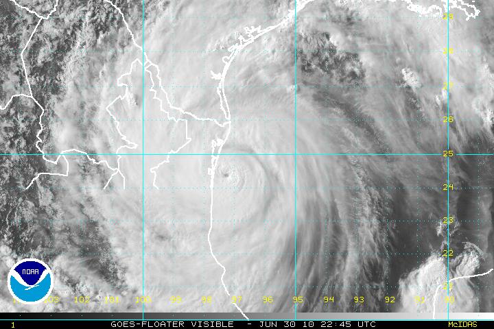
GOES visible satellite image of Alex at 5:45 pm CDT on 30 June, 3 hours from landfall.
According to a National Weather Service Brownsville public information statement, as of 9 pm last night (when the hurricane made landfall in Mexico), Brownsville had received a maximum of 6.76 inches of rain and had experienced peak winds of 66 mph. A couple of Mexican states have reported 24-hour rain totals of around 12 inches. At least 6 tornadoes have been reported along the south Texas coast as a result of Alex.
Tropical Storm Alex is now moving over east central Mexico, and is expected to dissipate over the higher terrain by tonight; however, heavy rain, flash floods, and landslides will still be possible in the area for the next few days.
Permalink
06.30.10
Posted in Tropical Weather, Weather News at 3:47 pm by Rebekah
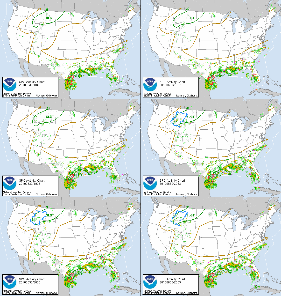
Check out the following radar loop from the Storm Prediction Center, showing Alex’s outer rainbands stretching from Mexico all the way around the Gulf to Florida!

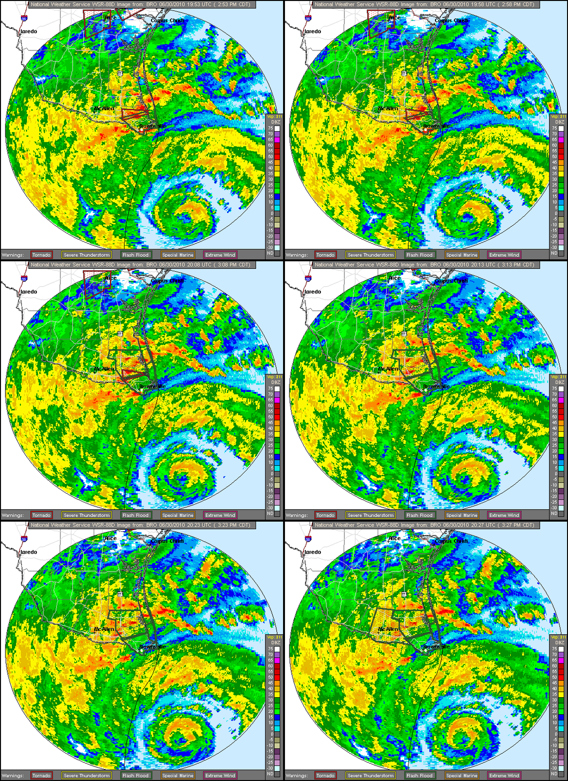
The National Weather Service Brownsville, Texas radar loop shows the eye nearing land.

The latest National Hurricane Center advisory says Alex’s current maximum sustained winds are at 90 mph. Alex is moving towards the west at 13 mph and is just hours away from landfall.
Permalink
« Previous Page — « Previous entries « Previous Page · Next Page » Next entries » — Next Page »
