04.24.11
Posted in Astronomy, Space Shuttle, Weather Forecast at 8:00 am by Rebekah
Well, it looks like a storm system will be chasing me to Florida…I should remain just ahead of it, though, so hopefully I’ll have nice weather on the way down.
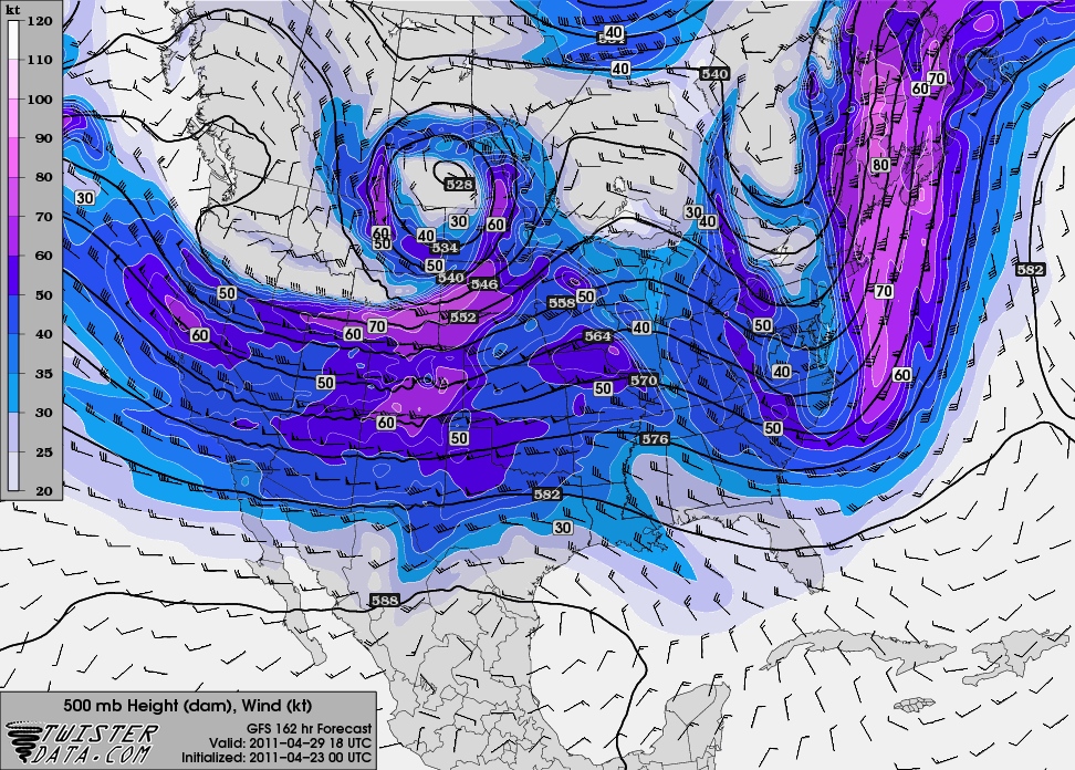
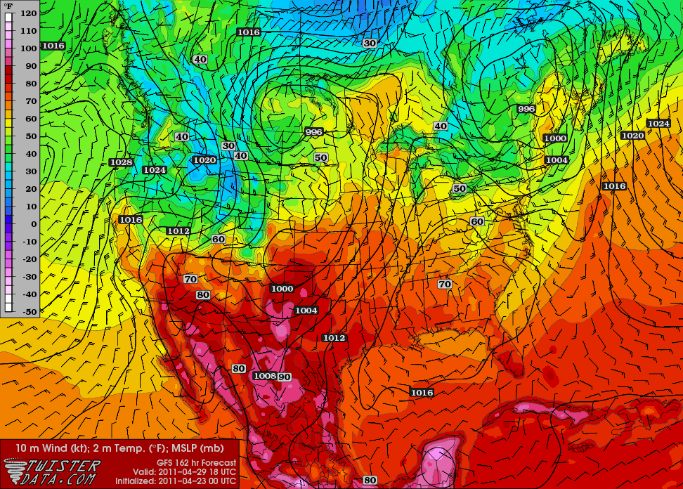
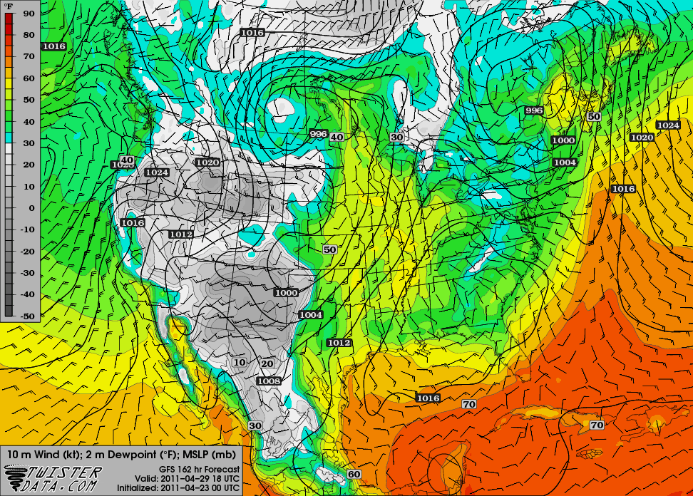
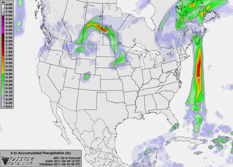
Here are the maps I posted yesterday, only based on last night’s 00Z run of the GFS. Getting closer and closer to launch day!
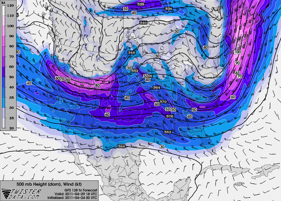
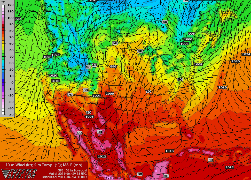
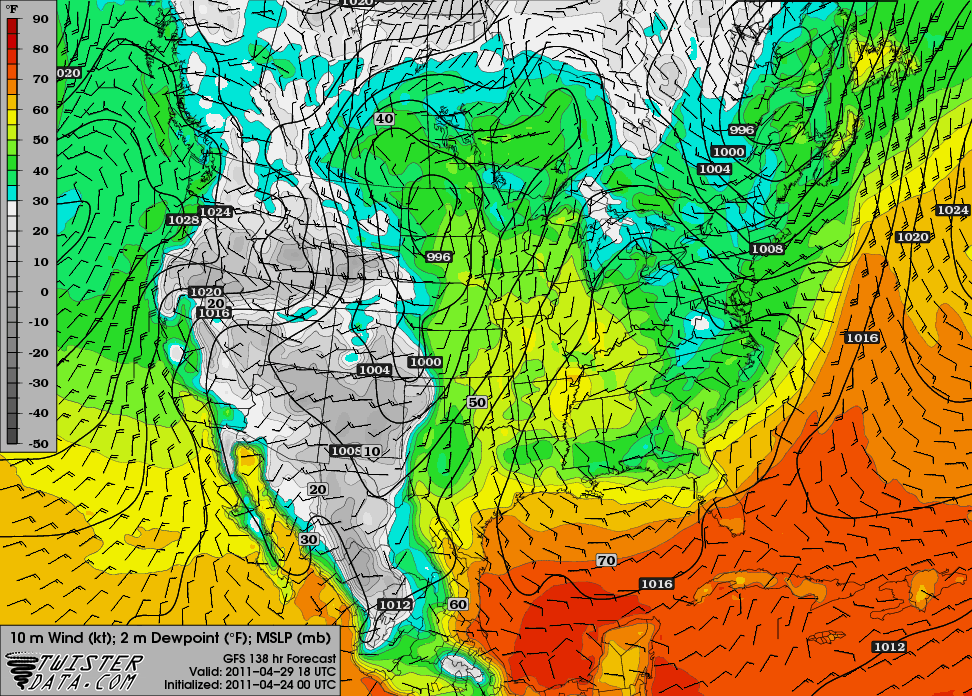
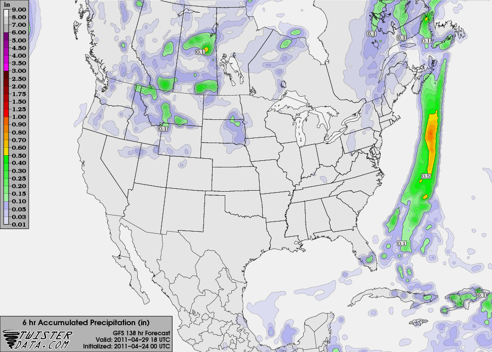
All maps are from TwisterData (click to enlarge) and are valid for 18Z on the 29th (i.e., 2 pm EDT on shuttle launch day).
500mb map:

Surface temperature (slightly warmer than the previous day’s 00Z run):

Dewpoint temperature (also slightly higher, as I expected):

Once again the precipitation forecast is for showers in southern Florida. I certainly hope the front passes through even earlier than expected, as that will keep rain chances to the south of the Cape.

Oh, and Happy Easter! 🙂
Permalink
04.23.11
Posted in Astronomy, Space Shuttle, Weather Forecast at 8:00 am by Rebekah
I’ve got so much on my plate right now, I’m going to keep this short.
Here are a few weather maps (click to enlarge) from TwisterData, based on last night’s 00Z run of the GFS, valid for 18Z on the 29th (i.e., 2 pm EDT on shuttle launch day).
The 500mb map shows a trough over the east coast, north of Florida, with a ridge building in the Midwest. I’d say this is a pretty good setup for a general lack of rain.

The surface temperature map indicates a weak front pushing through, with winds over Cape Canaveral out of the north-northeast and a temperature near 70 °F (I’m certain it’s going to be higher than that, though!).

The model forecast for dewpoints in the mid-50s to near 60 °F at the Cape is also lower than I expect it will be.

Finally, what we’re all most interested in…will it rain on launch day? Currently models have the front passing through central Florida the day before the launch, suggesting we could have a slight chance for showers and thunderstorms on the first day of the Tweetup, but hopefully will be good to go on launch day (the below 6-hour precipitation total shows showers in south Florida, but not east central Florida).

Note: Coming up this week, I plan on blogging more about my road trip, NASA, and the launch experience than about weather (except for perhaps weather along the way!). This means I plan on suspending the normal Monday and Tuesday series until I get back.
Permalink
01.31.11
Posted in Weather Forecast, Weather News, Winter Weather at 3:47 pm by Rebekah
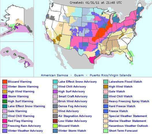
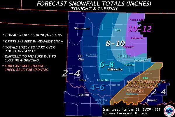
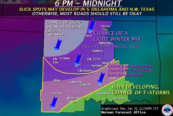
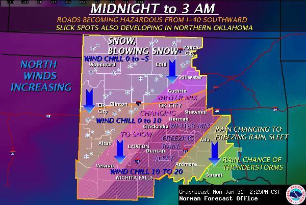
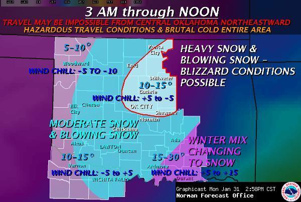
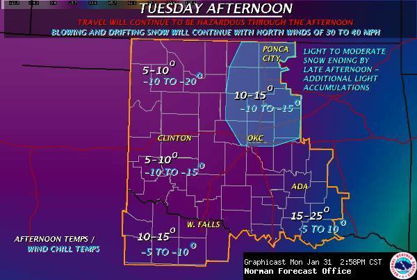
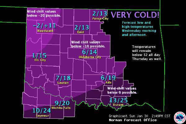
Nearly half of the U.S. and about 1/3 of the nation’s population is bracing for a major winter storm, to take place today through Wednesday or so. Since there’s a lot that could be said, and I don’t have a lot of time for an in-depth post, I’ll just post some graphics from the National Weather Service.


I might add that to my knowledge, this is the first blizzard warning that I have ever been under (I missed the Christmas Eve 2009 blizzard, which was the first blizzard in central Oklahoma in modern history and dumped 13.5 inches of snow on Oklahoma City, with several-foot drifts).
The National Weather Service has been using the following statements to describe this storm (taken from The Weather Channel):
-
Norman, OK: “Obvious analog would be Christmas Eve ’09. For some this may be as bad or worse.“
-
Kansas City, MO: “This could end up being one of the more significant weather events in the last 20 years in Missouri.“
-
St. Louis, MO: “Potentially historic winter storm headed for region.“
-
Milwaukee, WI: “Paralyzing blizzard“
-
Grand Rapids, MI: “Travel…and commerce in general…could be paralyzed with near record-breaking snowfall.“
-
Indianapolis, IN: “Could result in devastating conditions for central Indiana. Long duration power outages appear possible.”
Note: we could get more snow than this, and with the winds, several-foot snow drifts are possible
Currently, here in Norman, it’s mostly cloudy, dry, 45 °F, with a north wind of about 15 mph. It’s hard to believe that within 24 hours we could have several inches of snow on the ground!
Permalink
01.30.11
Posted in Non-US Weather, Tropical Weather, Weather Forecast at 1:46 pm by Rebekah
As if Queensland hasn’t already seen enough rain and flooding to last a lifetime, a new tropical cyclone is forming in the southeast Pacific, and models show it strengthening to possibly a Category 3 (Australian) cyclone (probably only Cat. 1 on the Saffir-Simpson scale) just before making landfall somewhere near or south of Townsville, Queensland on Thursday.
This tropical cyclone, Yasi (on the Fiji names list), may bring 70+ mph (110+ kph) winds and heavy rain when it makes landfall. The GFS model is currently predicting a minimum pressure of 976 mb, while the ECMWF is predicting a minimum pressure of 972 mb, with a slightly faster track.
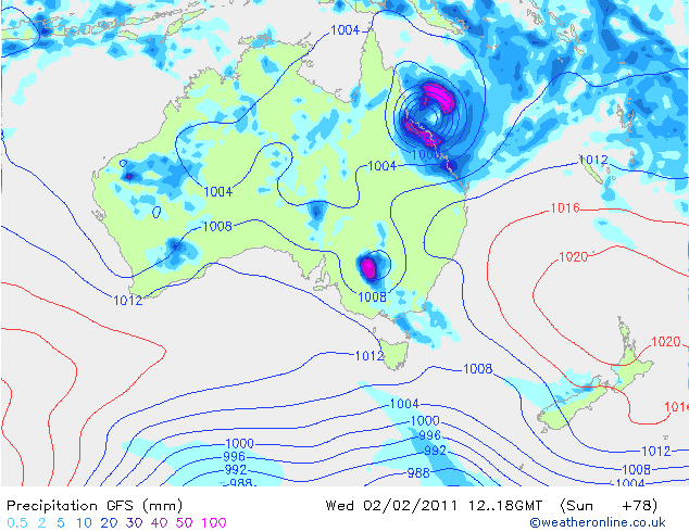
Here’s the GFS model’s forecast (from Weather Online UK) for surface pressure and precipitation, at 18Z on Wednesday (4 am Thursday, local time)…the cyclone is predicted to make landfall about 6 hours later:

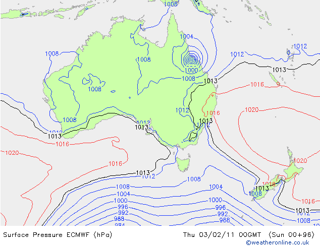
Here’s an ECMWF forecast for surface pressure, for comparison…the nearest time they have is for Thursday at 00Z (10 am Thursday, local time):

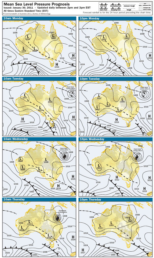
Here’s what the Australian Bureau of Meteorology is predicting for the next few days (for those of you in the U.S., the local “Eastern Standard Time” on this map is 15 hours ahead of the U.S. Eastern Standard Time):

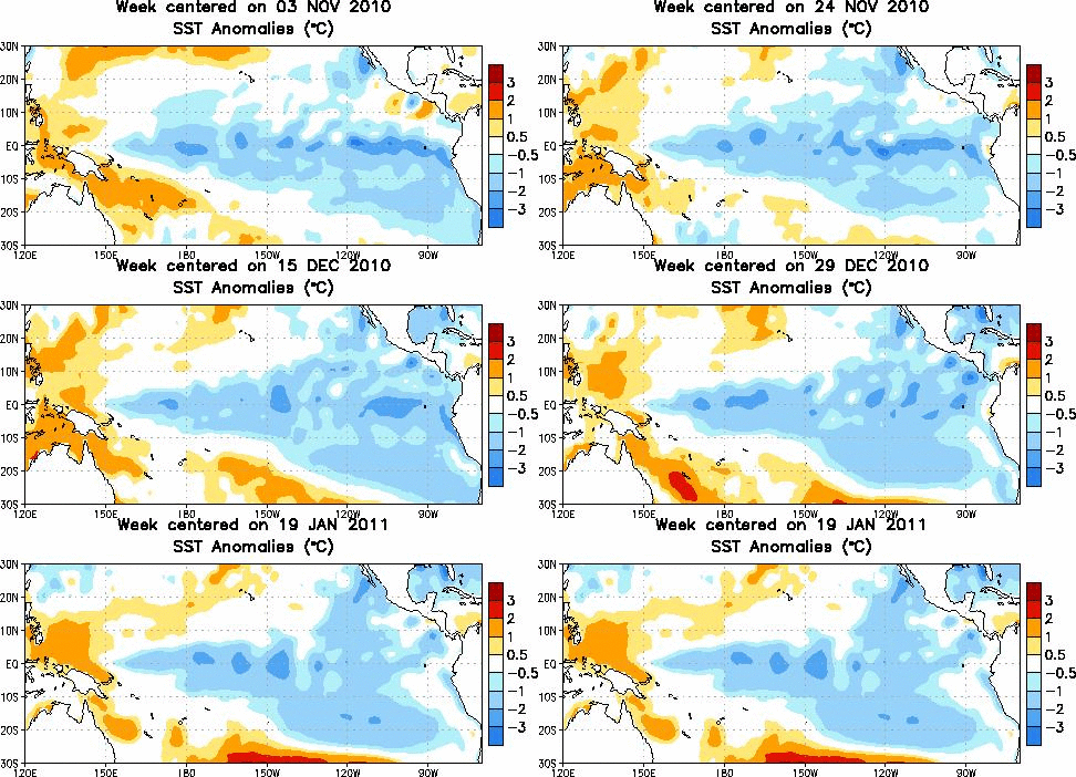
Waters off the eastern coast of Queensland are warmer-than-normal, aiding in the strengthening of Yasi just before landfall.
Tropical sea-surface temperature anomalies, from the Climate Prediction Center:

Here’s another link, from NCDC, showing sea-surface temperature anomalies across the entire globe over the past 5 weeks.
Permalink
01.08.11
Posted in Weather Forecast, Weather News, Winter Weather at 8:00 am by Rebekah
Weather Discussion

National: The primary features on satellite and upper-air maps are the large low-pressure system over the Northeast and the split-flow over the West, including a shortwave trough over the Northwest, a ridge over the northern Rockies, and a shortwave trough over the Southwest.
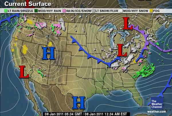
Rain and snow is ongoing in the Cascades and northern Rockies, a large surface high is located over the Great Basin, and the mature cyclone over the Northeast is bringing snow to New England and the Ohio River Valley. An arctic front extending across the central part of the country is bringing cold temperatures to the Plains as well as a chance for freezing rain and snow.
Southern Plains: The shortwave trough over the Southwest will dip down into Texas on Sunday, increasing lift and the chances for rain and snow in the wake of the cold front. Ground temperatures will probably be too warm for much snow accumulation; the greatest chance for snow would be in eastern Oklahoma, where temperatures are expected to be colder.
The type of precipitation is rather tricky to forecast for Oklahoma…forecast soundings for central Oklahoma Sunday evening show a saturated profile just at or below freezing. This means snow could fall, but if the temperature winds up just a little warmer than forecast, we could get just rain or even freezing rain. On the other hand, it looks a bit more certain that a snow/sleet event is building for the Arklatex region on Sunday and sleet/freezing rain for the Southeast on Monday and Tuesday.
On Monday, a trough will deepen over the Rockies and the exit region of a jet streak will be over Oklahoma. This will enhance lift and there will be another chance for some wintry precipitation. Forecast soundings for central Oklahoma again show saturated profiles just below freezing. Northern Oklahoma may get a bit more snow on this day.
The cooler weather will continue throughout the week…high temperatures in Oklahoma will primarily be in the 30s, with lows in the 20s. The latter half of the week should remain dry but breezy.
Permalink
