12.29.10
Posted in Weather News, Winter Weather at 8:01 am by Rebekah
So far for the month of December:
Seattle, Washington has had 8.59 inches of rain (3.65 inches above average).
Denver, Colorado has had NO SNOW (16.4 inches below average); in fact, no precipitation at all (0.55 inches below average).
Newark, New Jersey has had 3.87 inches of precipitation (0.78 inches above average), including 24.5 inches of snow (22 inches above average). [As an aside, check out this 40-second time lapse video from 20 hours of the blizzard in New Jersey on Sunday…it’s very impressive!]
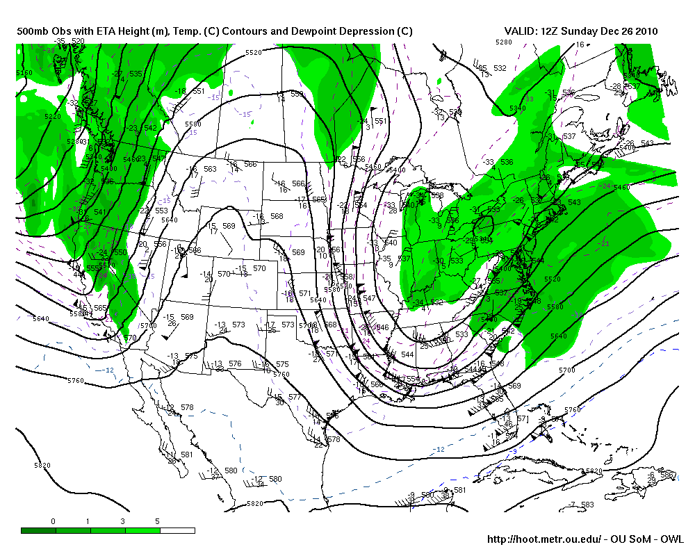
These are just a few stats at specific points, but they serve as examples of what the general weather pattern has been lately: trough in the west, ridge in the central US, and trough in the east.

Sunday (26th) morning’s 500mb map from HOOT, showing a trough in the west, a ridge over the Rockies, and a trough in the east.
This pattern is often conducive to rainy and/or snowy weather along parts of the West Coast, mild and dry weather in the Plains, and cold and snowy weather along parts of the East Coast. This pattern has some relation to La Niña, which I won’t get into in this post (see this post for how this compares to an El Niño pattern from earlier this year).
However, it looks like the atmosphere is ready for some change in the new year.
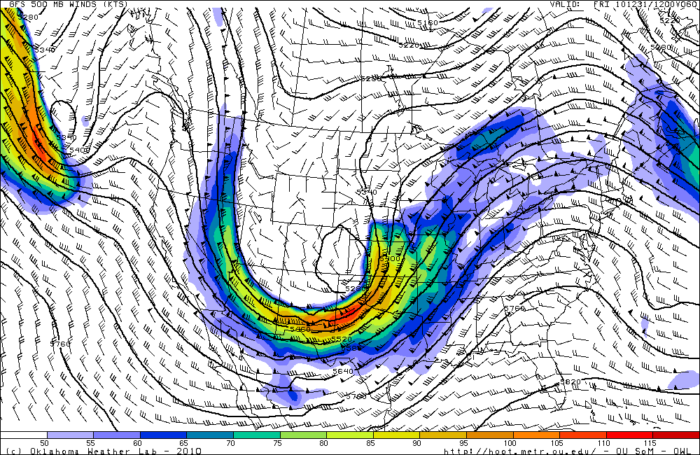
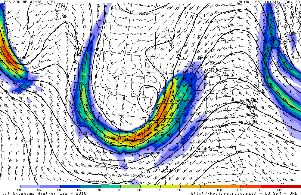
The ridge has been weakening for the last couple of days and moving eastward, which will allow a large trough to deepen and dig in over the western and central US. This will open the door for cold air to surge down into the Plains, and, with the assistance of some upslope winds, will finally allow Denver to receive several inches of snow.

GFS 500mb forecast (from HOOT) for 12Z on New Year’s Eve (i.e., morning of the 31st). Compare to the 500mb map from Sunday (above).

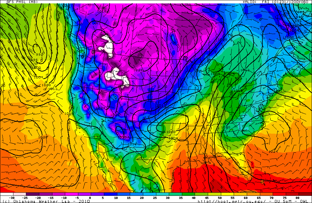
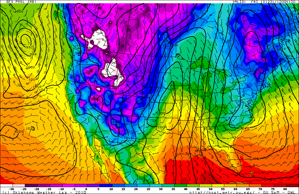
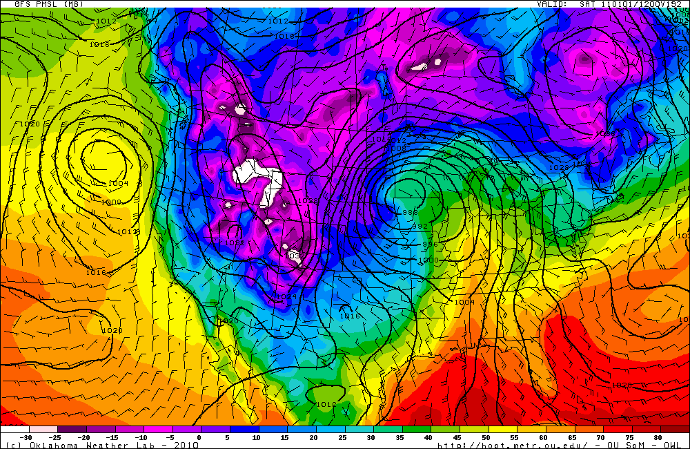
GFS surface analysis forecast (temperature is color-coded) for 12Z on New Year’s Eve. Note the cold air in the western US and the low pressure system over Oklahoma that will move up to Minnesota the next day.
Will we continue to see ridges over the West and troughs (and colder weather) over the central US? Will this just be the beginning of the atmosphere breaking out into a more progressive pattern?
We’ll have to wait and see!
Permalink
12.28.10
Posted in Non-US Weather, Weather News at 8:01 am by Rebekah
This week’s post in the global weather and climate series features Yogyakarta, Java, in Indonesia.

Jalan Malioboro, the most famous street in Yogyakarta for shopping and dining. Courtesy of Wikipedia.
Yogyakarta (or Jogjakarta) is a city of about 637,000 people in an area of 12.5 square miles. The city is found on the south central coast of Java, the 5th largest island in Indonesia (13th largest in the world, with a size of 51,000 square miles) and the most populated island in the world (136+ million). Situated on this volcanic island, Yogyakarta is prone to frequent earthquakes and occasional volcanic eruptions from nearby Mount Merapi.
Yogyakarta was established in 1756, under the Islamic Sultanate of Mataram. In the 1800s, the region fell into the hands of the Dutch. During the Indonesian War of Independence, from 1945, to 1949, Yogyakarta served as the capital of Indonesia.
Today, Yogyakarta is the second most important tourist destination in Indonesia (after Bali), as a result of the rich Javanese fine arts and culture found in the area, including batik dyed fabric (a manual, wax-resist dyeing technique), ballet, drama, gamelin music, poetry, silver work, and leather shadow puppet shows (wayang kulit). Yogyakarta is also home to the largest university in Indonesia, Gadjah Mada University.

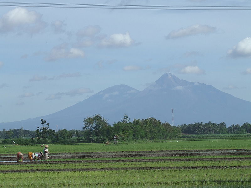
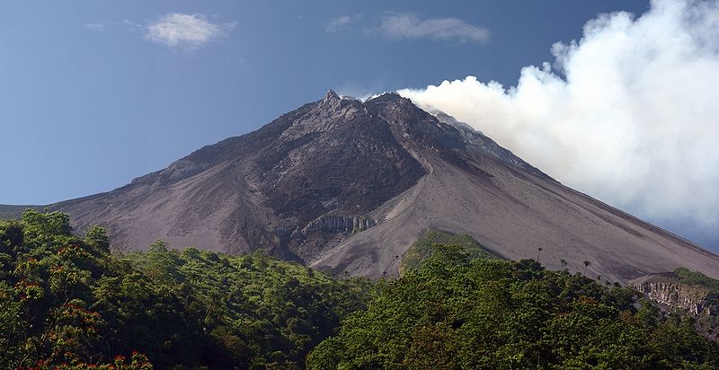
Mount Merapi (left) and Mount Merbabu, about 20 miles north of Yogyakarta. Rice farmers are in the foreground. Courtesy of Wikipedia.

Mount Merapi, elevation 9,738 feet, is the most active volcano in Indonesia. Merapi most recently erupted in November 2010. Courtesy of Wikipedia.
A few more facts about Yogyakarta (climate data from Wikipedia):
- Time zone: Western Indonesian Time (UTC+7)
- Average elevation: 374 feet (114 meters)
- Climate zone: Tropical monsoon
- Average high temperature: 86 °F (30 °C)
- Average low temperature: 71 °F (22 °C)
- Average annual high/low temperature range: 84 to 88 °F (29 to 31 °C) / 69 to 72 °F (21 to 22 °C)
- Average annual precipitation: 86 inches (2,180 mm)
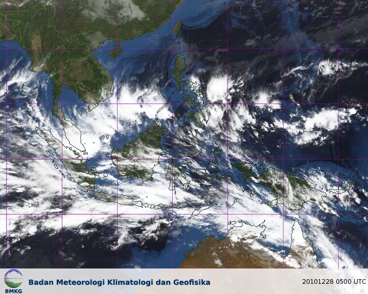
Weather: Yogyakarta is just south of the equator, at just north of 8 °S and just west of 110 °E. Because of its location, the city experiences a tropical monsoon climate. This means the temperature is warm and does not vary much throughout the year, and also means it is a rainy place but there are wet (November – April) and dry (May – October) seasons.
Currently, Yogyakarta is in the rainy season, with highs in the mid-80s, lows in the low 70s, and a chance of rain and thunderstorms every day. Winds are near calm.
Here’s a satellite image from the Meteorological Climatological and Geophysical Agency in Indonesia:

For weather maps and information on current and forecast Yogyakarta weather, see the Meteorological Climatological and Geophysical Agency of Indonesia, Weather Underground, and Weather Online UK.
For more information on Yogyakarta, here’s a link to Wikipedia.
Next Tuesday I plan to take a look at the climate and weather in another part of the globe. As always, if you have any comments or suggestions for future cities, please leave a comment!
Permalink
12.26.10
Posted in Weather News, Winter Weather at 12:58 pm by Rebekah

The East Coast is currently in the throes of a major snowstorm. Some parts of northern Alabama recorded their first White Christmas in recorded history yesterday (Atlanta had their first in over 100 years) and Philadelphia is expecting nearly a foot of snow within the next 48 hours (see The Weather Channel snow forecasts), leading the NFL to postpone the Vikings-Eagles game tonight.
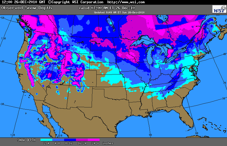
In the meantime, much of the rest of the U.S. had a White Christmas as well. According to a snow depth map from WSI (see below), the only states in the contiguous U.S. that did not have any recorded snow on the ground were Texas, Louisiana, and Florida.

Looking ahead, the next major weather-maker remains a digging trough on New Year’s Eve into New Year’s Day. There is a possibility for some severe storms and winter storms with this system.
Upper-air (500mb) map from HOOT, forecast valid for 12Z December 31st (morning of New Year’s Eve):

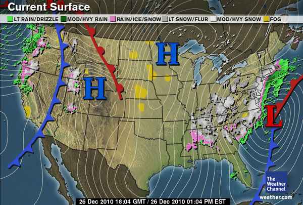
Surface map for the same time:

Stay tuned!
Permalink
12.24.10
Posted in Weather News, Winter Weather at 6:56 pm by Rebekah
Back in Ellensburg for the week, and once again we’ll be enjoying a White Christmas tomorrow! There is nearly a foot of snow on the ground, and there is a chance for more to fall before tomorrow night. In fact, I don’t remember the last time I had a Christmas where there wasn’t at least some patches of snow on the ground.
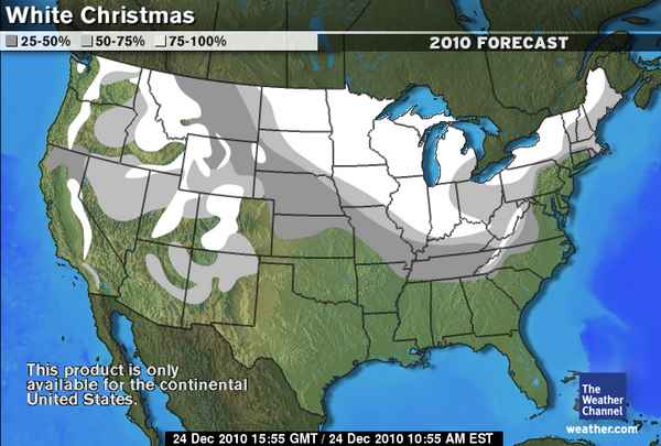
Here’s The Weather Channel‘s forecast for the chances of a White Christmas across the U.S.:

While the East Coast may not get much of a White Christmas this year, there is a chance for a decent winter storm from the Carolinas to New England on Sunday and Monday.
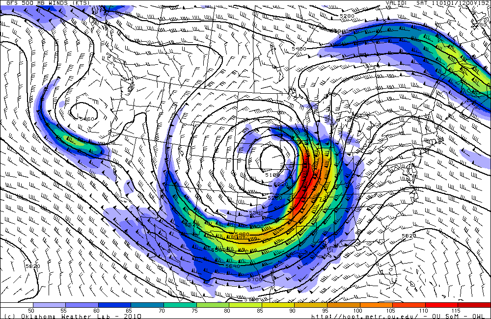
As to what other weather we may get in the near future, I leave you with these 500mb and surface model forecasts (from the GFS, from OU HOOT) for New Year’s Day morning:


Merry Christmas!
Permalink
