02.28.11
Posted in Uncategorized at 8:00 am by Rebekah

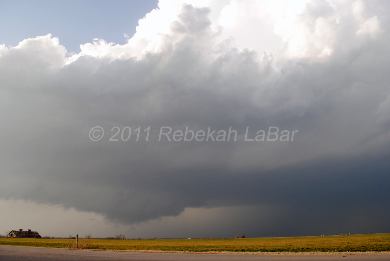
Yesterday we saw a supercell and about three wall clouds in north central Oklahoma, but missed out on the tornadoes this storm later produced, as we gave up just east of Blackwell when the supercell became more outflow dominant and picked up speed. The storm was getting away from us too quickly and we didn’t want to keep following it into worse chase territory (I prefer to stick to chasing west of I-35, as a general rule).
(Special note: this morning’s regularly scheduled weather education post will come later this afternoon.)
Permalink
02.27.11
Posted in Severe Weather Nowcast at 2:37 pm by Rebekah

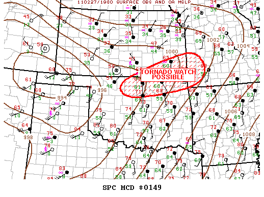
2:12 pm CDT mesoscale discussion graphic from the Storm Prediction Center.
I changed my mind about chasing today, and Jeff and I are on our way up I-35. We’re about 40 miles from Blackwell, Oklahoma, which is around my target area.
There is a nice cumulus field through western Oklahoma, MLCAPE is increasing to above 1500 J/kg in northwest Oklahoma (SBCAPE is above 2500 in western Oklahoma), lapse rates are fairly steep, dewpoints are in the low 60s, and 0 to 6 km bulk shear over much of western and northern Oklahoma is around 60 knots.
A dryline is sharpening in far western Oklahoma, and a warm front is stretching up from southern into eastern Kansas. A surface low is intensifying along the western Kansas/Oklahoma border, in response to a deep shortwave trough heading into the Texas Panhandle.
My expectations are fairly low, but there is a decent chance that there could be a supercell or two up around the Kansas/Oklahoma border late this afternoon. Some elevated storms have already formed along the warm front, but we’re hoping for more surface-based storms closer to the triple point.
Permalink
Posted in Severe Weather Forecast at 8:00 am by Rebekah
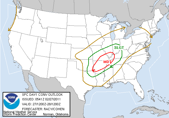
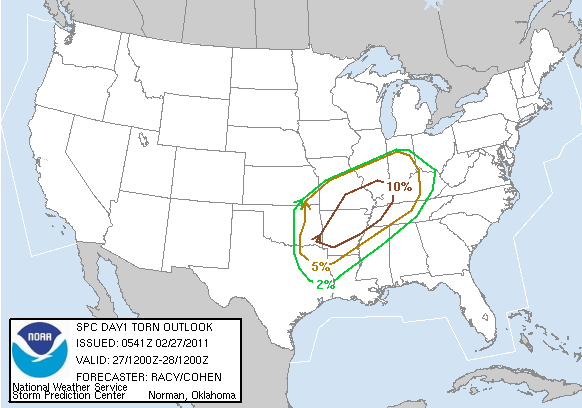
There is another moderate risk for severe storms today, from Arkansas through southeastern Missouri and into the Mississippi River Valley. It does appear that there will be a strong enough cap to prevent very many storms from firing until near or after dark, but there is a chance for an overnight severe weather outbreak.
I again will not be chasing today, and haven’t spent a lot of time looking at this setup…but here’s the 6Z Storm Prediction Center outlook:


Permalink
02.26.11
Posted in Weather News, Winter Weather at 8:00 am by Rebekah
The last few days have brought cold temperatures and snow to the Pacific Northwest. Even western Washington and northwestern Oregon received a rare few inches of snow, prompting a visit to Seattle from The Weather Channel’s meteorologist Chris Warren.
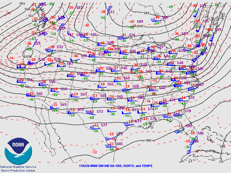
The trough associated with this storm system is dipping a bit further south into central California this morning, where cold air will advance behind a front and surface low moving over the Great Basin.

Friday night’s 500 mb analysis from the Storm Prediction Center, showing the trough over the West Coast.
This cold air is bringing snow early this morning down to at least 1000 feet in the San Francisco Bay Area, and it is even possible that a few flakes may fall at sea level in the Bay Area. As of 11 pm Pacific Time last night, light snow was already confirmed in the San Francisco metro.
It has not snowed in downtown San Francisco since February 1976.
Record cold and a few inches of snow is also forecast for southern California, as a stream of moisture is coming up from the tropics (the Pineapple Express); snow levels in the Los Angeles area could drop to 500 feet.
Record lows were set Friday morning in Seattle, Washington (21 °F) and Billings, Montana (-14 °F), and more records could be broken tomorrow morning. A few examples of California record lows that may be threatened (info from The Weather Channel) include Los Angeles (38 °F), Long Beach (37 °F), and Sacramento (28 °F).

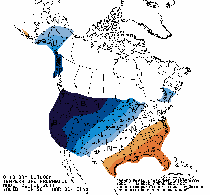
Climate Prediction Center outlook for temperatures from today through Wednesday, showing well below average temperatures expected across the West Coast.
Note also that this unusual cold follows record California warmth earlier in February (e.g., San Francisco experienced some 70 and 80-degree weather).
Permalink
02.25.11
Posted in Uncategorized at 8:00 am by Rebekah
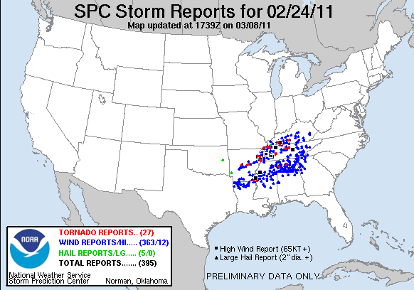
Here’s a map of the storm reports from yesterday/last night…the tornado risk was largely a bust in the forecast area, but there were a few tornadoes near the Mississippi River and into central Tennessee.

It looks like Sunday is shaping up to have a similar severe weather threat in about the same area. I don’t have time for a more detailed post on it just now, but you can check out the Storm Prediction Center’s website for more.
Once again, I don’t plan on chasing this next setup…with gas prices going up the way they are, I may have to be even pickier this year on which days I chase. The Southern Plains season should be gearing up fairly soon, though. The long-range model solution changes with just about every run, so it’s too early to say just when I may be chasing again.
Thanks for staying tuned!
Permalink
« Previous Page — « Previous entries « Previous Page · Next Page » Next entries » — Next Page »
