02.14.11
Posted in Weather Education at 8:00 am by Rebekah
Today’s post in the weather education series is on precipitation, one of the seven elements of weather (temperature, pressure, wind, moisture, clouds, precipitation, and visibility).
————————————————–
Last week we looked at clouds, including what they’re made of, how they form, and the different types. We said that clouds form when water vapor condenses/deposits on tiny particles (e.g., dust, smoke, salt) called cloud condensation nuclei / ice nuclei.
When those water droplets or ice crystals grow large enough, they will begin to fall out of the cloud.
Types of Precipitation
- Falling water droplet + other water droplets = coalescense, leading to rain
- Falling ice crystal + supercooled water droplets (liquid water existing below 0 °C or 32 °F) = accretion, leading to graupel (< 3 to 4 mm)…if the graupel gets lofted up in the cloud (more on this later), it may continue to collect water droplets and we will get hail
- Falling ice crystal + other ice crystals = aggregation, leading to snowflakes
- If the lowest layer of the atmosphere is warm enough (above 0 °C) and thick enough, the snowflakes can melt and will just fall as rain
- If there is a thick warm layer (above 0 °C) above a thin cold layer above the ground, the snow will melt but the raindrops will become supercooled, and you will get freezing rain as the liquid water freezes on contact with the ground
- If there is a thin warm layer (above 0 °C) above a cold layer above the ground, the snow will partially melt but then refreeze before hitting the ground as sleet
More info and illustrations on the temperature profiles needed for winter precipitation will come later in the series.
————————————————–
The final element of weather is visibility, but we will not treat this separately as it is dependent on other elements such as precipitation.
Next Monday we will move on to time zones!
Permalink
02.13.11
Posted in Non-US Weather, Tropical Weather, Weather News at 1:20 pm by Rebekah
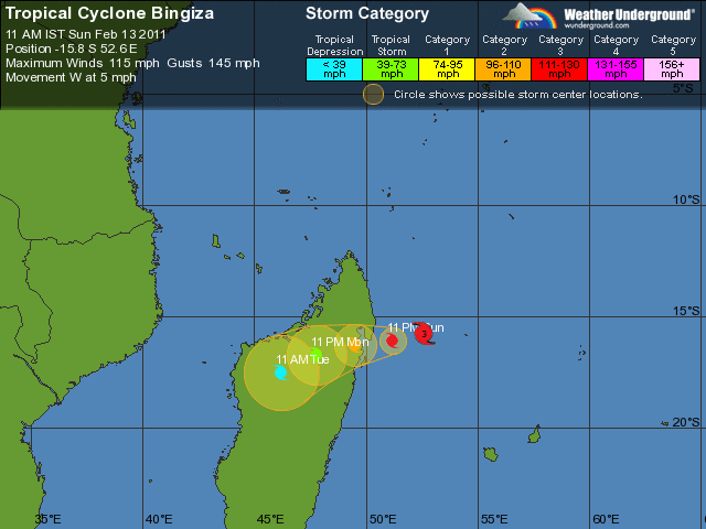
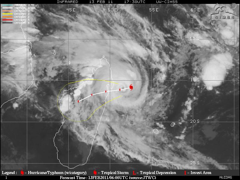
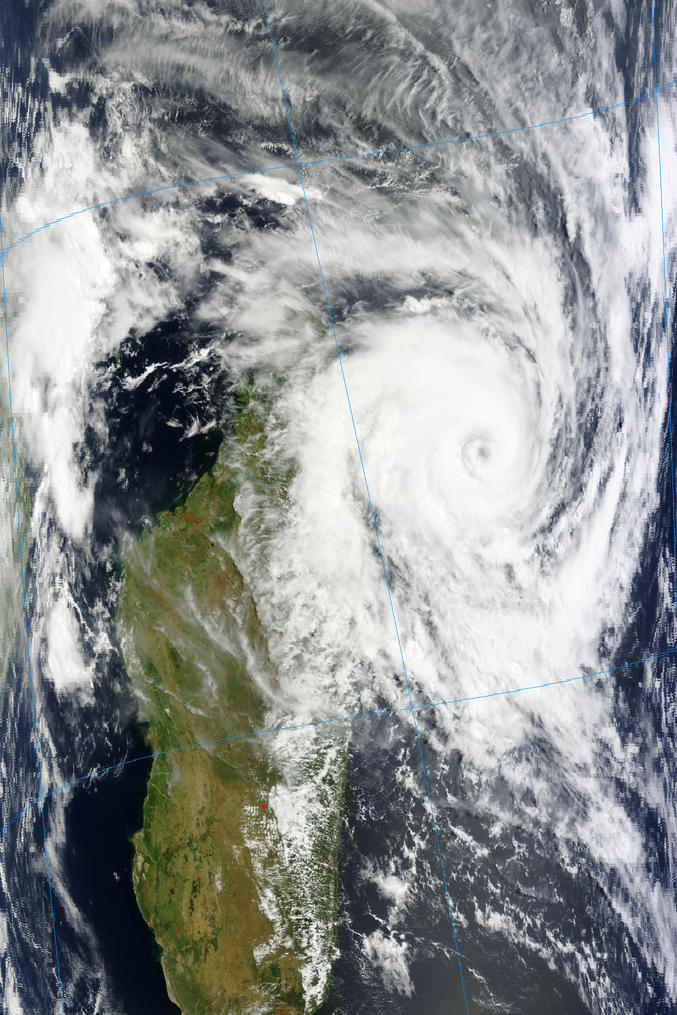
Intense Tropical Cyclone Bingiza (see southwest Indian Ocean ratings) now has 10-minute average sustained winds of 105 mph and a minimum pressure of 953 mb (equivalent of a Category 3 on the Saffir-Simpson Scale). The tropical cyclone is still slowly moving towards northeastern Madagascar at 5 mph, and is expected to now in about 24 hours (late Monday night local time).

Forecast track of Tropical Cyclone Bingiza, from Weather Underground

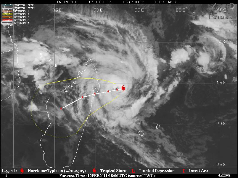
Tropical Cyclone Bingiza, from UW-CIMSS

Tropical Cyclone Bingiza, from Terra/MODIS
The tropical cyclone is still headed for the farming towns of Manambolosy, Mananara Nord, and Soanierana Ivongo, as well as affect a tiny, offshore island called Île Sainte-Marie.
See also the post earlier today on Bingiza.
Permalink
Posted in Non-US Weather, Tropical Weather, Weather News at 8:00 am by Rebekah
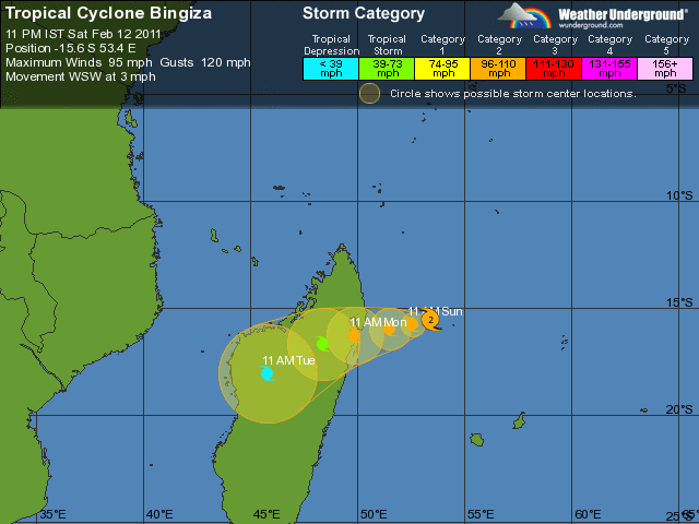
Tropical Cyclone Bingiza, with 10-minute average sustained winds of 90 mph and a minimum pressure of 963 mb (equivalent of a Category 2 on the Saffir-Simpson Scale), is slowly inching its way towards northeastern Madagascar. The tropical cyclone is currently moving west-southwest at 3 mph.

Forecast track of Tropical Cyclone Bingiza, from Weather Underground
The cyclone is expected to make landfall at about this intensity late Monday morning local time (Sunday night U.S. time).

Tropical Cyclone Bingiza, from UW-CIMSS
It appears that the cyclone’s eye will make landfall near the farming towns of Manambolosy (~11,000 people), Mananara Nord (~30,000), and Soanierana Ivongo (~22,000), as well as affect a tiny, offshore island called Île Sainte-Marie (~17,000).
Madagascar is no stranger to tropical cyclones. The southwest Indian Ocean’s most intense cyclone in recorded history struck this same part of Madagascar in March 2004, causing devastating damage. Cyclone Gafilo was the equivalent of a Category 5 on the Saffir-Simpson Scale, with a minimum central pressure of 895 mb and 10-minute sustained winds of 145 mph (1-minute sustained winds of 160 mph).
To see more on different tropical cyclone rating systems in different ocean basins, see another blog post I wrote, “Tropical Cyclone Ului Makes Landfall in Australia“.
To see a recent blog post I wrote on the weather and climate of the nearby capital of Madagascar, Antananarivo, check out “World Wide Weather #25: Antananarivo, Madagascar“.
Bingiza is the fifth tropical disturbance and the second named storm of the Southwest Indian Ocean tropical cyclone season, which begun on November 15th and will run until April 30th.
Permalink
02.12.11
Posted in Weather News at 8:00 am by Rebekah

Weather across the U.S. is pretty tranquil this weekend, but we soon expect a pattern change that will bring warmer temperatures and a chance for thunderstorms to the Southern Plains.
Central Oklahoma will likely reach 80 °F this week; a far cry from the sub-zero temperatures this past week.
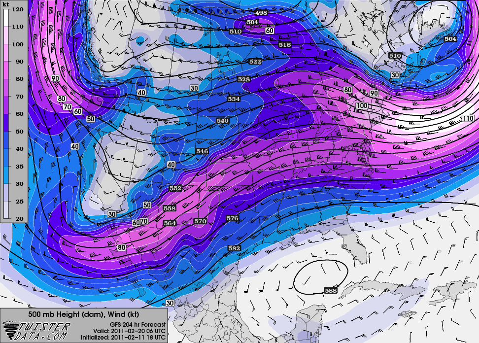
By the end of this coming week, models are showing the western ridge will break down and we’ll see a more progressive pattern with shortwave troughs digging into the Southwest. It also looks like the dewpoints will start to rise by the end of the week, and although we should get a few more fronts that will lower the dewpoints again, it certainly appears that the Southern Plains anyway is done with winter and we’ll soon be on to storm season!

500 mb GFS forecast for next Saturday, from Twister Data
Permalink
02.11.11
Posted in Winter Weather at 8:00 am by Rebekah
Four years ago, a massive winter storm struck the midwestern and northeastern U.S. and southeastern Canada, peaking in intensity on Valentine’s Day.

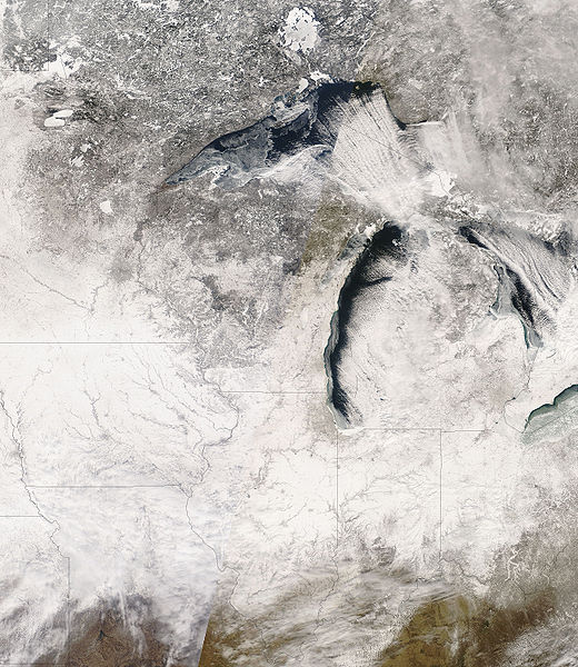
NASA image of snow cover over the Midwest
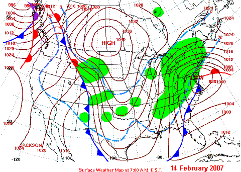
On February 10th, a low pressure system developed on the east side of the Rockies and began to move across the Great Plains. The low strengthened as it moved eastward, and reached the mid-Atlantic coast by the 14th, at which point it moved northward up the coast.
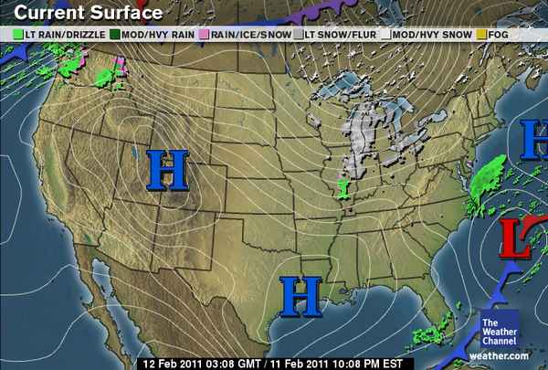
Cold, arctic air plunged southward in the wake of the low, as a high pressure system moved from Canada into the Northern Plains.

NWS surface weather map
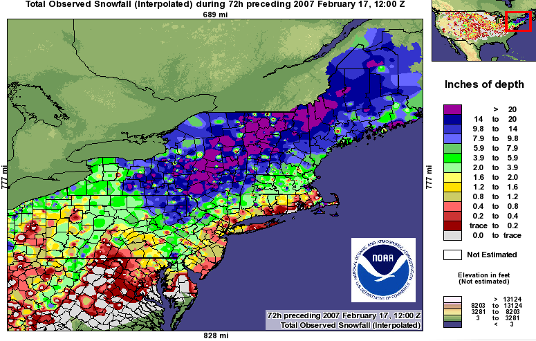
Throughout the storm’s life, over 6 inches of snow fell in a swath from the Midwest to the Northeast and up into southeastern Canada. The Northeast also experienced blizzard conditions after the low passed and up to 2 feet of snow in places. Areas east of Lake Ontario and Lake Erie received some record amounts of lake-effect snow. Heavy sleet and freezing rain also fell from the lower Ohio Valley to the mid-Atlantic and New England. In the Southeast, severe thunderstorms and tornadoes were reported.

The National Weather Service claimed this winter storm was one of the three largest snow storms to affect the Northeast since 1940.
For more on the Valentine’s Day Storm, see Wikipedia, NWS State College, NWS Burlington, and NOAA News.
Permalink
« Previous Page — « Previous entries « Previous Page · Next Page » Next entries » — Next Page »
