02.04.11
Posted in Tropical Weather at 8:00 am by Rebekah

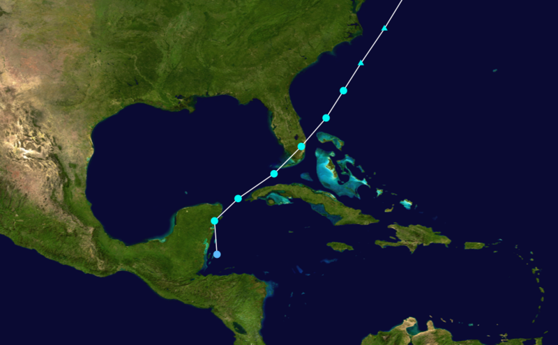
Groundhog Day, 1952: a rare tropical storm formed in the western Caribbean. The tropical cyclone quickly moved north-northwestward, and passed by Cancún before turning northeastward and tracking across the northwest coast of Cuba.
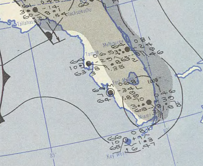
Early the next day, on February 3rd, the tropical storm struck Key West and then made landfall again near Cape Sable, in southern Florida. The Miami National Weather Service office reported a wind gust of 68 mph (110 kph) and a minimum pressure of 1004 mb. There was no serious damage or injuries, though some crops and power lines in southern Florida sustained some damage and 2 to 4 inches of rain fell along the storm’s path.
This tropical storm remains the only tropical cyclone to exist in the Atlantic in February in recorded history.

U.S. Weather Bureau (NWS predecessor) surface map on February 2, 1952
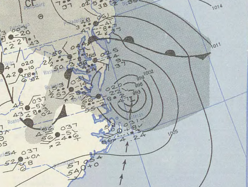
After the tropical storm went back to sea, it transitioned into an extratropical cyclone with maximum winds of 85 mph (140 kph) and waves up to 35 feet off the North Carolina coast on the 4th. The cyclone later moved past Cape Cod before coming ashore in Maine on the 5th. Damage included a freighter off the Outer Banks that washed ashore when water entered the fuel line and damaged the engine (the crew was all rescued by the Coast Guard), some downed power poles and tree limbs in the Northeast, and minor power outages.

U.S. Weather Bureau surface map on February 4, 1952
The tropical storm was very unusual, and it was initially left out of the official tropical cyclone database. Had it been included right away, the storm’s name would have been Tropical Storm Abel.
Source for much of the information and figures: Wikipedia
Permalink
02.03.11
Posted in Weather News, Winter Weather at 8:00 am by Rebekah

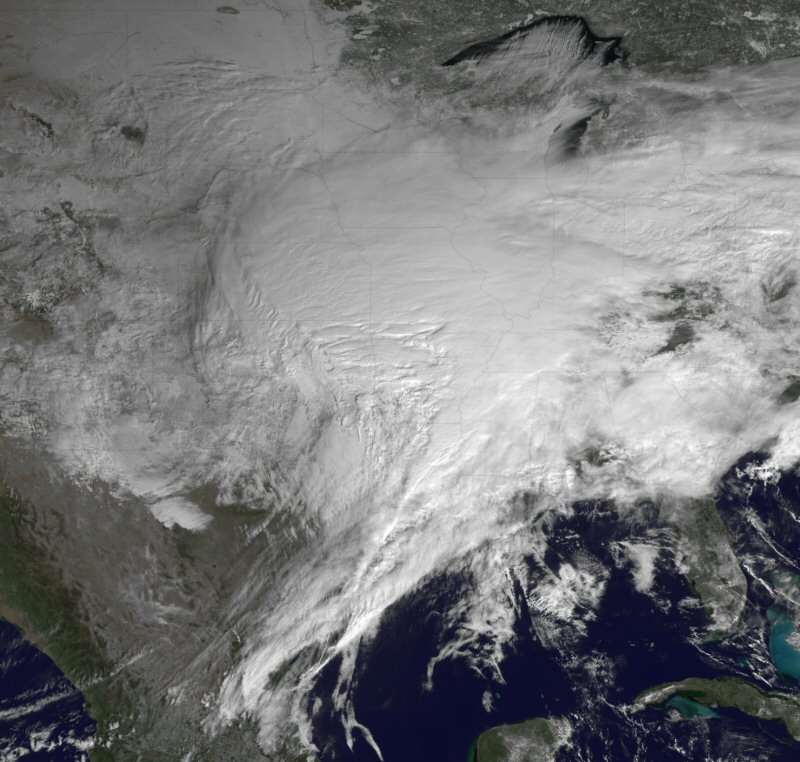
The big snowstorm of the last few days is pretty much over for the U.S. and Canada. The highest storm total report I heard was 26.5 inches of snow just west of Racine, Wisconsin.
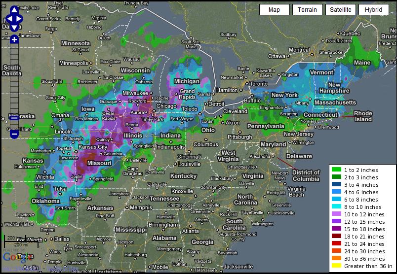
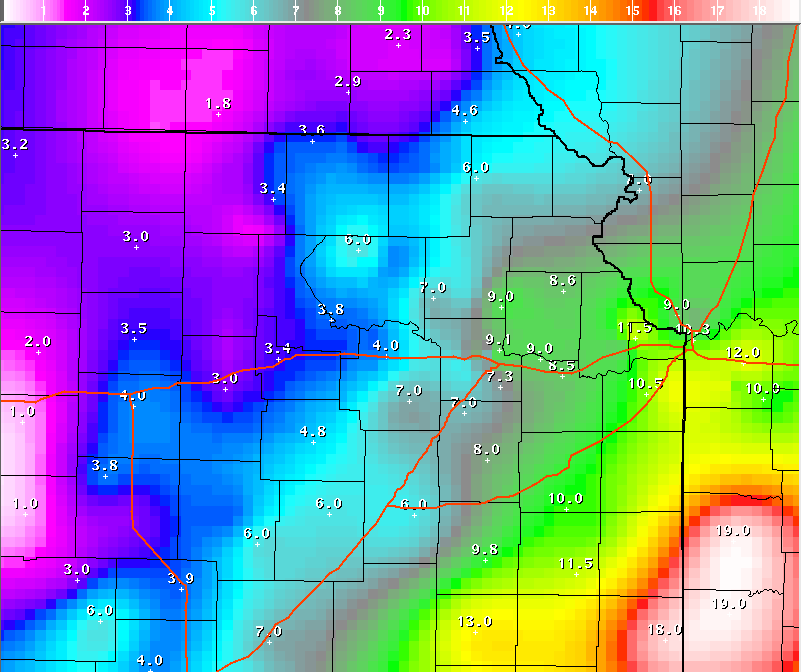
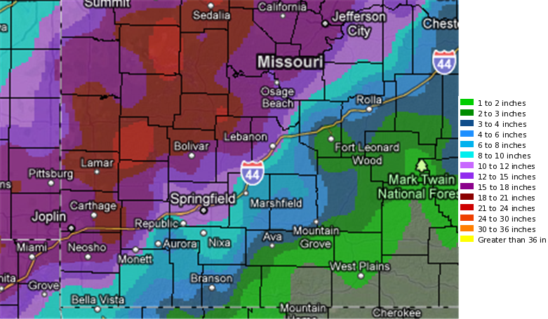
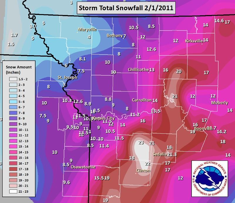
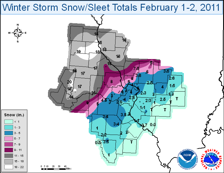
Following is a graphical summary of snow reports from the storm. Many of the NWS forecast offices have more information about the storm in their area; click on the desired link to get to that forecast office’s web page.
Note: all of these images may be enlarged by clicking on them, including the above image from NOAA, showing the storm on the 1st.
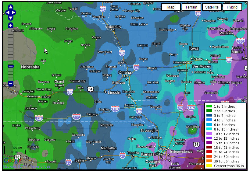
National, 24-hr snowfall ending 8 am Central Time on Feb. 2nd, from the NWS Experimental Snowfall Analysis (some of the below NWS offices just zoomed in on this map for their regional snow maps):

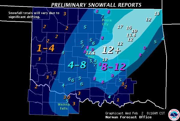
NWS Norman, Oklahoma:

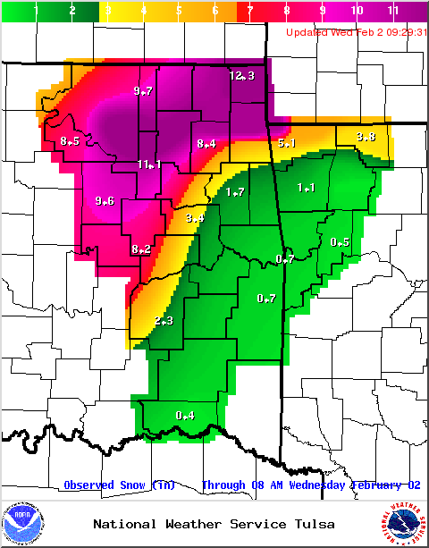
NWS Tulsa, Oklahoma:

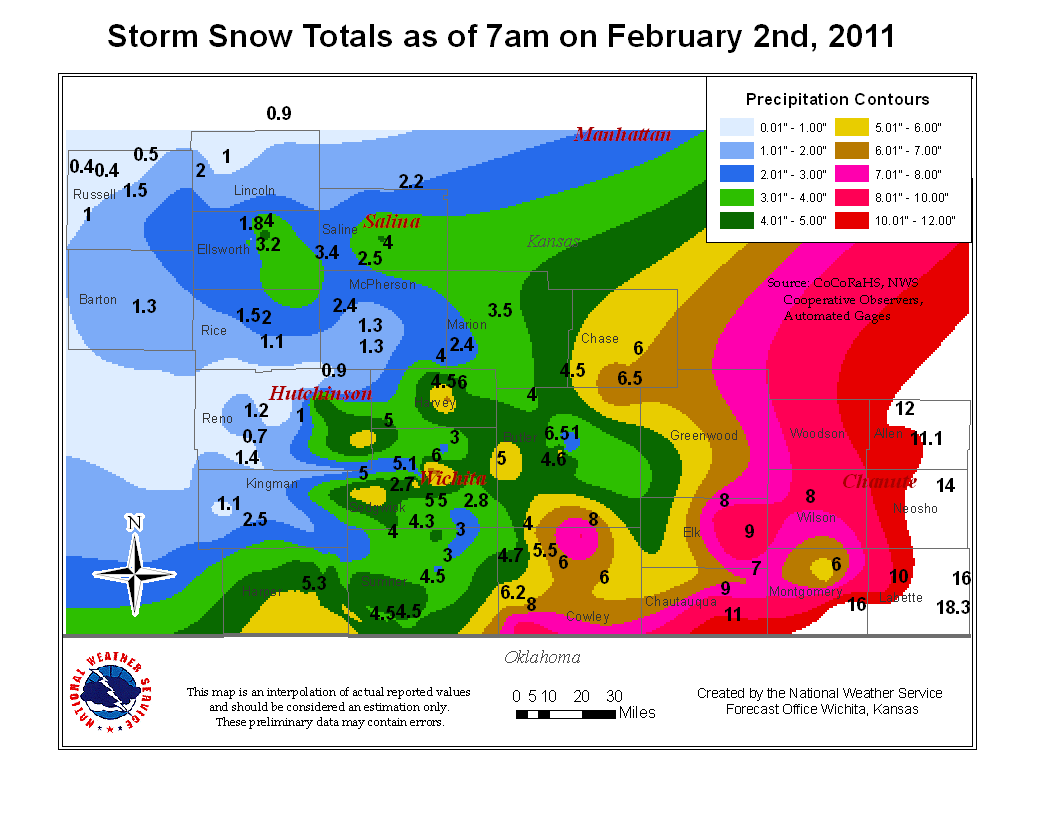
NWS Wichita, Kansas:

NWS Topeka, Kansas:

NWS Springfield, Missouri:

NWS Kansas City/Pleasant Hill, Missouri:

NWS St. Louis, Missouri:

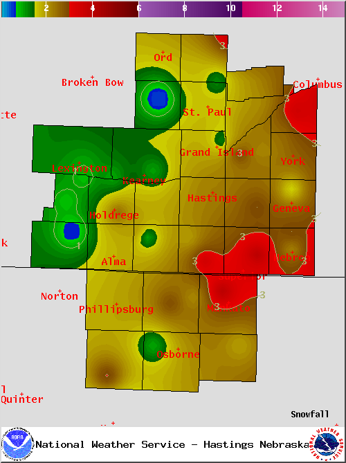
NWS Hastings, Nebraska:

NWS Omaha/Valley, Nebraska:

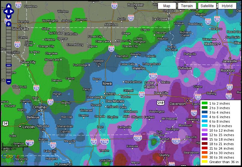
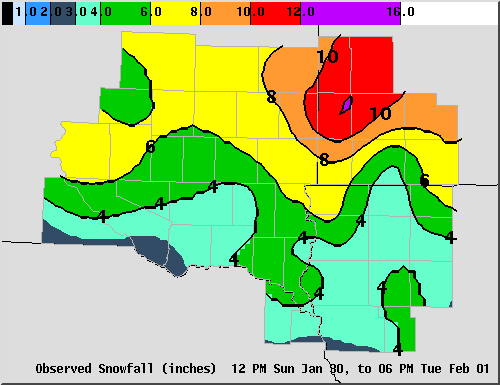
NWS Des Moines, Iowa:

NWS Sioux Falls, South Dakota:

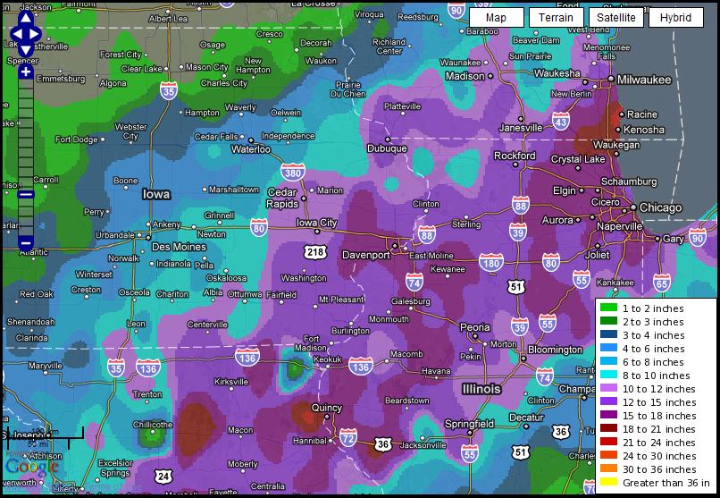
NWS Quad Cities, Iowa/Illinois:

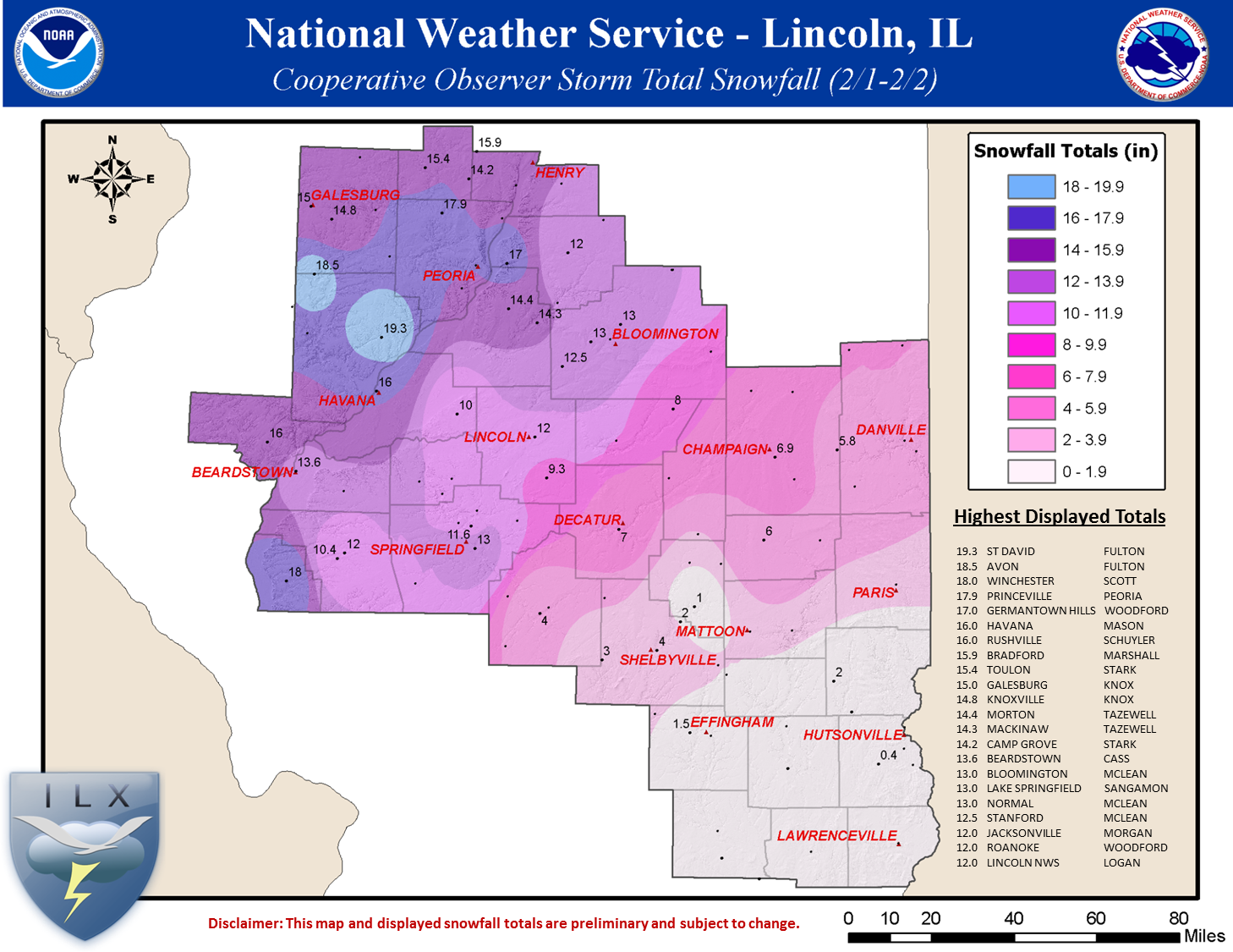
NWS Lincoln, Illinois:

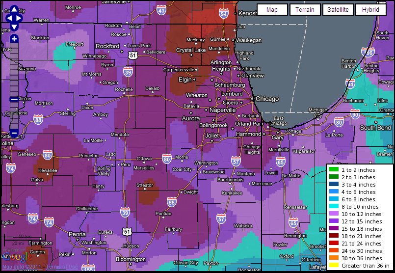
NWS Chicago, Illinois:

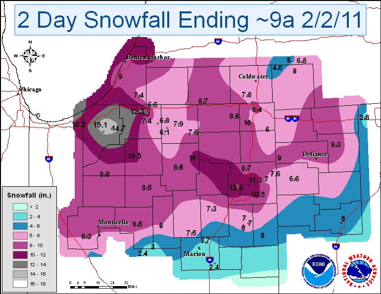
NWS Northern Indiana:

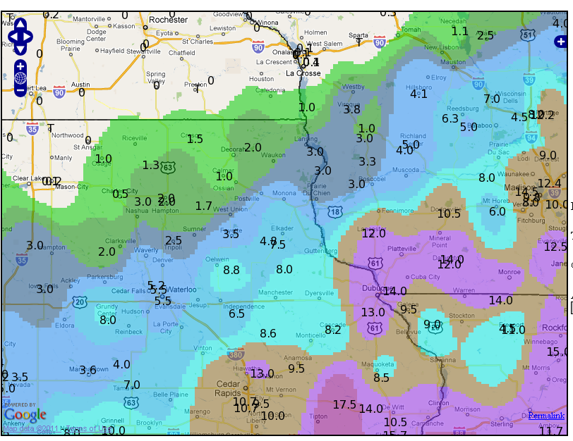
NWS La Crosse, Wisconsin:

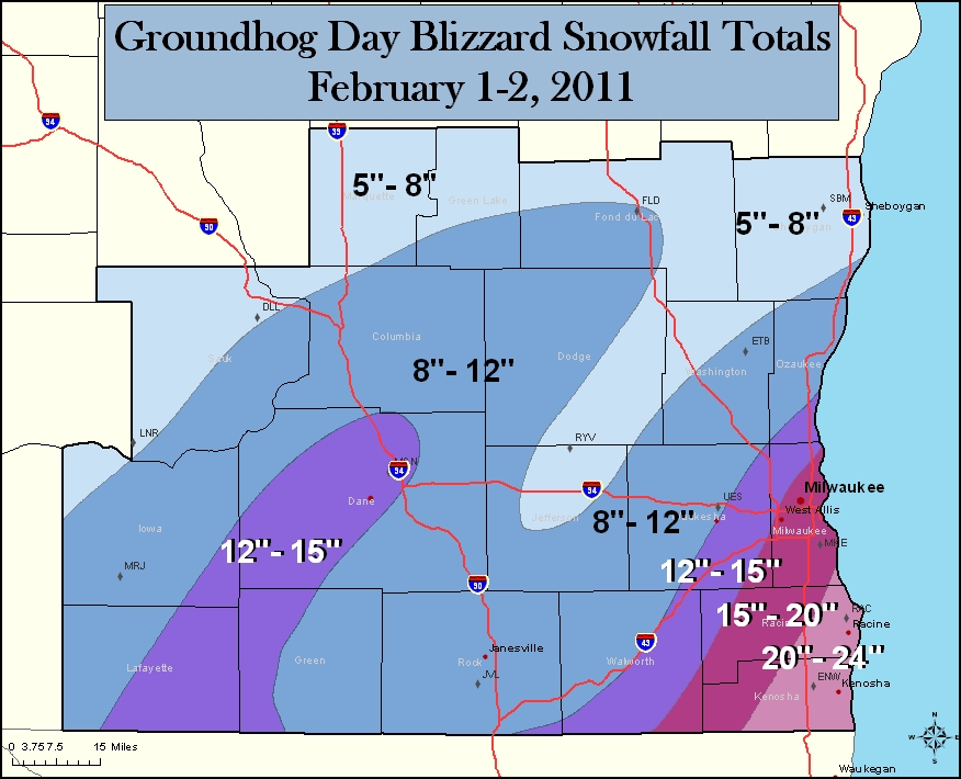
NWS Milwaukee, Wisconsin:

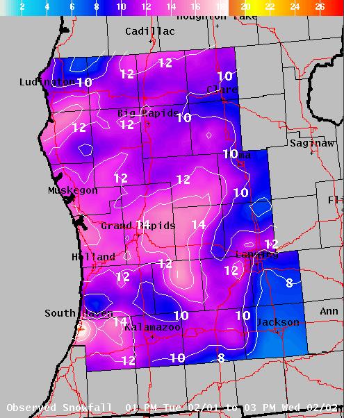
NWS Grand Rapids, Michigan (this write-up opens as a PDF):

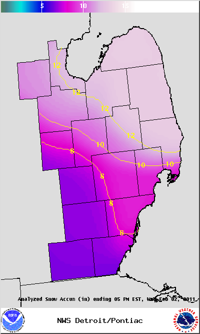
NWS Detroit, Michigan:

To see a text list of snow totals across the U.S., see the Hydrometeorological Prediction Center’s Storm Summary.
http://www.srh.noaa.gov/oun/enhanced.php
Permalink
02.02.11
Posted in Non-US Weather, Tropical Weather at 10:24 am by Rebekah
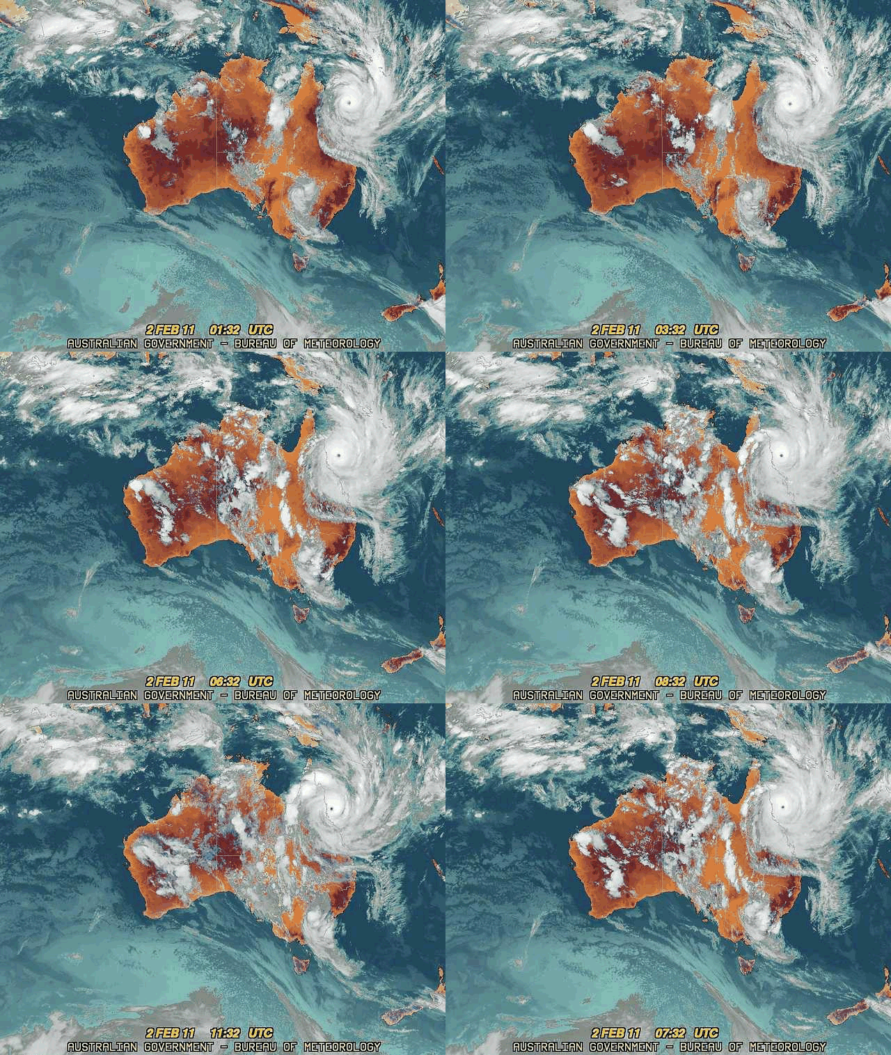
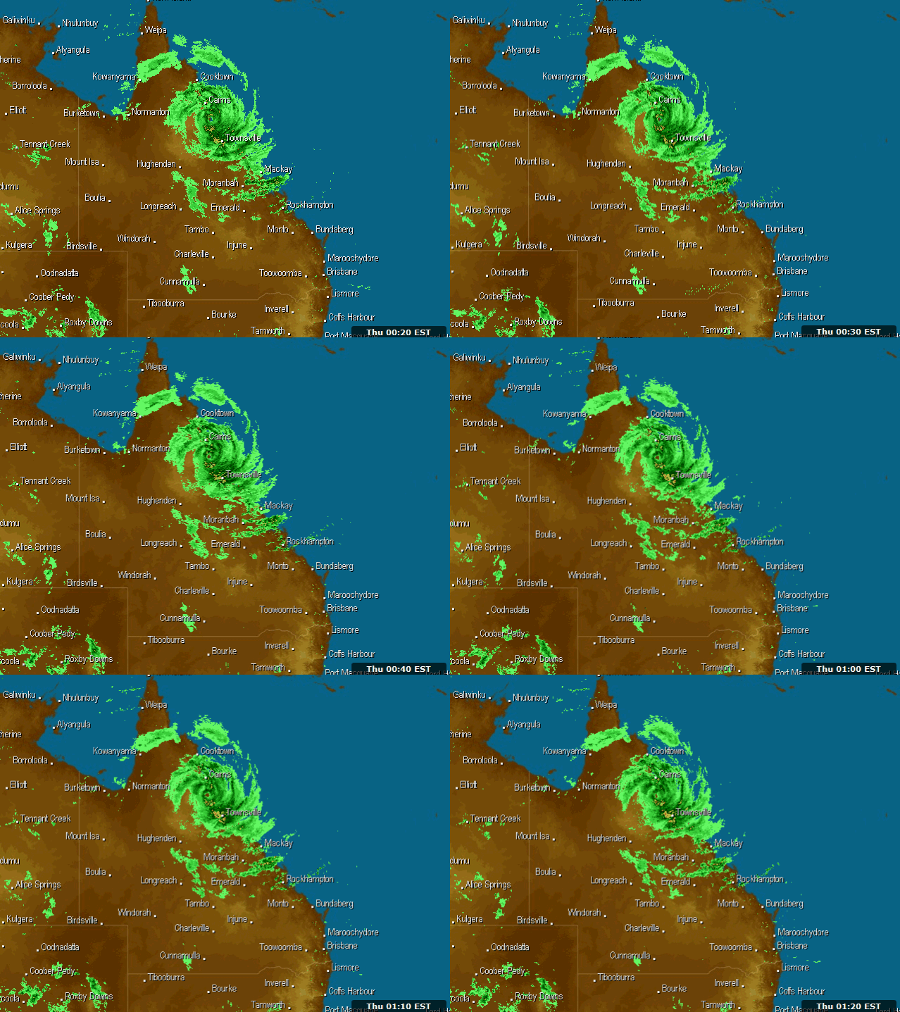
Category 5 Tropical Cyclone Yasi (equivalent of a Cat. 4 on the Saffir-Simpson scale) made landfall near Mission Beach, between Innisfail and Cardwell, Queensland about an hour and a half ago (12:30 am local time).
Here is a summary of the cyclone’s landfall and expected impacts.

12-hr infrared satellite loop of Yasi nearing the Queensland Coast, from the Bureau of Meteorology (click to enlarge)
Stats around landfall:
- Maximum sustained 10-minute wind speed: 127 mph (202 kph)
- Maximum 3-second wind gust: 178 mph (285 kph)
- Central pressure: 930 mb
- Maximum storm surge: 30 ft (9 m)

1-hr radar loop showing Yasi making landfall, from Weatherzone (click to enlarge)

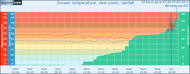
Meteogram (history of weather) for Lucinda Point over the last 24 hours, from Weatherzone…note the spike in temperature, dewpoint, and rain as the eye passes over (click to enlarge)

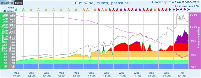
Meteogram for Lucinda Point over the last 24 hours, from Weatherzone…note the drop (and subsequent rise) in pressure and the peak in winds as the eye passes over…the lowest pressure recorded was 977 mb, the highest wind was 135 kph (84 mph), and the highest wind gust was 185 kph (116 mph) (click to enlarge)

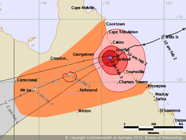
Latest forecast track and intensity for Yasi, as of 2 am local time, from the Bureau of Meteorology (click to enlarge)
Even once the winds slow down some, Yasi will bring a lot of rain to northeastern Queensland; the cyclone also looks like it will stall for a bit in the mountains, allowing even more rain to fall. Models show that the area could receive as much as a foot of rain, and some localized areas could even receive 2 feet or more of rain.
Permalink
Posted in Winter Weather at 8:00 am by Rebekah
Snowmageddon. Snowpocalypse. The Storm of the Century.
It seems like just about every snowstorm in the past year or so has been described in epic proportions, provided that it 1) has affected more than a couple of states, 2) has produced at least a few inches of snow, and 3) has occurred east of the Mississippi.
While some aspects of these storms may have been unprecedented in one way or another, I do not believe that such words should be used to describe every storm.

If we call every snowstorm “epic”, or always use such words to describe a storm, we lose some credibility and may not be able to adequately convey when a storm really is “epic”.
Any snowstorm can be dangerous and life-threatening, and snowstorms happen every year. Blizzards resulting in several foot snow drifts happen every year (granted, not always in highly-populated areas, but they do happen). If we hype up every ordinary snowstorm, some people may eventually stop paying attention to warnings when they need to.
They may say “oh, I made it through that one snowpocalypse just fine, so why should I prepare or stay home for this one?” This is part of why the media then proceeds to take up using even grander terms, to describe another blizzard that was not much different from the last one.
Then when a storm sets up that could truly be called “the storm of the century”, we may not be left with great enough words to describe it in a way that people will heed warnings, prepare, and stay home.
The National Weather Service and the media has used some pretty strong words to warn people of this recent/ongoing winter storm from Dallas to Boston. The National Weather Service in Norman (as well as some of the media outlets) claimed that the blizzard could produce similar results in Oklahoma to those from the Christmas Eve ’09 blizzard.
How did people react to these warnings?
While many people participated in panic buying over the weekend, hundreds of people became stuck on roads in northeastern Oklahoma on Tuesday. Why did the people who were out and about in the snow not stay home? The Christmas Eve ’09 blizzard left hundreds of cars stuck in the snow as well, and it was recent enough to where it should have easily been remembered. Did they not believe the warnings? Did they think that they were invincible? On a side note, what was so important that they “had” to be on the roads…schools were all closed and many, if not most, businesses were shut down as well…there seemed to be an awful lot of non-essential travel going on.
Whatever the reason for people driving in the blizzard, I somehow doubt that there would have been fewer people on the roads had this storm been called the storm of the millennium.
Chuck Doswell recently posted on a similar subject in his blog: “How much warning of danger is too much?”
Now, I’m interested to know, what do YOU think about the use of terms such as “snowpocalypse” and “snowmageddon”?
Permalink
02.01.11
Posted in Weather News, Winter Weather at 3:58 pm by Rebekah

The blizzard has struck Oklahoma…my first blizzard was a pretty big one, and by now the worst is up around Missouri and Illinois.
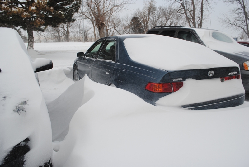
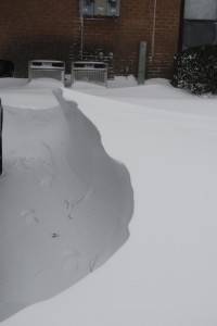
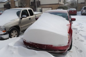
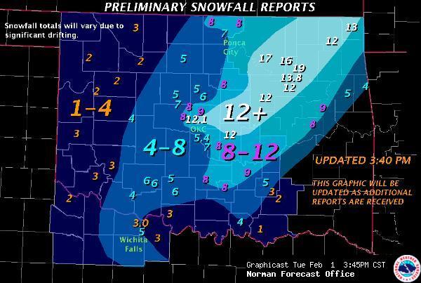
I measured about 8 or so inches of snow here in Norman, but it’s difficult to measure just how much snow we would have gotten without the strong winds. I found quite a few 2-foot snow drifts, and some drifts that were around or just over 3 feet deep!
The wind has really been howling, at about 30 mph or greater, with gusts to 40 mph. The temperature this afternoon when I went out was around 10 °F, with a wind chill of -15 °F!

Last night we got some heavy thundersleet (with quite a bit of lightning!), starting about 9:15 or so. We probably got around an inch of sleet before the snow even started, after midnight. The snow was done falling by noon, but it’s still blowing around out there.
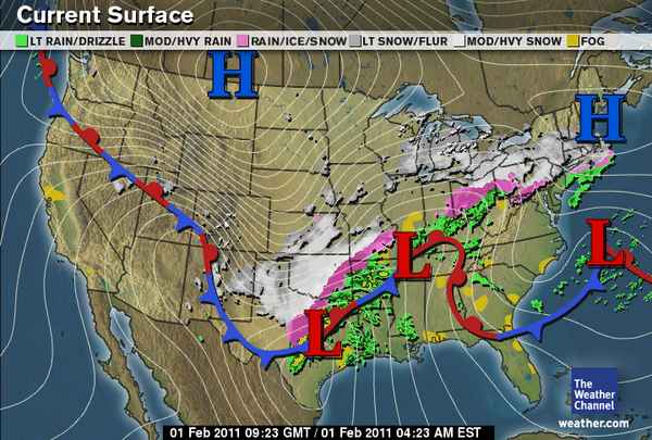
Here’s a surface map from The Weather Channel, at about 3:30 am Central Time:

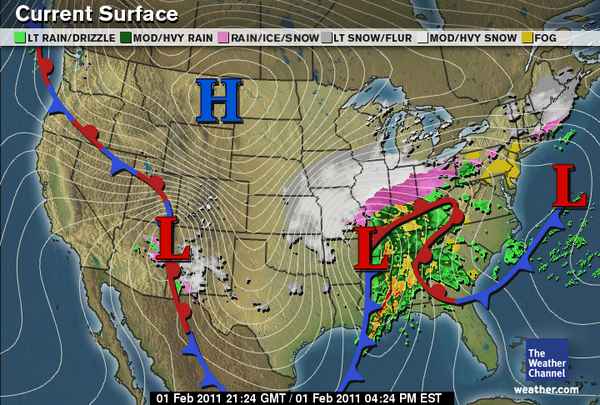
And here’s a map from 12 hours later, showing where the snow and ice has moved on to (there’s also a tornado threat for the Southeast):

Preliminary snow totals for Oklahoma, via the NWS Norman:

Permalink
« Previous Page — « Previous entries « Previous Page · Next Page » Next entries » — Next Page »
