05.24.11
Posted in Severe Weather Forecast at 12:28 pm by Rebekah
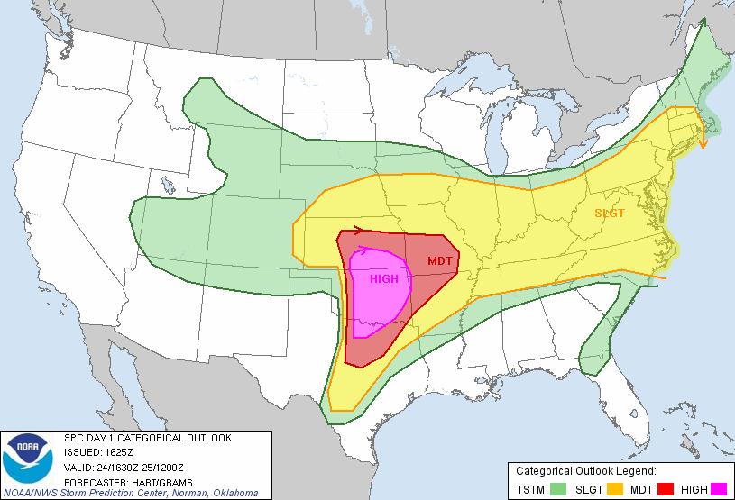
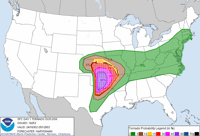
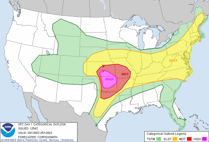
The 1630Z update from the Storm Prediction Center shows they expanded the High Risk area and increased the tornado risk to 45% hatched, which is almost unheard of! There is also a 60% hatched risk for large hail.
Be very careful today if you are in the risk area…keep a close eye on the weather and know where to go for safety if the sirens go off!


The first tornado watch will soon be issued for west Oklahoma into Wichita Falls, Texas. The National Weather Service and Storm Prediction Center are wording these forecasts VERY strongly.
Permalink
Posted in Uncategorized at 11:00 am by Rebekah

Another high risk for severe weather in Oklahoma today, with a 30% hatched for tornadoes in the high risk area (hatched means a chance for EF2 to EF5 tornadoes within 25 miles of a point).
Everything looks ripe for explosive supercell development later today along a dryline just west of I-35. A shortwave trough will be moving through Oklahoma this evening, a nice surface low will be setting up around southwest Kansas / northwest Oklahoma, dewpoints near 70, high shear, high instability, etc. It actually looks like a pretty scary tornado outbreak is possible, and I hope that everyone in the high and moderate risk areas will be weather aware today.
We’ll be heading out soon for Enid, initially, where we’ll wait around and adjust our target area if necessary. We’ll need to get on storms early, as they could quickly become messy.
Permalink
Posted in Uncategorized at 10:21 am by Rebekah
Yesterday I went chasing with Jeff and Mark, Dean’s uncle who is in the US for a few weeks to primarily gather info for a film he is writing about Dean and his time in the States. We first headed to Clinton, where we sat for a little while as we waited for one of the cumulus clouds to take root and really grow. We got on one of the first supercells of the day just north of Clinton and saw two solid rope funnels come out of the side of the updraft base. They were rotating, and we started to get our hopes up.
We waffled a bit between staying on this storm and going for a storm just to our south. Our storm started to weaken a bit, and at some point around then we noticed a nice-looking supercell on radar to our north, up around Fairview. We decided to immediately make our way up there, especially as the storm was closer to the warm front and would probably have a better chance of sustaining itself and producing a tornado. Not long before we got to the slow-moving supercell, we heard reports of at least one tornado on the storm. As we drew near, however, the storm suddenly got absorbed by a small storm cluster to its northeast.
Disappointed and not sure what to do, we ultimately decided to go back south and aim for a supercell going southeast towards the Oklahoma City metro. As we got close to that storm, part of the storm cluster to the north broke off, became supercellular, and also headed southward. We thought we could stop in Edmond and wait for the storms to pass, perhaps giving us some large hail. However, the storms were moving extremely slow and started to dissipate and turn eastward before they got to the metro.
We made it back to Norman before sunset for once, after 325 miles and 7 hours. A lot of the storms really did have difficulty keeping their identities.
Today’s setup should be different, though, as the shortwave trough will be moving across the risk area and the shear will be higher.
Permalink
05.23.11
Posted in Severe Weather Forecast at 9:48 am by Rebekah
First, my heart goes out to those affected by yesterday’s storms and tornadoes, especially to those in Joplin. This year has been particularly bad for large tornadoes in populated areas, leading to record numbers of fatalities.
Today a surface low is moving into far northwest Oklahoma, with a warm front stretching eastward near the Oklahoma/Kansas border and a dryline that will tighten near the Oklahoma/Texas Panhandle border. Dewpoints are already in the upper 60s, though some of the moisture may mix out a little bit later in the day. There is a trough out west, but not much upper-level support in the Plains. In fact, there may actually be some height rises in the Southern Plains unless we get a little shortwave trough to come through. Instability will be highest along and ahead of the dryline, and shear will be highest along the warm front, of course. The shear is not going to be that great (especially low-level shear), but should be sufficient for supercells should storms form.
I should be available to chase after about noon or 12:30 today, so I’m planning on leaving Norman by 1 or hopefully sooner. My current target area is around Seiling to Enid, but I may head out west on I-40 to Clinton, and evaluate then what I want to do.
Permalink
05.22.11
Posted in Severe Weather Nowcast, Weather News at 4:31 pm by Rebekah

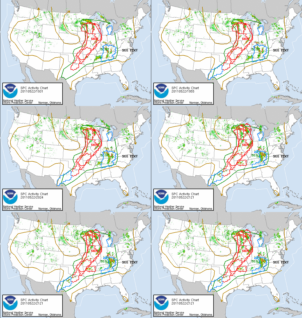
There is more tornadic activity in parts of the Plains today, albeit the eastern Plains.
There may be a couple setups to tempt me to chase tomorrow and Tuesday as well, however there once again may not be enough lift for decent storms tomorrow (the trough may be too far west).
I’ve only got another couple of weeks to chase storms…
Permalink
« Previous Page — « Previous entries « Previous Page · Next Page » Next entries » — Next Page »
