03.27.13
Posted in General News, Traveling at 7:54 pm by Rebekah

My two year contract at the weather station on Kwajalein is coming to a close (already?! where did the time go?). While I had the opportunity to renew it, I decided for various reasons to pursue other opportunities. I have loved my time here and there are some people and some things I will miss, but further challenges and interesting weather are calling me.
I just accepted an offer to work as a meteorologist for MetService, New Zealand’s National Weather Service. I am beyond excited to say I will be moving to Wellington, New Zealand this August! The position sounds great, and I look forward to learning more about Southern Hemisphere and New Zealand weather and exploring this beautiful country.
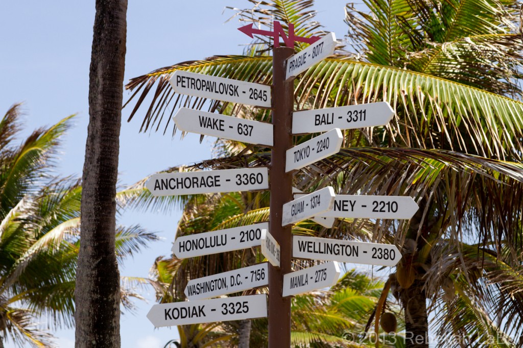
The above photo is the famous Kwaj signpost by the airport, showing the direction and approximate distance in miles to various places around the world. Wellington has been added to the signpost sometime since I first got here, and now I smile whenever I notice it as I pass by–“only” about 2,400 miles further south!
The next few months will bring a lot of traveling for me, as I’ll also soon be flying back to Oklahoma to go storm chasing and visit friends for a few weeks across the Plains. I plan on updating this blog with my latest storm chase adventures this May; hopefully there will be a lot to write about and post photos of! I am going to be chasing with a tablet for the first time; every time I chase I seem to change something up. This year I will have an iPad, and between the built-in GPS, data connection, and various apps, I should be able to get the information I want without having a bulky laptop and cords everywhere. One of my chasing buddies, Dean (coming back from Australia with a couple of his friends) will have the full laptop setup though, so we’ll have double the data!
Anyway, I also plan on updating this (mainly) weather blog more often once I no longer have to dial up to use the Internet at home (really looking forward to high speed Internet again!). I may even start a separate New Zealand blog soon, too.
Permalink
05.25.11
Posted in Severe Weather Post-analysis at 7:23 pm by Rebekah

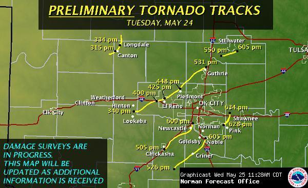
Here is the Norman National Weather Service map of yesterday’s preliminary tornado tracks.
They are working on the damage surveys and have information on this page about the outbreak. So far they have rated the Canton multi-vortex tornado as an EF3, and many of the other tornadoes as at least EF3 (some of these are likely to go up).
There is another high risk for severe weather today in the central Mississippi River Valley, and so far there have been 56 tornado reports.
Permalink
05.24.11
Posted in Severe Weather Post-analysis at 9:34 pm by Rebekah

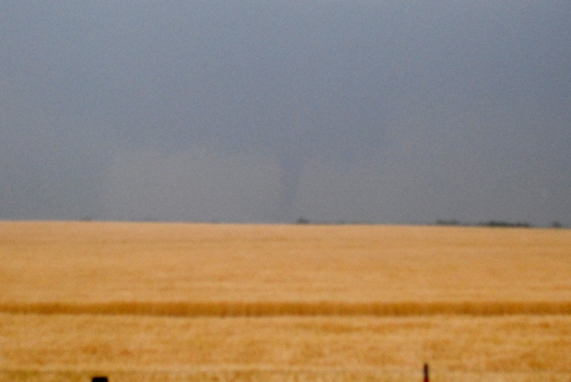
We saw two tornadoes today, a multi-vortex near Canton, Oklahoma at 3:20 pm and the rope-out stage of an elephant trunk tornado near Fairview at about 3:48 pm.
My photos didn’t turn out very well (the above photo is from the touchdown of the Canton tornado), as the rain was starting to fall and my camera had trouble focusing…plus I was busy trying to call in the tornadoes and plot our next route.
The high risk was certainly warranted today, and props to the forecasters for nailing this one. Sadly, there were many large, destructive tornadoes that affected many cities from Kansas to Texas. I thought for a while that my home was in the crosshairs, but the tornadoes lifted just in time. My heart is very heavy tonight for those who were hit by the storms, and for some areas it’s not over yet.
Permalink
Posted in Severe Weather Forecast at 12:28 pm by Rebekah
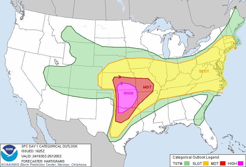
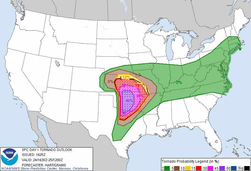
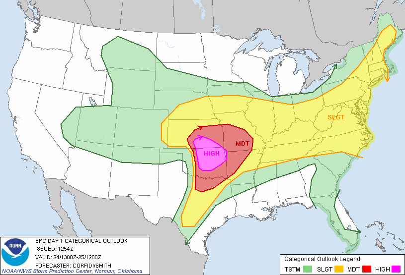
The 1630Z update from the Storm Prediction Center shows they expanded the High Risk area and increased the tornado risk to 45% hatched, which is almost unheard of! There is also a 60% hatched risk for large hail.
Be very careful today if you are in the risk area…keep a close eye on the weather and know where to go for safety if the sirens go off!


The first tornado watch will soon be issued for west Oklahoma into Wichita Falls, Texas. The National Weather Service and Storm Prediction Center are wording these forecasts VERY strongly.
Permalink
Posted in Uncategorized at 11:00 am by Rebekah

Another high risk for severe weather in Oklahoma today, with a 30% hatched for tornadoes in the high risk area (hatched means a chance for EF2 to EF5 tornadoes within 25 miles of a point).
Everything looks ripe for explosive supercell development later today along a dryline just west of I-35. A shortwave trough will be moving through Oklahoma this evening, a nice surface low will be setting up around southwest Kansas / northwest Oklahoma, dewpoints near 70, high shear, high instability, etc. It actually looks like a pretty scary tornado outbreak is possible, and I hope that everyone in the high and moderate risk areas will be weather aware today.
We’ll be heading out soon for Enid, initially, where we’ll wait around and adjust our target area if necessary. We’ll need to get on storms early, as they could quickly become messy.
Permalink
« Previous Page — « Previous entries « Previous Page · Next Page » Next entries » — Next Page »
