05.11.11
Posted in Uncategorized at 3:52 pm by Rebekah
We’re about 50 miles east of Woodward on Highway 412. We got slowed up a bit by the heavy rain and hail on I-35, as well as several slow vehicles on other highways we took (e.g., a house going up Highway 77).
I’m a little discouraged by the increased cloudiness in western Oklahoma. The better target area does appear to be western (especially southwestern) Kansas, but I don’t think we’ll be able to make it up there in time. We’ll head north soon at Highway 281, and probably evaluate what we want to do when we get to about Waynoka.
Permalink
Posted in Uncategorized at 1:22 pm by Rebekah
Jeff and I are storm chasing today, heading up I-35. We’re near Oklahoma City at present, and are currently targeting Enid, Oklahoma. We may actually drop south of Enid, but we’ll decide that once we get closer.
After this midday convection rolls through central Oklahoma, we may get a fairly nice dryline day in western Oklahoma. I’m actually a bit concerned about there being too many storms popping up.
Permalink
Posted in Uncategorized at 8:00 am by Rebekah
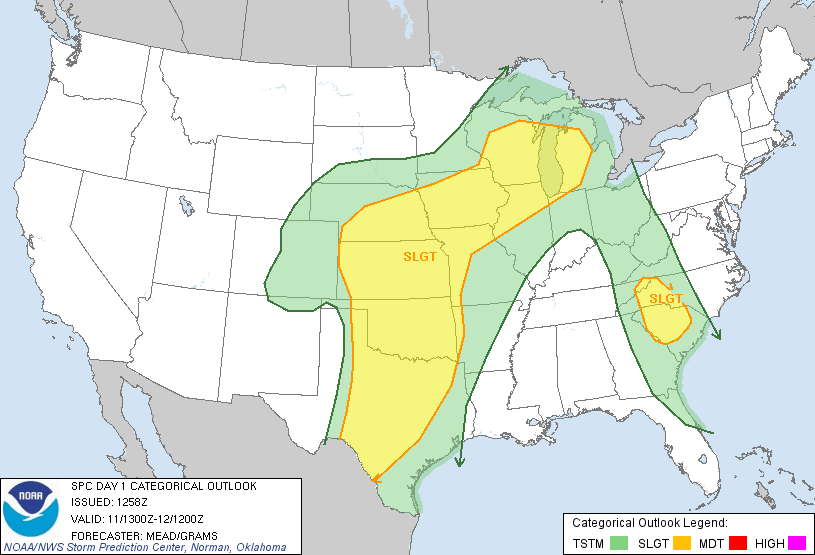
There WAS a moderate risk for severe weather in west central Oklahoma and west central Kansas today…at 13Z, the Storm Prediction Center removed the moderate. A fairly deep trough will set up over Colorado and a surface low will be in western Kansas with a dryline stretching south of the low through western Oklahoma this afternoon.

I’ll be free to chase after about noon, and likely would not have far to go to see supercells and possibly tornadoes.
I’ll see what the day is looking like by midday.
Permalink
05.08.11
Posted in Severe Weather Post-analysis at 10:24 am by Rebekah
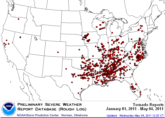
A look at the preliminary number of tornado reports so far this year shows a general lack of tornadoes west of I-35 in the Plains.

It is nearly mid-May already, and this year is proving especially difficult for Plains storm chasers, despite the large number of tornadoes so far.
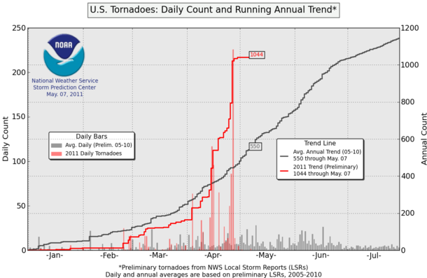
The following graph shows the running count of tornado reports this year as compared to the average annual number based on tornado reports from 2005 through 2010. As you can see, a few tornado outbreaks in April have brought this year’s tornado report count to nearly twice the average.

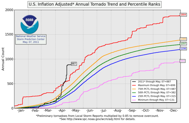
The following graph shows the “inflation-adjusted” number of tornadoes for 2011 (adjusted to account for some tornadoes being counted more than once) compared with percentiles based on averages from 1954 through 2007. Again, note that we are currently well above the maximum recorded number of tornadoes for this time of year!

Are the Plains going to heat up any time soon? That remains to be seen. It does look like at some point this week we may get a dryline day in western Oklahoma, perhaps on Wednesday, that may yield some tornadic supercells. There also may be a chance for some supercells and chasing weather later in the month.
The map and charts are from the Storm Prediction Center, and can be found at the following links: http://www.spc.noaa.gov/climo/online/monthly/2011_annual_summary.html and http://www.spc.noaa.gov/wcm/.
Permalink
04.22.11
Posted in Uncategorized at 8:00 am by Rebekah
Jeff and I headed down to Texas late yesterday afternoon, in hopes of finding a supercell forming along the warm front near / just south of the Red River. There were a couple of nice supercells that formed in far west Texas, but in the end, nothing for us. Oh well, it was just a 7-hour, 315 mile trip, and back by 10!
Today there could be a shot at storms in the same general area, but I’m not sure if I’ll be persuaded to go or not yet as I’ve still got some preparing to do for the Florida trip! 3 days until I leave, and 1 week until launch (if no delays)! 🙂
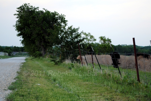
Here is a little calf I tried to make friends with yesterday, near Denton, Texas. Sadly, he would have none of it, and quickly ran into the field, where he blended in quite nicely.

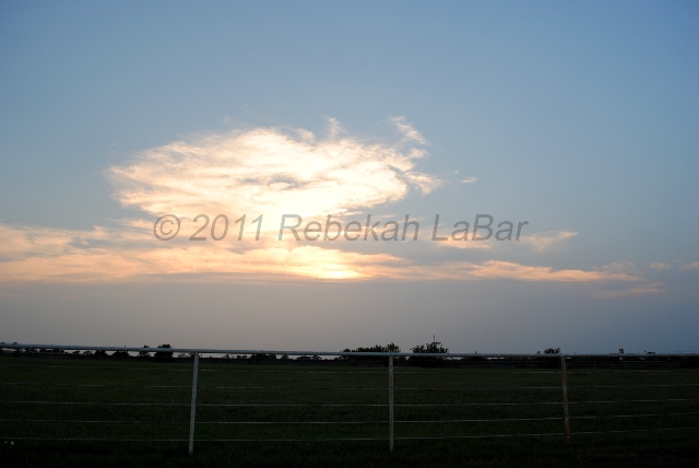
And here is the anvil of a tornado-warned supercell just northwest of Abilene (also taken from Denton). It was a nice sunset!

Permalink
« Previous Page — « Previous entries « Previous Page · Next Page » Next entries » — Next Page »
