04.09.11
Posted in Severe Weather Post-analysis at 8:00 am by Rebekah
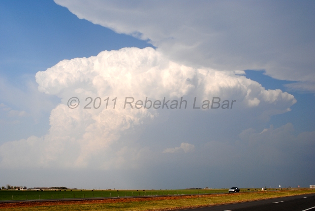
Yesterday I went chasing in north central Oklahoma, and got on a cell just as it began to form, south of Enid. We followed this developing supercell for a little while, before heading off to chase the more beautiful-looking storm to our northeast, in Kay County. We figured it may have been closer to a boundary that might allow for better rotation and a more sustainable updraft.
To make a long story short, we got closer to the Kay County storm before calling it off to head south, as our first storm had begun to show signs of tightening rotation. This could have been a mistake, but the northern storm wasn’t looking any better, and both storms looked pretty ugly on radar.
Shortly after making the decision to go south and meet up with the approaching southern storm, the northern storm was tornado-warned. Of course! Someone reported a tornado up there, but it was too late for us. A funnel cloud had been reported anyway with the southern storm.
The southern storm was starting to cross I-35, and with the bad road networks east of the freeway, we decided to try to keep well out ahead of the storm, which cost us the chance to see any of the large hail that some chasers witnessed, or any rotating wall clouds from up close.
There are a few things we could have done differently, but it was a tough day in terms of first deciding a target area, and then deciding a storm, and then deciding the best roads in not-very-good chase territory (east of I-35, anyway).
I still had fun, though, and remind myself it’s early season. We saw two supercells (updraft bases but missed the wall clouds, boo), beautiful convection (I’d been missing that!), lots of mammatus, lightning (cloud-to-ground, anvil, and other intracloud lightning) and thunder, and some much needed rain. We didn’t even have to leave the state!
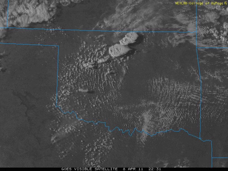
I didn’t take a lot of photos this day, but here’s one of the Kay County (northern storm) as it was going off (you can see the edge of the southern storm’s anvil at the top), followed by a visible satellite image showing the two storms at this time:


Permalink
04.08.11
Posted in Uncategorized at 3:13 pm by Rebekah
Well, I decided to chase today after all. I had my eye on tomorrow more, but in the end couldn’t resist the opportunity to go for an in-state chase.
Currently we’re just northeast of Enid, and headed for Enid and possibly points south of there. There is already a decent cumulus field forming in southwest Oklahoma, but I’m still tempted by the northern Oklahoma target.
A stationary front near the Kansas / Oklahoma border could provide a greater chance for lift and low-level shear for supercells, but of course the instability is higher and cap is more likely to break in southwest Oklahoma.
Permalink
Posted in Severe Weather Forecast at 8:00 am by Rebekah
Eastern Kansas up into Iowa may get a shot at some supercells tomorrow, if lift proves sufficient for storm initiation.
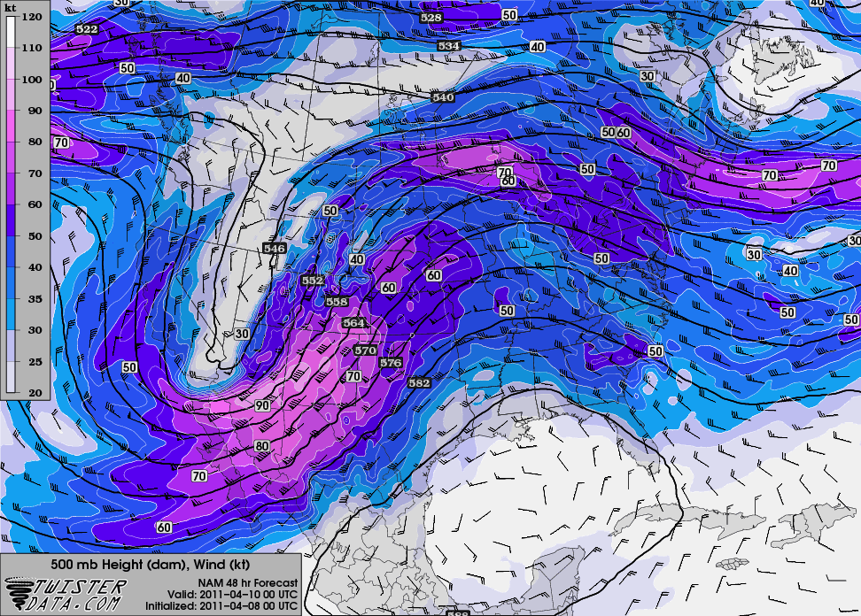
I still wish temperatures were cooler and the trough was a tad further east by 00Z.
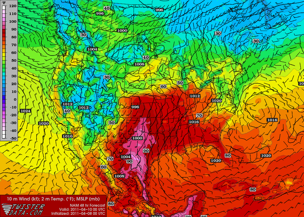
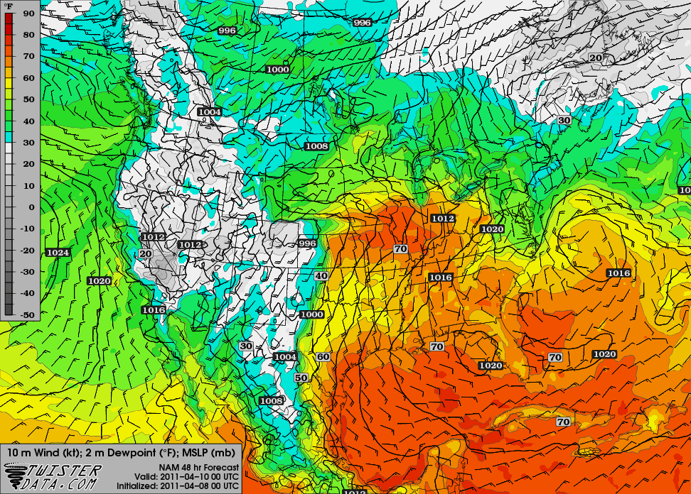
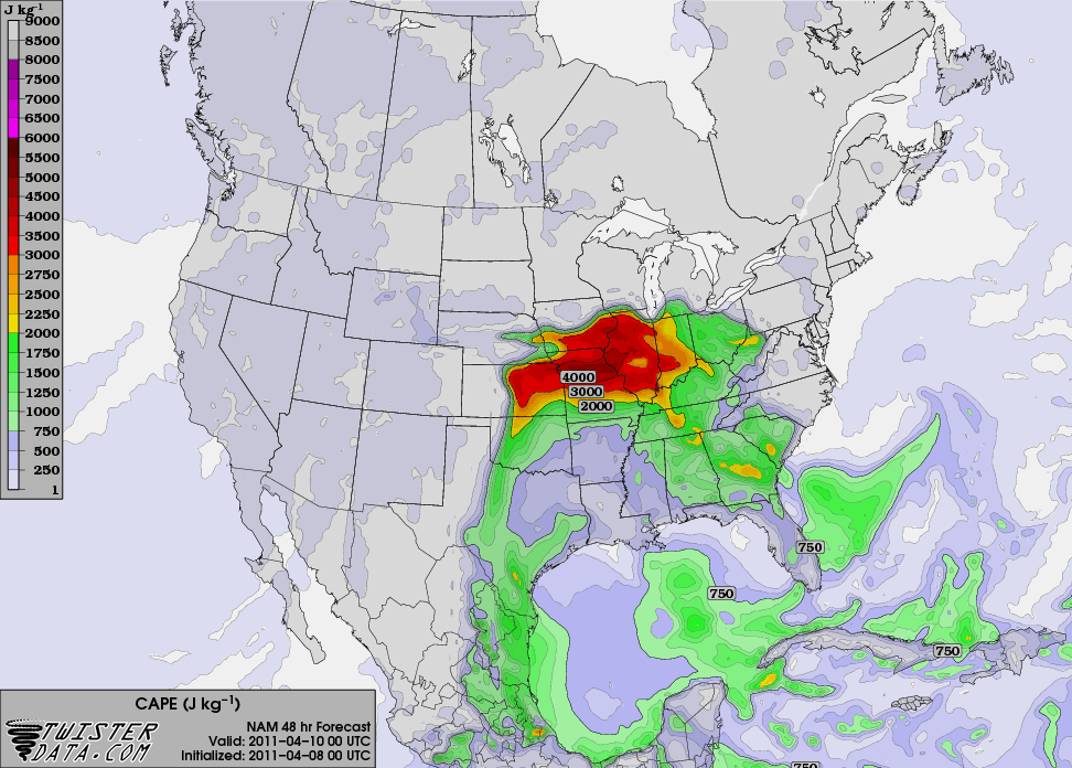
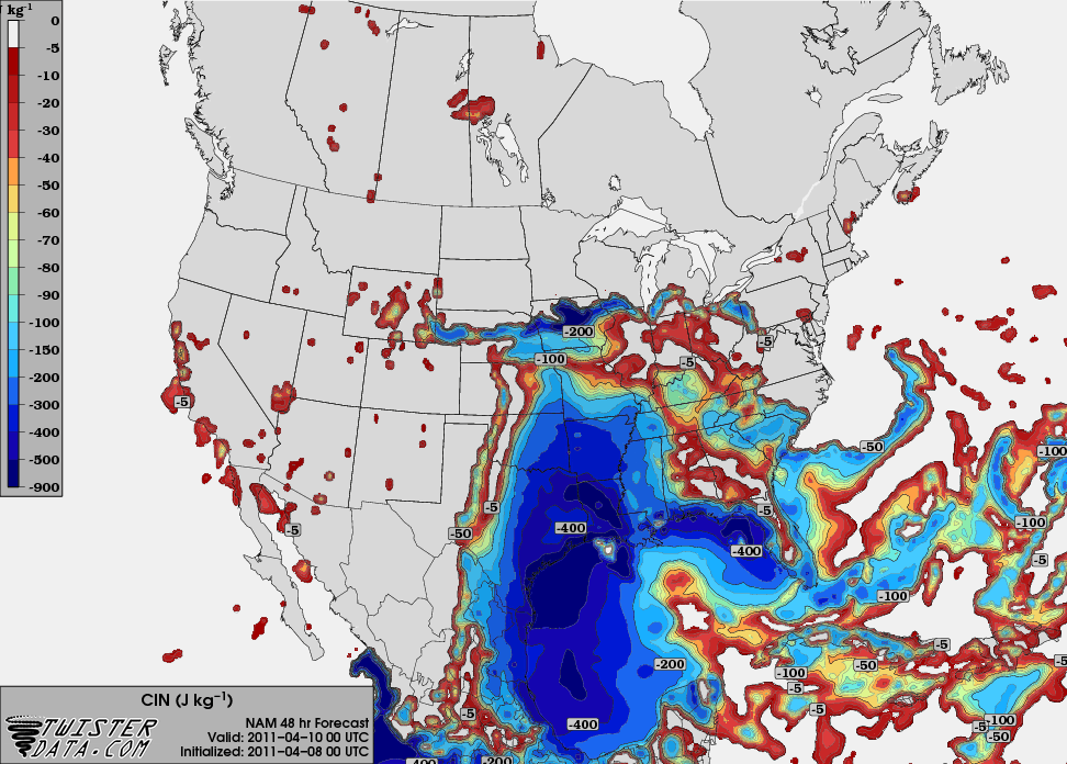
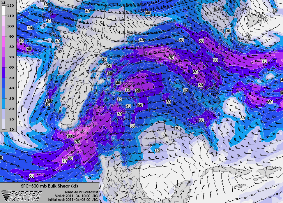
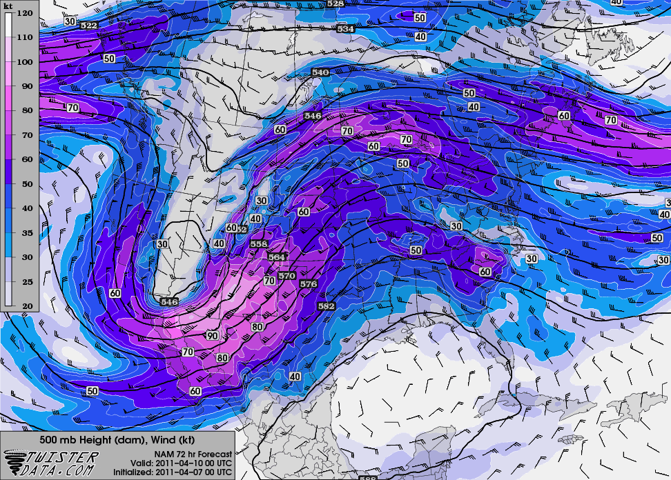
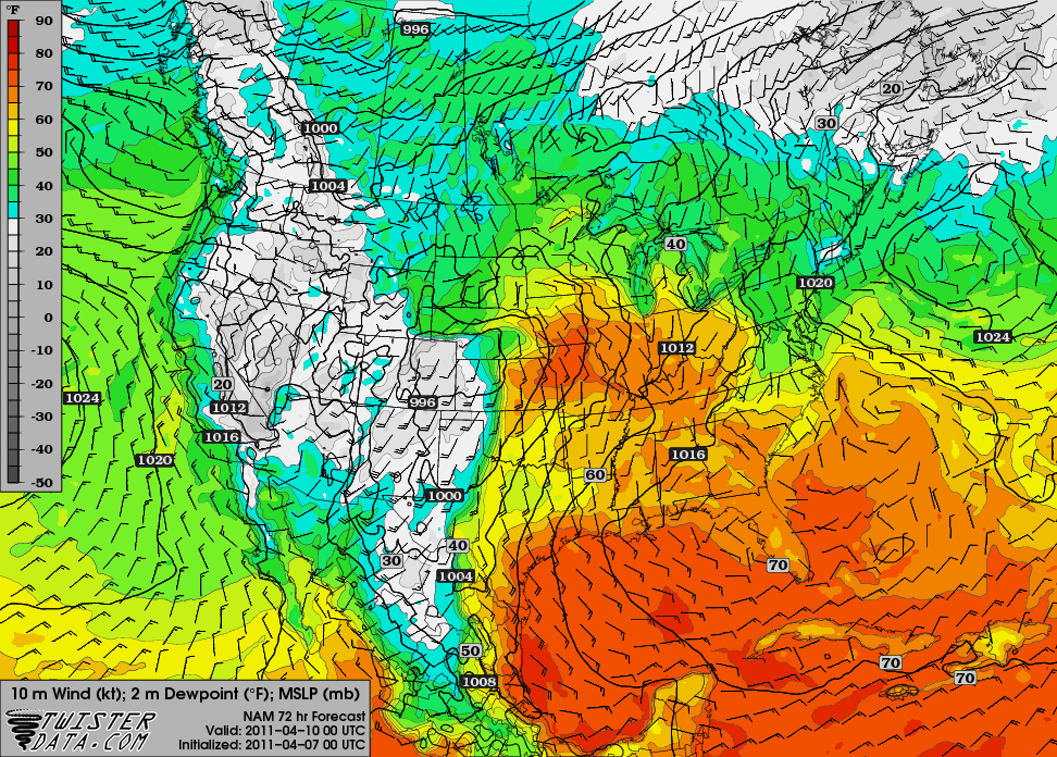
Here are some maps from the 00Z NAM, valid for 00Z Sunday (Saturday evening), from TwisterData.
500 mb:

Surface temperature and pressure (it’s HOT for early April!):

Surface dewpoint and pressure:

Max SBCAPE:

Max SBCINH:

0 – 6 km bulk shear:

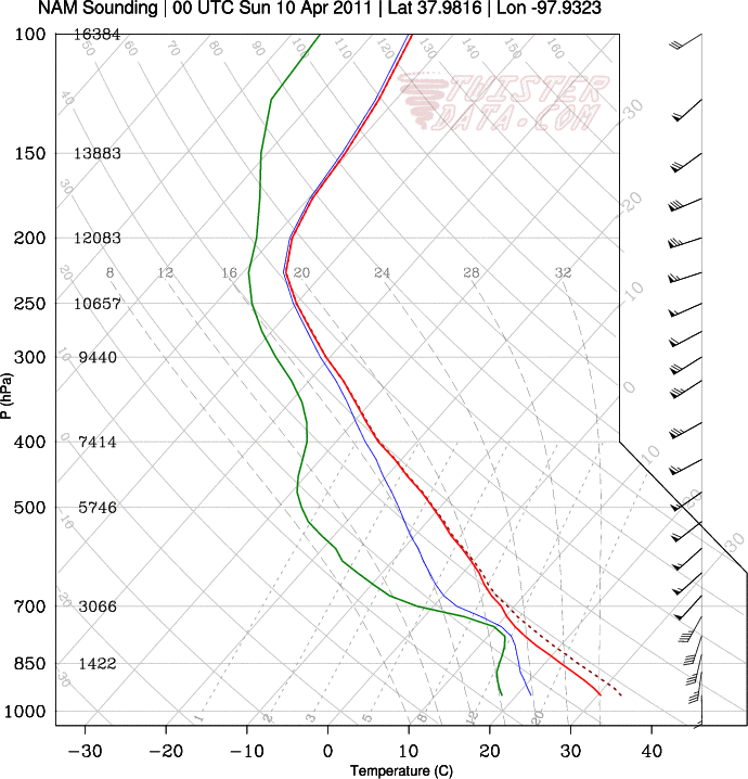
A sounding for / Hutchinson, Kansas:

The NAM isn’t showing any precipitation at 00Z for Kansas or Oklahoma, but that doesn’t have me too concerned yet. On the other hand I’m not excited about this setup, but I do think it may have some potential.
Permalink
04.07.11
Posted in Severe Weather Forecast at 8:00 am by Rebekah
Here’s the next big trough that the NAM model shows for us, valid at 00Z Sunday (Saturday evening):

The model output for the dewpoint shows a dryline in far western Oklahoma (the GFS shows a bit higher dewpoints, a slightly tighter dryline, and a more well-defined surface low):

Temperatures are going to be a little high, though, and there may not be enough forcing in time to get storms firing along the dryline.
There may be a supercell or two that forms up closer to the dryline / warm front intersection, but so far this setup isn’t anything for me to get excited about.
The bigger severe weather day may be Sunday, but I haven’t looked at that one as much as it will be beyond my chase territory (into the Mississippi River Valley area).
Permalink
03.27.11
Posted in Uncategorized at 8:00 am by Rebekah
Which state do you think has had the most tornado reports so far in 2011?
You might be surprised.
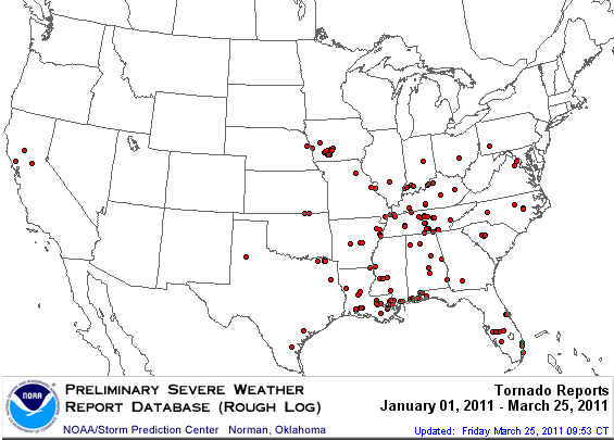
Here’s a map from the Storm Prediction Center showing the location of tornado reports in the U.S. so far, not including the few Georgia tornadoes from yesterday (keep in mind that this is a preliminary map, and not all tornadoes are reported, just as not every report turns out to be a tornado):

The answer is Louisiana!
Louisiana has had 28 tornado reports. Tennessee came in second, with 23 tornado reports. Alabama and Iowa are tied at third, with 18 tornado reports.
For more state statistics on severe weather reports, check out the Storm Prediction Center’s Annual Report Summary for 2011:
http://www.spc.noaa.gov/climo/online/monthly/2011_annual_summary.html
Permalink
« Previous Page — « Previous entries « Previous Page · Next Page » Next entries » — Next Page »
