02.27.11
Posted in Severe Weather Forecast at 8:00 am by Rebekah
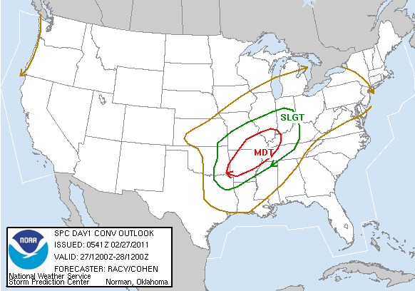
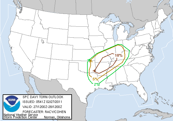
There is another moderate risk for severe storms today, from Arkansas through southeastern Missouri and into the Mississippi River Valley. It does appear that there will be a strong enough cap to prevent very many storms from firing until near or after dark, but there is a chance for an overnight severe weather outbreak.
I again will not be chasing today, and haven’t spent a lot of time looking at this setup…but here’s the 6Z Storm Prediction Center outlook:


Permalink
02.25.11
Posted in Uncategorized at 8:00 am by Rebekah
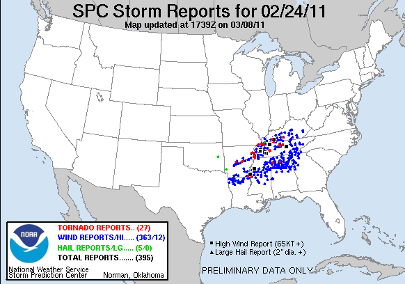
Here’s a map of the storm reports from yesterday/last night…the tornado risk was largely a bust in the forecast area, but there were a few tornadoes near the Mississippi River and into central Tennessee.

It looks like Sunday is shaping up to have a similar severe weather threat in about the same area. I don’t have time for a more detailed post on it just now, but you can check out the Storm Prediction Center’s website for more.
Once again, I don’t plan on chasing this next setup…with gas prices going up the way they are, I may have to be even pickier this year on which days I chase. The Southern Plains season should be gearing up fairly soon, though. The long-range model solution changes with just about every run, so it’s too early to say just when I may be chasing again.
Thanks for staying tuned!
Permalink
02.24.11
Posted in Severe Weather Forecast at 8:00 am by Rebekah
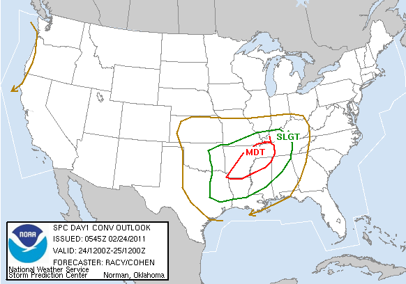
The Storm Prediction Center issued the first moderate risk of the year yesterday, valid today and tonight. Today’s moderate risk includes a 15% chance for tornadoes, 30% for 1″ or greater hail, and 45% for severe wind, centered in eastern Arkansas into northwest Mississippi and western Tennessee.

I won’t be chasing this one; I’m planning on waiting for better setups farther west. That being said, this is a fairly potent setup and there may be a similar one in about the same location on Sunday.
I’ll probably post a bit more on this setup and the storms that form later in the day.
Stay safe!
Permalink
02.16.11
Posted in Severe Weather Forecast at 8:00 am by Rebekah
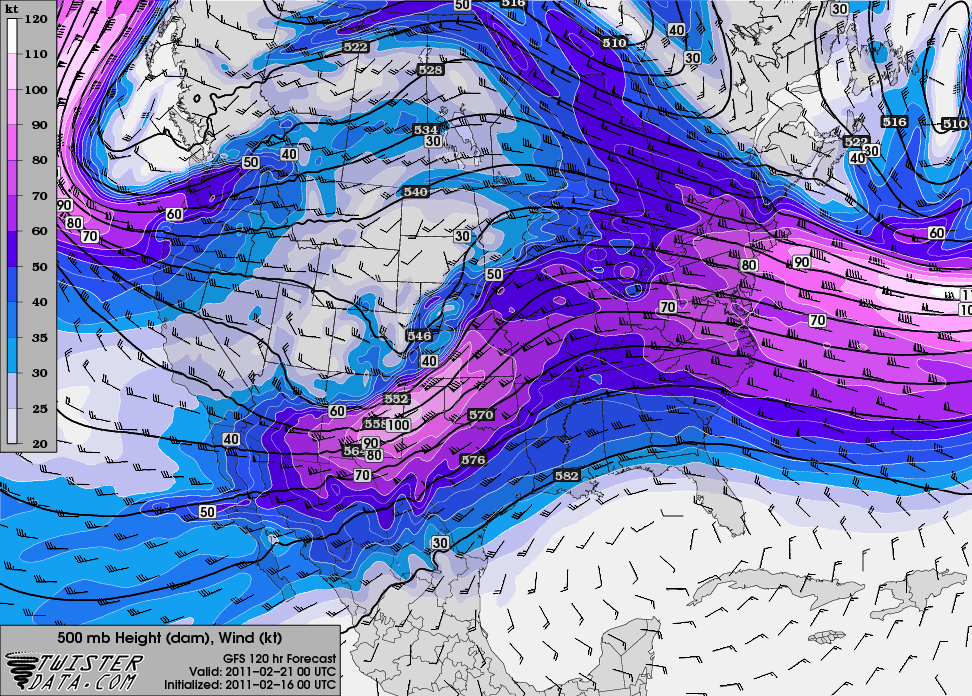
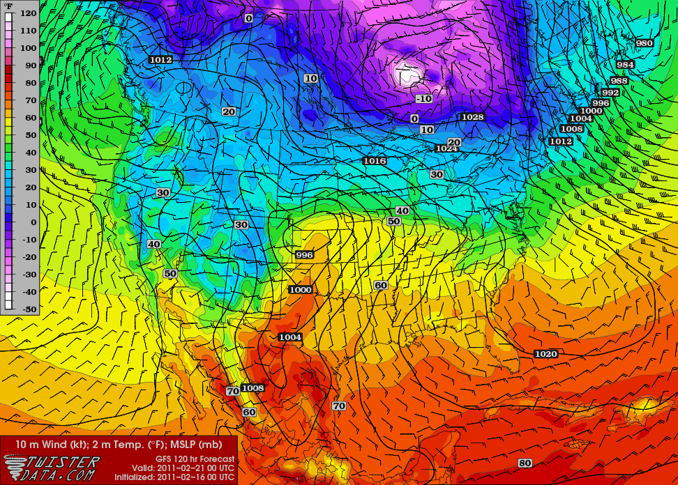
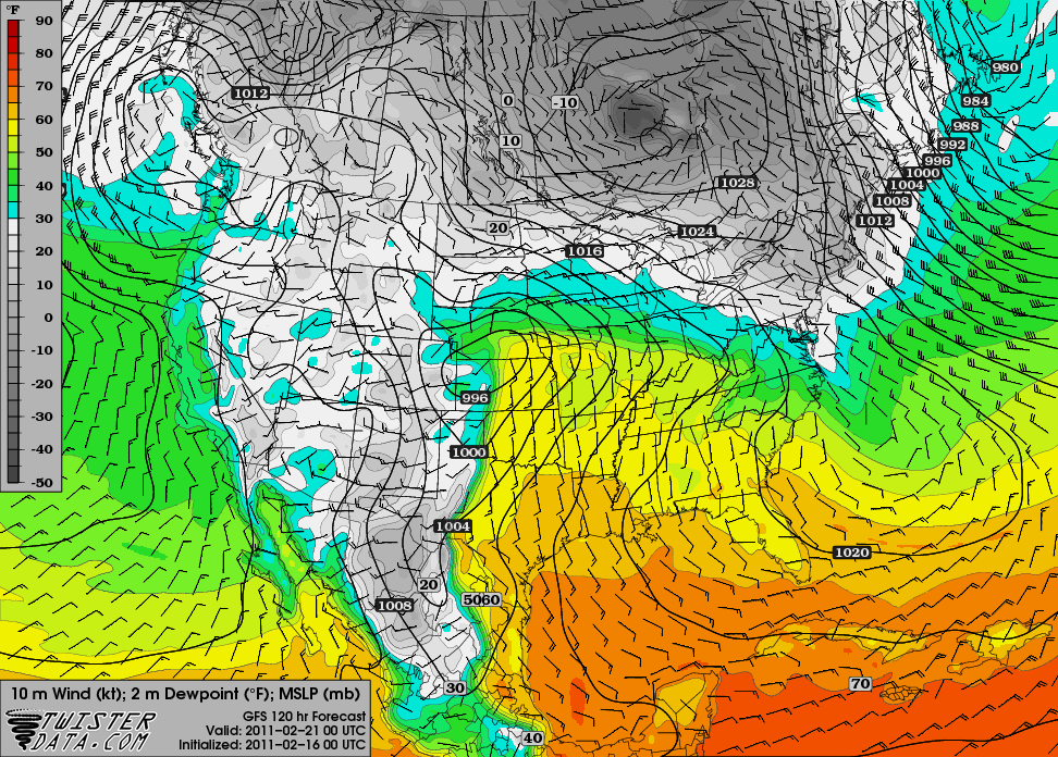
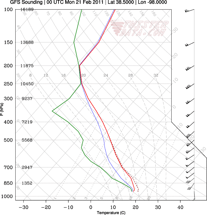
A quick look at last night’s 00Z GFS run for 00Z Monday, or 6 pm Central Time on Sunday (bound to change, but it can be interesting to look at trends as it gets closer):
500 mb shows a nice little shortwave trough centered over New Mexico:

Surface temperatures in the lower 60s in western Kansas and western Oklahoma, with a surface low over western Kansas…surface winds in central Kansas are from the south-southeast:

Surface dewpoints in the lower 50s up through central and eastern Kansas:

Sounding from Hutchinson, Kansas…would be nice if the high clouds would be gone and the surface could warm up a bit more…but hey, it’s February:

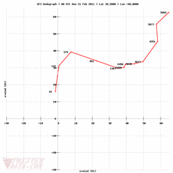
Hodograph for Hutchinson also shows decent wind shear:

Does this mean severe storms are returning to the Plains? No. But even thunderstorms of the non-severe variety would be welcome at this point, and the models are certainly showing some hope of that.
If moisture return is any greater, surface temperatures any higher, and the winds are a little more backed (more out of the southeast), I would be happier and might even consider a jaunt to Kansas, but this is still not a bad setup for February storms. We’ll have to wait and see. There may be another few setups coming soon as well…but a lot of this is still in wishcasting land!
Maps from TwisterData.
Permalink
02.12.11
Posted in Weather News at 8:00 am by Rebekah

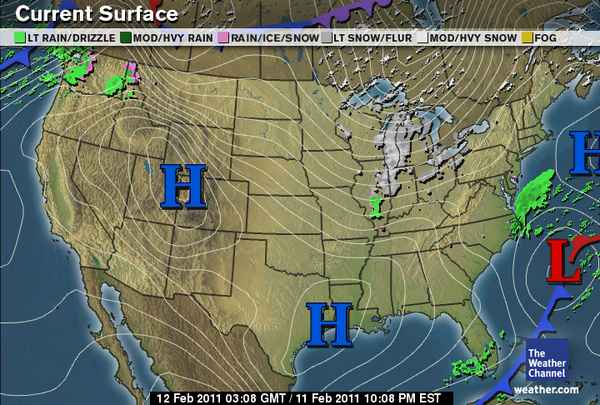
Weather across the U.S. is pretty tranquil this weekend, but we soon expect a pattern change that will bring warmer temperatures and a chance for thunderstorms to the Southern Plains.
Central Oklahoma will likely reach 80 °F this week; a far cry from the sub-zero temperatures this past week.
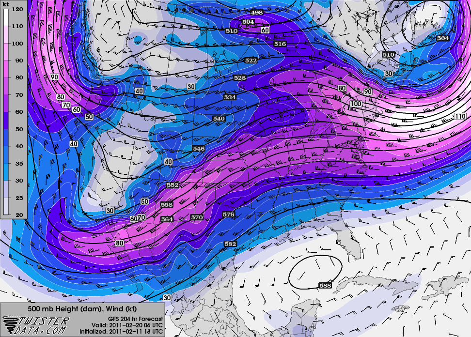
By the end of this coming week, models are showing the western ridge will break down and we’ll see a more progressive pattern with shortwave troughs digging into the Southwest. It also looks like the dewpoints will start to rise by the end of the week, and although we should get a few more fronts that will lower the dewpoints again, it certainly appears that the Southern Plains anyway is done with winter and we’ll soon be on to storm season!

500 mb GFS forecast for next Saturday, from Twister Data
Permalink
« Previous Page — « Previous entries « Previous Page · Next Page » Next entries » — Next Page »
